2000s (21st Century) Maps of Teasdale, Utah
Explore 2 historic maps of Teasdale from the 2000s (21st Century). These maps offer a rare glimpse into what life looked like during the 2000s — showing old roads, neighborhoods, homes, and landmarks that have changed or disappeared over time.
Whether you're researching your family's past, planning a metal detecting trip, or studying how Teasdale's landscape evolved across the 2000s, these high-resolution maps are a powerful tool for exploring the history of this region.
- Focus on a specific era: All maps on this page are from the 2000s, giving you a focused view of this time period.
- See what’s changed: Compare century-old streets, trails, and buildings to today's modern landscape using overlays and satellite layers.
- Research with precision: Use these maps for genealogy, historical research, land use analysis, or educational projects.
- View, download, or print: Maps are fully viewable online in high resolution, and can be downloaded or printed for your own records.
Start exploring Teasdale's history through authentic maps from the 2000s. This is your window into the past.
Teasdale, UT maps
(2)- 2002 Map of Torrey, 2005 Print
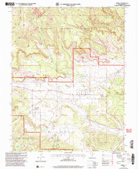 2002 Torrey2005 Print · USGSTorrey and Teasdale sit at the edge of the canyonlands at the turn of the millennium, where high forest plateaus give way to irrigated ranching valleys. Trace the paths of the Great Western Trail and the lifelines of the Fremont River and Canal.
 - 2023 Map of Torrey, 2023 Print
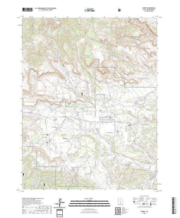 2023 Torrey2023 Print · USGSTorrey and Teasdale sit at the edge of the national forests in this contemporary record of Wayne County's high-plateau ranching and recreation country. Researchers can pinpoint Teasdale Cem, follow the Torrey Canal, and trace the Great Western Trail across the mesas.
End of results
Showing maps 1-2 of 2
Top cities near Teasdale
Frequently asked questions
- What are the different types of historical maps available for Teasdale?
- What is the oldest map of Teasdale?
- Where can I purchase historical maps of Teasdale for my home or office?
- Where can I download high-res historical maps of Teasdale?
- Are there historical topographic maps available for Teasdale?
- Is there historical aerial imagery available for Teasdale?
- Where are historical maps of Teasdale sourced from?