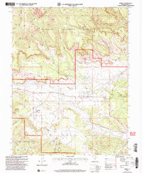
2002 Map of Torrey
USGS Topo · Published 2005About this map
Torrey and Teasdale anchor this landscape where the high plateaus meet the desert canyonlands. The Fremont River carves through the central valley, supported by a network of irrigation features like the Canal and Siphon that transformed Poverty Flat into viable agricultural land. The transition from the high elevations of the Fishlake National Forest and Dixie National Forest down to the arid lowlands is clearly visible through the varied terrain of Velvet Ridge and the Teasdale Bench. Notable water management is evident at Flatiron Lakes and Torrey Allotment Reservoir No 2, reflecting the essential relationship between the community and its water sources in the early 2000s. Long-distance transit and recreation are represented by the Great Western Trail and Highway 12, which traverse the complex geography of canyons like Red Canyon and Calf Canyon.
Find a feature on this map
47 named features on this map. Tap any name to fly to it.
Don’t see what you’re looking for? This feature index may not catch every label — zoom into the map to look around manually.
Map Details
Editions of this 2002 Torrey Map
This is the sole edition of this map. No revisions or reprints were ever made.
Other maps of this area

1885 · Fish Lake
USGS Topo · 1:250,000

1896 · Fish Lake
USGS Topo · 1:250,000

1952 · Notom 2 NW
USGS Topo · 1:24,000

1952 · Loa 1 SE
USGS Topo · 1:24,000

1952 · Notom 3 NW
USGS Topo · 1:24,000

1952 · Notom 2 SE
USGS Topo · 1:24,000

1952 · Notom 2 SW
USGS Topo · 1:24,000

1952 · Notom 2 NE
USGS Topo · 1:24,000

1952 · Notom 3 NE
USGS Topo · 1:24,000

1952 · Grover
USGS Topo · 1:62,500