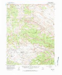
1952 Map of Torrey
USGS Topo · Published 1984About this map
Torrey and Teasdale sit at the center of this high-plateau landscape, recorded just as the region was coming under closer study in the early 1950s. The agricultural character of the Fremont River valley is evident in the network of ditches, such as those crossing Poverty Flat and Teasdale Bench, which supported these remote Mormon settlements. To the east, the dramatic geology of the Waterpocket Fold and the Capitol Reef National Monument dominates the terrain, featuring distinctive landmarks like Chimney Rock, The Castle, and The Motorman. The map reflects a period of transition, noting a Power Plant near the river and a local Airport south of Torrey, while the surrounding high country is managed through the Fishlake National Forest and Dixie National Forest.
Find a feature on this map
86 named features on this map. Tap any name to fly to it.
Don’t see what you’re looking for? This feature index may not catch every label — zoom into the map to look around manually.
Map Details
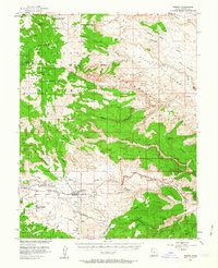
Editions of this 1952 Torrey Map
3 editions found

Other maps of this area

1885 · Fish Lake
USGS Topo · 1:250,000

1896 · Fish Lake
USGS Topo · 1:250,000

1952 · Notom 2 NW
USGS Topo · 1:24,000

1952 · Loa 1 SE
USGS Topo · 1:24,000

1952 · Notom 3 NW
USGS Topo · 1:24,000

1952 · Notom 2 SE
USGS Topo · 1:24,000

1952 · Notom 2 SW
USGS Topo · 1:24,000

1952 · Notom 4 NW
USGS Topo · 1:24,000

1952 · Notom 2 NE
USGS Topo · 1:24,000

1952 · Notom 3 NE
USGS Topo · 1:24,000