Old Maps of Lower Granville, Granville for Metal Detecting
Plan your next treasure hunt with 14 historic maps of Lower Granville. Find old homesites, ghost towns, trails, and gathering spots that may be lost to time — perfect for identifying promising metal detecting locations.
- Locate forgotten sites: Uncover places like long-lost settlements, abandoned rail lines, or gathering spots.
- Plan better hunts: Use map overlays combined with LiDAR or satellite views to narrow in on historically rich areas.
- Made for detectorists: Thousands of hobbyists use these maps to discover relics, coins, and hidden history.
Use these historic maps to boost your research and find new opportunities beneath the surface of Lower Granville.
Lower Granville, Granville maps
(14)- 1915 Map of Rochester, 1963 Print
 1915 Rochester1963 Print · USGSThe Green Mountains in the early twentieth century were a landscape of remote hollow schools and narrow valley settlements. Genealogists and historians can trace old property lines and landmarks like the Williams Mine, Hancock Tunnel, and the Texas School.
 - 1917 Map of Rochester
 1917 Rochester1917 Print · USGSThe Green Mountains in the mid-1910s reveal a network of isolated valley settlements and high-altitude gaps. Genealogists and hikers can trace old mountain schools like Corner School and remote landmarks such as Bingo Camp and the Hancock Tunnel.5 unique versions available
 - 1950 Map of Glens Falls
 1950 Glens Falls1950 Print · USGSThe Adirondacks and the Green Mountains meet in this mid-century survey of the New York and Vermont borderlands. Researchers can trace the industrial rail corridors of the Rutland RR and Delaware & Hudson RR connecting Glens Falls, Rutland, and the shores of Lake George.
 - 1956 Map of Glens Falls, 1968 Print
 1956 Glens Falls1968 Print · USGSUpper New York and the Vermont mountains are captured here in the mid-fifties, showing the rugged rail-and-river network of the Northeast. Researchers can trace the paths of the Delaware and Hudson RR and Rutland RR as they wind through valley towns like Poultney and Whitehall.3 unique versions available
 - 1959 Map of Glens Falls
 1959 Glens Falls1959 Print · USGSUpper New York and Vermont are captured here during the late 1950s, a period of transition for these mountain communities. Researchers can trace the legacy of the region's river-and-rail economy through landmarks like Lake George, Saratoga Springs, and Killington Peak.2 unique versions available
 - 1964 Map of Glens Falls
 1964 Glens Falls1964 Print · USGSThe tri-state borderlands of New York, Vermont, and New Hampshire appear here in the mid-1960s. Researchers can trace the rail routes of the Rutland RR and find historic sites like Ticonderoga and Saratoga National Historical Park.
 - 1970 Map of Hancock, 1972 Print
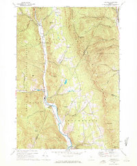 1970 Hancock1972 Print · USGSCentral Vermont in the early seventies shows a landscape of deep valleys and mountain passes along the White River. Researchers can trace the layout of mountain hamlets from Granville to Rochester, locating the Upper Branch Sch, Elmwood Cem, and the high Lookout Tower.3 unique versions available
 - 1985 Map of Rutland, 1988 Print
 1985 Rutland1988 Print · USGSThe Upper Valley of the mid-1980s comes to life along the winding Connecticut River as it divides the Green Mountain and Granite states. Historians can trace the industrial rail hubs of White River Junction and the paths of the Appalachian Trail and Long Trail.
 - 1997 Map of Hancock, 2000 Print
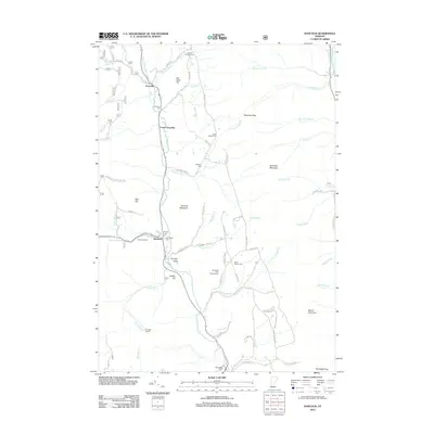
 1997 Hancock2000 Print · USGSThe White River valley in central Vermont appears here in the late nineties, showing the vital road links between Granville and Hancock. Researchers can locate several family burial sites including Elmwood Cem and South Hollow Cem, or trace the remote Boyden Trail.
 - 2012 Map of Hancock, 2012 Print
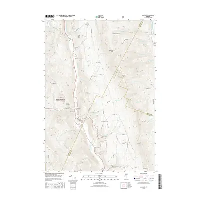
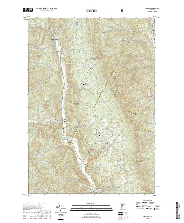
 2012 Hancock2012 Print · USGSCovers Lower Granville, including Hancock, Rochester, and other nearby areas
 - 2015 Map of Hancock, 2015 Print
 2015 Hancock2015 Print · USGSCovers Lower Granville, including Hancock, Rochester, and other nearby areas
 - 2018 Map of Hancock, 2018 Print
 2018 Hancock2018 Print · USGSCovers Lower Granville, including Hancock, Rochester, and other nearby areas
 - 2021 Map of Hancock, 2021 Print
 2021 Hancock2021 Print · USGSCovers Lower Granville, including Hancock, Rochester, and other nearby areas
 - 2024 Map of Hancock, 2024 Print
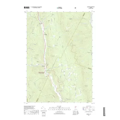
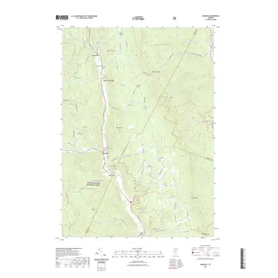
 2024 Hancock2024 Print · USGSThis mountain valley landscape at the edge of the Green Mountains shows the close relationship between the White River and the villages of Hancock and Granville. Researchers can trace old family burial grounds like North Hollow Cem and explore the historic routes crossing Braintree Gap.
End of results
Showing maps 1-14 of 14
Top cities near Lower Granville
- Middlebury historical maps
- Northfield historical maps
- Randolph historical maps
- Brandon historical maps
- Williamstown historical maps
- Berlin historical maps
See more
Frequently asked questions
- What are the different types of historical maps available for Lower Granville?
- What is the oldest map of Lower Granville?
- Where can I purchase historical maps of Lower Granville for my home or office?
- Where can I download high-res historical maps of Lower Granville?
- Are there historical topographic maps available for Lower Granville?
- Is there historical aerial imagery available for Lower Granville?
- Where are historical maps of Lower Granville sourced from?