1900s (20th Century) Maps of Peacham, Vermont
Explore 14 historic maps of Peacham from the 1900s (20th Century). These maps offer a rare glimpse into what life looked like during the 1900s — showing old roads, neighborhoods, homes, and landmarks that have changed or disappeared over time.
Whether you're researching your family's past, planning a metal detecting trip, or studying how Peacham's landscape evolved across the 1900s, these high-resolution maps are a powerful tool for exploring the history of this region.
- Focus on a specific era: All maps on this page are from the 1900s, giving you a focused view of this time period.
- See what’s changed: Compare century-old streets, trails, and buildings to today's modern landscape using overlays and satellite layers.
- Research with precision: Use these maps for genealogy, historical research, land use analysis, or educational projects.
- View, download, or print: Maps are fully viewable online in high resolution, and can be downloaded or printed for your own records.
Start exploring Peacham's history through authentic maps from the 1900s. This is your window into the past.
Peacham, VT maps
(14)- 1938 Map of St. Johnsbury
 1938 St. Johnsbury1938 Print · USGSNorthern Vermont in the late thirties reveals a landscape of rail-connected valley towns and upland farming districts. Locate old schoolhouses like Stark Sch, trace the St Johnsbury and Lake Champlain RR, and find family landmarks near Harvey Lake.
 - 1939 Map of Plainfield
 1939 Plainfield1939 Print · USGSVermont's granite-and-timber country is captured here on the eve of the 1940s, when remote rail lines still connected upland villages. Genealogists can trace family names at the Old West Ch, Hollister Hill Sch, and the isolated Lanesboro rail stop.
 - 1940 Map of Plainfield, 1953 Print
 1940 Plainfield1953 Print · USGSVermont's hill country is captured here just before the war, showing a landscape defined by small farms and upland schools. Genealogists can locate family landmarks at Maple Cors Calais PO, Old West Ch, and the St Johnsbury and Lake Champlain RR.2 unique versions available
 - 1943 Map of Plainfield
 1943 Plainfield1943 Print · USGSVermont's highland farming and rail communities are captured here in the 1940s as the state's rural landscape remained densely settled. Genealogists can locate family-named landmarks like Hollister Hill Sch, trace the Montpelier and Wells River RR, or find the Old West Ch near Kent Cors.2 unique versions available
 - 1943 Map of St. Johnsbury
 1943 St. Johnsbury1943 Print · USGSUpper Vermont and New Hampshire communities thrive along the Connecticut and Passumpsic rivers during the early war years. Genealogists can trace family names at Walden Four Corners, find rural schoolhouses like Stanton Sch, or locate the Goslants Mill site.3 unique versions available
 - 1949 Map of St. Johnsbury, 1957 Print
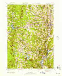 1949 St. Johnsbury1957 Print · USGSCaledonia County and the upper Connecticut River valley are captured here just after the war, showing a landscape defined by rail and river. Genealogists and local historians can locate early landmarks like Walden Four Corners, the Frank D Comerford Hydro-electric Plant, and the historic Hazen Road.3 unique versions available
 - 1950 Map of Lake Champlain
 1950 Lake Champlain1950 Print · USGSThe Lake Champlain valley and its surrounding peaks are captured in detail during the late 1940s, showing the vital rail and road connections between New York and Vermont. Researchers can trace the routes of the Central Vermont Railway or locate old industrial centers like Mineville and Witherbee.2 unique versions available
 - 1953 Map of Plainfield, 1954 Print
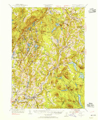 1953 Plainfield1954 Print · USGSThe hills of Washington and Caledonia counties are captured here in the early fifties, showing the region's transition from old upland farming to a wood-and-water economy. Researchers can locate vanished landmarks like Maple Cor Calais PO, the Dwinell Sch, and the St Johnsbury and Lake Champlain RR.4 unique versions available
 - 1958 Map of Lake Champlain
 1958 Lake Champlain1958 Print · USGSThe Champlain Valley and surrounding high peaks are captured here in the late fifties, showcasing the cross-border region from the Adirondacks to the Green Mountains. Researchers can trace historic rail routes like the Rutland Railway or locate old valley settlements such as Keeseville and Vergennes.2 unique versions available
 - 1962 Map of Lake Champlain, 1975 Print
 1962 Lake Champlain1975 Print · USGSLake Champlain and the high peaks of the Adirondacks and Green Mountains are captured here during the mid-twentieth century. Researchers can trace the industrial legacy of the Lyon Mountain Mine and the rail corridors of the Central Vermont RR and Delaware & Hudson RR.3 unique versions available
 - 1983 Map of Barnet
 1983 Barnet1983 Print · USGSThe Vermont and New Hampshire borderlands come alive in the early eighties, centered on the river-and-rail corridor of the Connecticut River. Researchers can trace the Canadian Pacific tracks through Barnet and locate small hamlets like Ewells Mills and Mosquitoville.
 - 1983 Map of St. Johnsbury
 1983 St. Johnsbury1983 Print · USGSCaledonia County's rail and river corridors are captured in the early eighties as the region balanced its industrial heritage with expanding highway infrastructure. Genealogists can locate family sites from Greenbank Hollow to Walden, including the Pope Cem and the Noyesville Sch.2 unique versions available
 - 1986 Map of Marshfield, 1987 Print
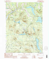 1986 Marshfield1987 Print · USGSThe Green Mountain foothills and the sprawling Groton State Forest are documented in the mid-eighties. Trace old settlements like Marshfield Station and Lanesboro alongside the shores of Lake Groton.
 - 1988 Map of Montpelier
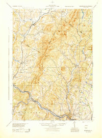 1988 Montpelier1988 Print · USGSThe area surrounding Vermont’s capital city appears here during the early 1940s, showing the vital rail-and-river network. Genealogists can trace family names across a dozen district schools and rural sites like Middlesex Center and the Talc Mine.2 unique versions available
End of results
Showing maps 1-14 of 14
Top cities near Peacham
- Saint Johnsbury historical maps
- Littleton historical maps
- Haverhill historical maps
- Hardwick historical maps
- East Montpelier historical maps
- Danville historical maps
See more
Top neighborhoods of Peacham
- Peacham Corner historical maps
- Ewells Mills historical maps
- South Peacham historical maps
- Green Bay historical maps
- East Peacham historical maps
Frequently asked questions
- What are the different types of historical maps available for Peacham?
- What is the oldest map of Peacham?
- Where can I purchase historical maps of Peacham for my home or office?
- Where can I download high-res historical maps of Peacham?
- Are there historical topographic maps available for Peacham?
- Is there historical aerial imagery available for Peacham?
- Where are historical maps of Peacham sourced from?