Old Maps of Essex, Vermont for Hiking & Exploration
Hike through history with 28 historic maps of Essex. Explore old trails, ghost towns, and forgotten backroads — perfect for outdoor adventurers and local explorers.
- Rediscover forgotten places: Map out old mining camps, roads, and footpaths that no longer exist on modern maps.
- Layer with modern tools: Combine with LiDAR or satellite views to plan hikes through historical terrain.
- Made for exploration: Popular among hikers, overlanders, and local history lovers.
Use these maps to find adventure and explore the hidden past of Essex.
Essex, VT maps
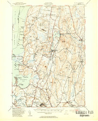
(28)- 1906 Map of Burlington
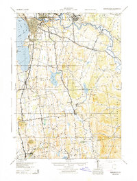
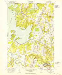
 1906 Burlington1906 Print · USGSBurlington and the Lake Champlain shoreline appear at the height of the railroad era, showing a dense city grid and industrial waterfront. Researchers can locate early schools and burial grounds like the University of Vermont and Greenmount Cemetery, alongside vanished stops like Mechanicsville.7 unique versions available
 - 1913 Map of Milton
 1913 Milton1913 Print · USGSVermont's northwestern lakefront settlements are captured here just before the Great War, showing a landscape of small school districts and lakeside camps. Trace early transport routes like the CENTRAL VERMONT railroad or locate historic homesites near Miltonborough, Georgia Plains, and Checkerberry Village.
 - 1915 Map of Milton
 1915 Milton1915 Print · USGSNorthwest Vermont's shoreline and interior towns come alive in the decade before the Great War, showing a network of rural schools and lakeside camps. Trace the early layout of Colchester, Westford, and Fort Ethan Allen, or locate family-named sites like Brigham Hill and Bowman Corners.5 unique versions available
 - 1919 Map of Burlington
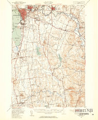
 1919 Burlington1919 Print · USGSLake Champlain and the Winooski River valley are shown here just after the Great War, during a period of industrial and rail growth. Genealogists can trace family homesteads near Prindle Corners or locate graves at Greenmount Cemetery and Lakeview Cemetery.
 - 1925 Map of Mount Mansfield
 1925 Mount Mansfield1925 Print · USGSNorthern Vermont in the mid-1920s is captured here at the intersection of rail-era commerce and early mountain tourism. Genealogists can trace families through district schools like Governors Right School and landmarks like Morses Mill or Smugglers Notch.
 - 1927 Map of Mount Mansfield
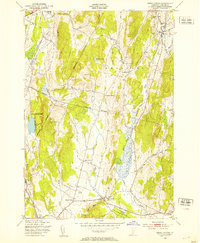
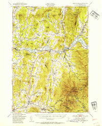
 1927 Mount Mansfield1927 Print · USGSLamoille County and the Green Mountain ridge are captured here in the mid-1920s, showing the height of the valley's rail-and-river era. Genealogists can locate family homesteads near the Irish Settlement, dozens of district schools like Hooper School, and the historic Mt Mansfield Hotel.5 unique versions available
 - 1944 Map of Milton
 1944 Milton1944 Print · USGSThe Lake Champlain shoreline and the Lamoille River valley are captured here just before the mid-forties. Genealogists and local historians can trace rural schoolhouse districts, the grounds of Fort Ethan Allen, and early lakeside retreats like Camp Winisquam.
 - 1944 Map of Mount Mansfield
 1944 Mount Mansfield1944 Print · USGSNorthern Vermont in the mid-1940s is defined here by high mountain peaks and a dense network of rural school districts. Genealogists can trace family footprints through numerous local landmarks like Irish Settlement Sch, Marses Mill, and the high-altitude Mt Mansfield Hotel.
 - 1944 Map of Burlington
 1944 Burlington1944 Print · USGSMid-century Burlington and its surrounding Lake Champlain shorelines are captured here at the height of the war years. Local historians can trace the Rutland Railroad through Shelburne or locate family sites near Prindle Corners and Fays Corners.2 unique versions available
 - 1948 Map of Essex Center, 1953 Print
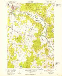
 1948 Essex Center1953 Print · USGSChittenden County in the late 1940s is characterized by a network of crossroads settlements and small-scale quarries. Researchers can find old landmarks like St Anns Ch, the Central Vermont railroad, and family-named locations such as Butlers Corners.4 unique versions available
 - 1948 Map of Burlington, 1953 Print
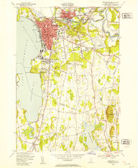 1948 Burlington1953 Print · USGSMid-century Burlington and its surrounding lakefront villages were thriving during this era of post-war growth. Researchers can trace the rail lines of the Rutland, locate the University of Vermont, and find early landmarks like Union Sta and Lakeview Cem.5 unique versions available
 - 1948 Map of Underhill, 1953 Print
 1948 Underhill1953 Print · USGSChittenden County in the late 1940s reveals a network of tight-knit rural school districts and river valley hamlets. Researchers can trace historic family-named landmarks and upland outposts like English Settlement Sch, Cloverdale, and Stevensville.4 unique versions available
 - 1948 Map of Fort Ethan Allen, 1953 Print
 1948 Fort Ethan Allen1953 Print · USGSChittenden County’s shoreline and military history are preserved here just after the war. You can trace the footprint of the Fort Ethan Allen Military Reservation, locate old district schools like Blakey Sch, and explore the 1940s layout of Colchester.4 unique versions available
 - 1948 Map of Essex Junction, 1953 Print
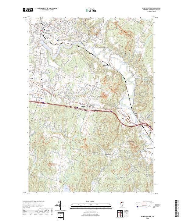
 1948 Essex Junction1953 Print · USGSThe Winooski River valley in the late 1940s reveals a landscape of railroad towns and rural schoolhouses. Genealogists and historians can trace the early layout of Essex Junction and find long-lost landmarks like Kirby Corner, Fays Corner, and the Lake Iroquois Sch.5 unique versions available
 - 1948 Map of Burlington, 1954 Print
 1948 Burlington1954 Print · USGSThe Lake Champlain shoreline and Winooski River valley are shown here just after the war, balancing urban growth with deep-rooted rural townships. Genealogists can locate family names and sites from St Michael College to remote landmarks like Prindle Corners and Fays Corner.4 unique versions available
 - 1948 Map of Mount Mansfield, 1954 Print
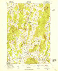
 1948 Mount Mansfield1954 Print · USGSThe Green Mountains of Vermont meet the Lamoille River valley here during the post-war era, showing a mix of mountain tourism and traditional farming. Genealogists can trace family lines through the Irish Settlement and numerous rural sites like Sanderson Cem and Buck Hollow Sch.5 unique versions available
 - 1948 Map of Milton, 1954 Print
 1948 Milton1954 Print · USGSMid-century Chittenden County shows a landscape of lakeside camps and interior dairy farms connected by the Central Vermont rail. Genealogists can trace family roots at St Anns Ch, Hope Cem, and vanished school districts like Silvertown Sch.4 unique versions available
 - 1950 Map of Lake Champlain
 1950 Lake Champlain1950 Print · USGSThe Lake Champlain valley and its surrounding peaks are captured in detail during the late 1940s, showing the vital rail and road connections between New York and Vermont. Researchers can trace the routes of the Central Vermont Railway or locate old industrial centers like Mineville and Witherbee.2 unique versions available
 - 1958 Map of Lake Champlain
 1958 Lake Champlain1958 Print · USGSThe Champlain Valley and surrounding high peaks are captured here in the late fifties, showcasing the cross-border region from the Adirondacks to the Green Mountains. Researchers can trace historic rail routes like the Rutland Railway or locate old valley settlements such as Keeseville and Vergennes.2 unique versions available
 - 1962 Map of Lake Champlain, 1975 Print
 1962 Lake Champlain1975 Print · USGSLake Champlain and the high peaks of the Adirondacks and Green Mountains are captured here during the mid-twentieth century. Researchers can trace the industrial legacy of the Lyon Mountain Mine and the rail corridors of the Central Vermont RR and Delaware & Hudson RR.3 unique versions available
 - 1986 Map of Lake Champlain South
 1986 Lake Champlain South1986 Print · USGSIn the mid-1980s, the shores of Lake Champlain linked the Adirondack high peaks with the Vermont valley. Genealogists and researchers can trace the rail lines of the Delaware & Hudson RR or locate historic settlements like Mineville and Au Sable Forks.2 unique versions available
 - 1986 Map of Lake Champlain North
 1986 Lake Champlain North1986 Print · USGSThe Lake Champlain borderlands in the mid-1980s show a mix of mountain villages and busy island shorelines. Researchers can trace the Delaware and Hudson RR through Plattsburgh or locate old rural sites like Mooers Forks and St Josephs Cem.2 unique versions available
 - 1989 Map of Mount Mansfield
 1989 Mount Mansfield1989 Print · USGSNorthern Vermont in the late eighties remains a landscape of deep forests and isolated mountain villages. Genealogists and hikers can trace the old rail lines of the Canadian Pacific RR or locate family sites near Lake Willoughby and Brownington Village.
 - 2024 Map of Essex Junction, 2024 Print
 2024 Essex Junction2024 Print · USGSChittenden County comes alive in this contemporary record of the suburbs and foothills east of Burlington. Researchers can trace family history at the Thomas Chittenden Cem or explore the shifting industrial landscape near IBM Rd and Essex Junction.
 - 2024 Map of Colchester, 2024 Print
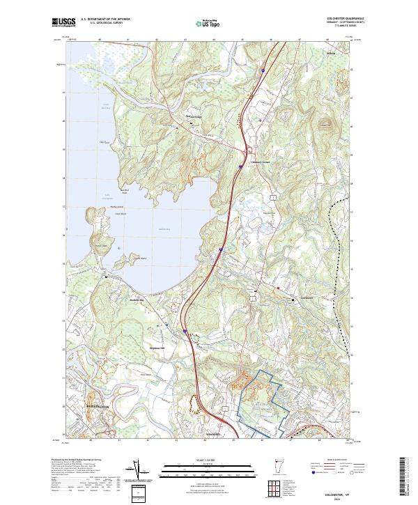 2024 Colchester2024 Print · USGSCoastal Chittenden County is captured here in the early twenty-first century as suburban growth meets the shores of Lake Champlain. Researchers can trace family history at the Village Cem and Champlain Cem, or locate the NG Ethan Allen AFB MTA near Shipman Hill.
Showing maps 1-25 of 28
Top cities near Essex
- Burlington historical maps
- South Burlington historical maps
- Colchester historical maps
- Essex Junction historical maps
- Williston historical maps
- Winooski historical maps
See more
Top neighborhoods of Essex
Frequently asked questions
- What are the different types of historical maps available for Essex?
- What is the oldest map of Essex?
- Where can I purchase historical maps of Essex for my home or office?
- Where can I download high-res historical maps of Essex?
- Are there historical topographic maps available for Essex?
- Is there historical aerial imagery available for Essex?
- Where are historical maps of Essex sourced from?