Old Maps of Essex County, Vermont for Academic Research
Study the evolution of Essex County with 198 high-resolution historic maps. Whether you're teaching, researching, or modeling changes in land use, these maps provide essential visual documentation of urban, environmental, and geographic change.
- Analyze long-term change: Track patterns in development, transportation, and natural features.
- Ideal for environmental or urban studies: Support academic projects with primary historical map data.
- Use in the classroom or lab: Educators and researchers rely on these maps to bring historical context to life.
These maps are a powerful tool for teaching, research, and visualizing how Essex County has changed over the decades.
Essex County, VT maps
(198)- 1900 Map of Whitefield
 1900 Whitefield1900 Print · USGSWhite Mountains rail and tourism reached a peak at the turn of the century, as seen in this 1897 survey. Trace the old junctions and grand hotels of the era, from the Mount View House to the busy tracks at Whitefield Junction and Wing Road.5 unique versions available
 - 1920 Map of Guildhall
 1920 Guildhall1920 Print · USGSThe upper Connecticut River valley is captured here in the early twentieth century as a bustling railroad corridor on the border of Vermont and New Hampshire. Genealogists can trace family names at Wheeler Corner or Hapgood Corner and locate regional hubs like North Stratford and Guildhall Station.
 - 1924 Map of Island Pond
 1924 Island Pond1924 Print · USGSNortheast Kingdom hill towns and isolated rail stops are captured here in the mid-1920s. Genealogists can locate many rural schoolhouses like Bazzinet School and Blake School, or trace the Grand Trunk Railway past Wenlock and Island Pond.
 - 1925 Map of Indian Stream
 1925 Indian Stream1925 Print · USGSThe northern tip of New Hampshire is captured here in the mid-1920s, showing a rugged territory of logging camps and border schools. Researchers can trace the lineage of remote settlements through Indian Stream School, Greeleys Camp, and the community at Happy Corner.
 - 1926 Map of Island Pond
 1926 Island Pond1926 Print · USGSNortheast Vermont during the mid-twenties shows a landscape of timberlands and rail-dependent villages along the Canadian border. Genealogists and researchers can trace local school districts like Buck School or follow the Grand Trunk Railway past Norton Mills.4 unique versions available
 - 1926 Map of Indian Stream
 1926 Indian Stream1926 Print · USGSUpper Coos County at the Canadian border comes alive in this survey of northern New Hampshire's timberlands and early settlements. Genealogists and historians can trace rural schoolhouses like Wheeler School and Indian Stream School, or locate old camps such as Happy Corner and Depot Camp.4 unique versions available
 - 1927 Map of Indian Stream
 1927 Indian Stream1927 Print · USGSThe northern reaches of Coos County are captured here in the mid-1920s, showing the remote borderlands between New Hampshire and Canada. Genealogists and historians can locate rural landmarks like the Clarksville Town Hall, the Wheeler School, and numerous timber camps like Varney Camp.5 unique versions available
 - 1929 Map of Averill
 1929 Averill1929 Print · USGSThe northern borderlands of Vermont and New Hampshire appear here during the peak of the region's timber era. Trace the industrial landscape of the Maine Central RR and early logging outposts like Camp No 10 and Buzzell Dam.5 unique versions available
 - 1930 Map of Dixville, 1954 Print
 1930 Dixville1954 Print · USGSNorthern New Hampshire at the start of the 1930s reveals a landscape of isolated hill farms and small timber towns. Genealogists can locate family-named landmarks like Piper Hill Cem and numerous district schools including Cedar Brook Sch and Forbes Sch.5 unique versions available
 - 1931 Map of Guildhall
 1931 Guildhall1931 Print · USGSThe Upper Connecticut River valley was a bustling rail corridor in the early thirties where New Hampshire and Vermont met. Genealogists and rail historians can trace the paths of the Maine Central RR through Groveton or find rural landmarks like East Stratford Sch.
 - 1931 Map of Littleton
 1931 Littleton1931 Print · USGSUpper Connecticut River Valley life is recorded here in the early thirties, just as aerial photography began to modernize topographic surveying. Genealogists can locate family-named hills and district schools like the Walker Hill Sch and Gilmanton Sch.2 unique versions available
 - 1932 Map of Littleton
 1932 Littleton1932 Print · USGSThe Upper Connecticut River valley and the hills of Vermont's Northeast Kingdom appear here in the early thirties. Trace family connections through numerous rural schoolhouses like Sugar Hill Sch or locate the old Kirby Mtn Quarries and the original path of the Maine Central Railroad.3 unique versions available
 - 1933 Map of Guildhall
 1933 Guildhall1933 Print · USGSThe Upper Connecticut River Valley thrives during the early thirties as a nexus of New England rail and timber. Trace early families and industry at Maidstone Lake, the Grand Trunk Railway corridor, and the Stone Mtn Firetower.3 unique versions available
 - 1933 Map of Dixville
 1933 Dixville1933 Print · USGSCoos County's rugged North Country is captured in the early 1930s, documenting a landscape of remote timber camps and hillside schoolhouses. Genealogists can trace family landmarks like the East Colebrook Ch, Bungy, and over a dozen named schools including Bear Rock Sch.2 unique versions available
 - 1934 Map of Dixville
 1934 Dixville1934 Print · USGSThe White Mountains of Coos County appear here in the early 1930s, showing a landscape defined by timber camps and rural school districts. Genealogists can trace family roots through landmarks like Stewartstown Hollow, East Columbia Ch, and several mountain camps including Carr Camp.2 unique versions available
 - 1935 Map of Littleton
 1935 Littleton1935 Print · USGSThe Upper Connecticut River Valley comes alive in the mid-1930s, showing the borderlands of Vermont and New Hampshire during a period of hydroelectric and rail expansion. Researchers can trace the legacy of local education and industry through sites like the Kirby Mtn Quarries, the Frank D. Comerford Hydro-Electric Plant, and the Slate Ledge Sch.4 unique versions available
 - 1935 Map of Whitefield
 1935 Whitefield1935 Print · USGSThe White Mountains region in the mid-1930s shows a landscape of busy rail junctions and early aviation fields. Trace old family plots at Baptist Hill Cem or locate vanished structures near Mill Village and Quebec Junction.4 unique versions available
 - 1937 Map of Guildhall
 1937 Guildhall1937 Print · USGSThe Connecticut River valley comes alive in the 1930s, documenting a landscape of rail-connected river towns and remote mountain bogs. Genealogists and historians can trace the locations of the Chessman Sch, the Maine Central rail lines, and local landmarks like Brunswick Springs.3 unique versions available
 - 1938 Map of Whitefield
 1938 Whitefield1938 Print · USGSCoos County at the end of the Great Depression was a landscape of mountain rail junctions and valley farms. Trace the vanished railroad stops at Quebec Junction, locate family homesteads near Baptist Hill Sch, or find the CCC Camp at Pierce Bridge.3 unique versions available
 - 1949 Map of Jackman
 1949 Jackman1949 Print · USGSThe Quebec and Maine borderlands are shown in great detail during the late 1940s, highlighting the industrial and natural geography of the region. Trace old rail lines like the Canadian Pacific and locate settlements from Sherbrooke to Scotstown.2 unique versions available
 - 1950 Map of Lewiston
 1950 Lewiston1950 Print · USGSThe Maine and New Hampshire borderlands come alive in this post-war survey of the White Mountains and Androscoggin valley. Genealogists and historians can trace rail lines like the Maine Central Railroad and find high-altitude landmarks from Mount Washington to Bretton Woods.2 unique versions available
 - 1951 Map of Burke, 1953 Print
 1951 Burke1953 Print · USGSNortheastern Vermont in the early 1950s is a landscape of high peaks and isolated logging hamlets. Genealogists and local historians can trace rural schools like White Sch, family burial grounds such as Pownal Cem, and the timber history of Gallup Mills.6 unique versions available
 - 1953 Map of Island Pond, 1954 Print
 1953 Island Pond1954 Print · USGSNortheast Vermont at the mid-century shows a landscape of rail-linked settlements and timberlands. Genealogists and historians can trace Island Pond and Norton Mills, or locate landmarks like Cargill Cem and Buck School.5 unique versions available
 - 1953 Map of Averill, 1954 Print
 1953 Averill1954 Print · USGSThe northern edge of Vermont and New Hampshire meets the Quebec border in this mid-century portrait of a river-and-rail economy. Researchers can trace family sites from the Alice Hunt Cemetery to the crossing at Columbia Bridge and the logging camps of Lemington.5 unique versions available
 - 1956 Map of Guildhall, 1957 Print
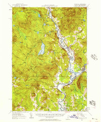 1956 Guildhall1957 Print · USGSThe upper Connecticut River valley comes alive in the mid-fifties, showing the rail-and-river economy of the Vermont-New Hampshire border. Genealogists and researchers can trace the tracks of the Grand Trunk railroad through North Stratford or locate the Central Sch and Browns Mill.3 unique versions available
Showing maps 1-25 of 198
Top cities of Essex County
- Lunenburg historical maps
- Concord historical maps
- Brighton historical maps
- Canaan historical maps
- East Haven historical maps
- Guildhall historical maps
See more
Frequently asked questions
- What are the different types of historical maps available for Essex County?
- What is the oldest map of Essex County?
- Where can I purchase historical maps of Essex County for my home or office?
- Where can I download high-res historical maps of Essex County?
- Are there historical topographic maps available for Essex County?
- Is there historical aerial imagery available for Essex County?
- Where are historical maps of Essex County sourced from?