Old Maps of South Cambridge, Cambridge for Academic Research
Study the evolution of South Cambridge with 15 high-resolution historic maps. Whether you're teaching, researching, or modeling changes in land use, these maps provide essential visual documentation of urban, environmental, and geographic change.
- Analyze long-term change: Track patterns in development, transportation, and natural features.
- Ideal for environmental or urban studies: Support academic projects with primary historical map data.
- Use in the classroom or lab: Educators and researchers rely on these maps to bring historical context to life.
These maps are a powerful tool for teaching, research, and visualizing how South Cambridge has changed over the decades.
South Cambridge, Cambridge maps
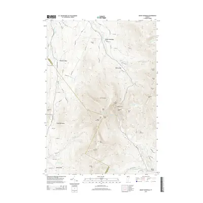
(15)- 1925 Map of Mount Mansfield
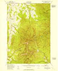
 1925 Mount Mansfield1925 Print · USGSNorthern Vermont in the mid-1920s is captured here at the intersection of rail-era commerce and early mountain tourism. Genealogists can trace families through district schools like Governors Right School and landmarks like Morses Mill or Smugglers Notch.
 - 1927 Map of Mount Mansfield
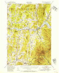
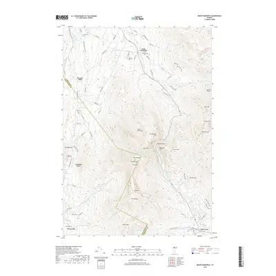
 1927 Mount Mansfield1927 Print · USGSLamoille County and the Green Mountain ridge are captured here in the mid-1920s, showing the height of the valley's rail-and-river era. Genealogists can locate family homesteads near the Irish Settlement, dozens of district schools like Hooper School, and the historic Mt Mansfield Hotel.5 unique versions available
 - 1944 Map of Mount Mansfield
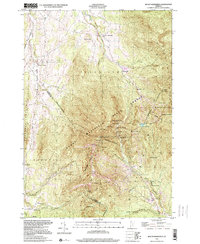
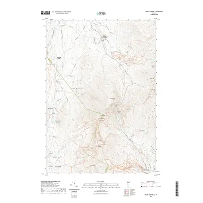
 1944 Mount Mansfield1944 Print · USGSNorthern Vermont in the mid-1940s is defined here by high mountain peaks and a dense network of rural school districts. Genealogists can trace family footprints through numerous local landmarks like Irish Settlement Sch, Marses Mill, and the high-altitude Mt Mansfield Hotel.
 - 1948 Map of Mount Mansfield, 1953 Print
 1948 Mount Mansfield1953 Print · USGSMount Mansfield and the Sterling Range appear here in the late 1940s, showcasing early Vermont ski culture and mountain hiking. Researchers can trace the original path of The Long Trail as it passes Taft Lodge, the Mount Mansfield Hotel, and the State Ski Dormitory.6 unique versions available
 - 1948 Map of Mount Mansfield, 1954 Print
 1948 Mount Mansfield1954 Print · USGSThe Green Mountains of Vermont meet the Lamoille River valley here during the post-war era, showing a mix of mountain tourism and traditional farming. Genealogists can trace family lines through the Irish Settlement and numerous rural sites like Sanderson Cem and Buck Hollow Sch.5 unique versions available
 - 1950 Map of Lake Champlain
 1950 Lake Champlain1950 Print · USGSThe Lake Champlain valley and its surrounding peaks are captured in detail during the late 1940s, showing the vital rail and road connections between New York and Vermont. Researchers can trace the routes of the Central Vermont Railway or locate old industrial centers like Mineville and Witherbee.2 unique versions available
 - 1958 Map of Lake Champlain
 1958 Lake Champlain1958 Print · USGSThe Champlain Valley and surrounding high peaks are captured here in the late fifties, showcasing the cross-border region from the Adirondacks to the Green Mountains. Researchers can trace historic rail routes like the Rutland Railway or locate old valley settlements such as Keeseville and Vergennes.2 unique versions available
 - 1962 Map of Lake Champlain, 1975 Print
 1962 Lake Champlain1975 Print · USGSLake Champlain and the high peaks of the Adirondacks and Green Mountains are captured here during the mid-twentieth century. Researchers can trace the industrial legacy of the Lyon Mountain Mine and the rail corridors of the Central Vermont RR and Delaware & Hudson RR.3 unique versions available
 - 1989 Map of Mount Mansfield
 1989 Mount Mansfield1989 Print · USGSNorthern Vermont in the late eighties remains a landscape of deep forests and isolated mountain villages. Genealogists and hikers can trace the old rail lines of the Canadian Pacific RR or locate family sites near Lake Willoughby and Brownington Village.
 - 1997 Map of Mount Mansfield, 2000 Print
 1997 Mount Mansfield2000 Print · USGSThe Green Mountains near the Lamoille and Chittenden county line are captured here in the late 1990s, showcasing a landscape of high summits and recreational heritage. Researchers can trace the Long Trail past Taft Lodge or locate the old Harvey Sch and Morses Mill in the valleys.
 - 2012 Map of Mount Mansfield, 2012 Print
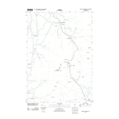 2012 Mount Mansfield2012 Print · USGSCovers South Cambridge, including Stowe, Underhill, and other nearby areas
 - 2015 Map of Mount Mansfield, 2015 Print
 2015 Mount Mansfield2015 Print · USGSCovers South Cambridge, including Stowe, Underhill, and other nearby areas
 - 2018 Map of Mount Mansfield, 2018 Print
 2018 Mount Mansfield2018 Print · USGSCovers South Cambridge, including Stowe, Underhill, and other nearby areas
 - 2021 Map of Mount Mansfield, 2021 Print
 2021 Mount Mansfield2021 Print · USGSCovers South Cambridge, including Stowe, Underhill, and other nearby areas
 - 2024 Map of Mount Mansfield, 2024 Print
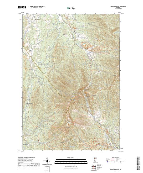 2024 Mount Mansfield2024 Print · USGSThe Green Mountains in the early twenty-first century are defined here by high peaks and valley hamlets. Researchers can trace historic burial sites like Hopkins Cem and navigate the high passes of Smugglers Notch and Chilcoot Pass.
End of results
Showing maps 1-15 of 15
Top cities near South Cambridge
- Essex historical maps
- Williston historical maps
- Swanton historical maps
- Waterbury historical maps
- Stowe historical maps
- Jericho historical maps
See more
Frequently asked questions
- What are the different types of historical maps available for South Cambridge?
- What is the oldest map of South Cambridge?
- Where can I purchase historical maps of South Cambridge for my home or office?
- Where can I download high-res historical maps of South Cambridge?
- Are there historical topographic maps available for South Cambridge?
- Is there historical aerial imagery available for South Cambridge?
- Where are historical maps of South Cambridge sourced from?