Old Maps of Lamoille County, Vermont
Explore 84 old maps of Lamoille County, spanning from 1919 to today. These high-resolution historic maps reveal how streets, neighborhoods, landmarks, and natural features evolved over time — perfect for genealogy, metal detecting, research, and local history exploration.
What you can do with these maps:
- See how Lamoille County changed over time: Compare historical maps to modern-day views to trace roads, homesites, rail lines & more.
- View detailed metadata: Each map includes creators, publishers, year, scale, and archive source.
- Overlay maps with satellite & LiDAR: Visualize the past alongside modern tools to explore terrain & human change.
- Trusted historical sources: Maps sourced from the USGS, Library of Congress, and other archives.
- Access maps your way: View online, download high-res files, or order prints for personal or research use.
Start exploring old maps of Lamoille County to uncover forgotten places, hidden landmarks, and the deep history beneath your feet.
Lamoille County, VT maps
(84)- 1919 Map of Montgomery, 1920 Print
 1919 Montgomery1920 Print · USGSFranklin County at the close of the Great War was a landscape of mountain passes and railroad junctions. Genealogists and historians can trace the early layout of Montgomery and Richford, locating family-named landmarks like Nutting Corner and Farrar Corner.
 - 1919 Map of Montpelier, 1958 Print
 1919 Montpelier1958 Print · USGSMontpelier and the Winooski River valley are shown here just after the Great War, when rail lines and early highways connected a landscape of small hill farms and mines. Genealogists can locate dozens of rural landmarks, including the Talc Mine, the Sodom PO, and the Green Mountain Cemetery.2 unique versions available
 - 1920 Map of Franklin Pond
 1920 Franklin Pond1920 Print · USGSFranklin County's landscape at the Canadian border comes alive in this post-war military survey. Genealogists can trace family homesteads and local commerce through settlements like Pumpkin Village and rail stops such as Fairfield (Sta.) or the busy mills at Enosburg Falls.
 - 1920 Map of Montgomery
 1920 Montgomery1920 Print · USGSNorthern Vermont's rugged borderlands come alive in this post-World War I survey of the Missisquoi River valley. Genealogists can trace family homesteads near Grocers Corner, Hectorville, and old schoolhouses like the Notch School.
 - 1920 Map of Irasburg
 1920 Irasburg1920 Print · USGSNorthern Vermont near the Canadian border is shown here after the Great War, featuring a landscape of crossroads settlements and river valleys. Researchers can trace historic family-named junctions like McAllisters Corner, the path of the Canadian Pacific R.R., and the rural Grant School.
 - 1921 Map of Richmond
 1921 Richmond1921 Print · USGSThe Green Mountains in the early twenties were defined by the deep valleys of the Winooski River and the high peaks of the northern range. Genealogists and hikers can trace the original footprints of Underhill Center, the Duxbury School, and the Central Vermont rail line.
 - 1921 Map of Montpelier
 1921 Montpelier1921 Print · USGSMontpelier and the Winooski valley are seen here in the early twenties, framed by the peaks of the Worcester Mountains. Genealogists and local historians can locate dozens of district schools and unique landmarks like the Talc Mine, Sodom PO, and the Central Vermont Ry.6 unique versions available
 - 1922 Map of Enosburg Falls
 1922 Enosburg Falls1922 Print · USGSUpper Vermont near the Canadian border thrived in the early twenties as a hub of rail commerce and rural education. Genealogists can trace family footprints across dozens of local schoolhouses like Lost Nation School or explore the industrial roots of Gilbert Tannery and Enosburg Falls.2 unique versions available
 - 1923 Map of Irasburg
 1923 Irasburg1923 Print · USGSOrleans County is captured in the early 1920s, showing a landscape defined by dairy farming, rail transport, and a dense network of one-room schoolhouses. Genealogists can trace family lands near North Troy or locate ancestral sites like the Center Cemetery and West Hill School.
 - 1924 Map of Camels Hump
 1924 Camels Hump1924 Print · USGSThe Green Mountains in the early 1920s are centered on the iconic peak of Camels Hump and the busy Winooski River corridor. Genealogists and historians can trace the foundations of local life through the State Hospital for the Insane in Waterbury, small mountain schools like Piddock School, and the path of the Central Vermont railroad.5 unique versions available
 - 1924 Map of Enosburg Falls
 1924 Enosburg Falls1924 Print · USGSNorthern Vermont's dairy and rail landscape is captured here in the 1920s, showing the borderlands along the Canadian border. Genealogists can trace family names through dozens of rural landmarks like Pomeroy School, Gilberts Tannery, and Fairfield Station.5 unique versions available
 - 1925 Map of Irasburg
 1925 Irasburg1925 Print · USGSOrleans County, Vermont, sits at the Canadian border in the mid-1920s, showing a landscape of small hill farms and rural school districts. Researchers can trace the CANADIAN PACIFIC rail line through North Troy or locate family roots near the Farrar School and Center Cemetery.4 unique versions available
 - 1925 Map of Jay Peak
 1925 Jay Peak1925 Print · USGSThe Green Mountains of northern Vermont meet the Canadian border in the mid-1920s, showing a rugged landscape of rail junctions and mountain passes. Genealogists and historians can trace defunct district schoolhouses like Corey School, the operations of the Asbestos Mine, and timber-era landmarks like Stevens Mill.4 unique versions available
 - 1925 Map of Mount Mansfield
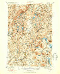
 1925 Mount Mansfield1925 Print · USGSNorthern Vermont in the mid-1920s is captured here at the intersection of rail-era commerce and early mountain tourism. Genealogists can trace families through district schools like Governors Right School and landmarks like Morses Mill or Smugglers Notch.
 - 1927 Map of Mount Mansfield
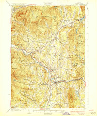
 1927 Mount Mansfield1927 Print · USGSLamoille County and the Green Mountain ridge are captured here in the mid-1920s, showing the height of the valley's rail-and-river era. Genealogists can locate family homesteads near the Irish Settlement, dozens of district schools like Hooper School, and the historic Mt Mansfield Hotel.5 unique versions available
 - 1927 Map of Hyde Park
 1927 Hyde Park1927 Print · USGSLamoille County was a landscape of small river towns and mountain hollows in the late twenties. Researchers can locate dozens of district schoolhouses like Wescome Sch, the local Talc Mine, and family burial grounds including Blake Cem.
 - 1928 Map of Hardwick, 1938 Print
 1928 Hardwick1938 Print · USGSUpper Vermont at the end of the 1920s is seen here through its network of district schools and valley rail lines. Genealogists can trace family landmarks like Jackson Bridge or locate vanished schoolhouses such as Beeler Sch and Speir Sch.
 - 1930 Map of Hyde Park
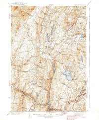
 1930 Hyde Park1930 Print · USGSLamoille County in the late twenties shows a landscape of busy river towns and upland mines connected by the St Johnsbury and Lake Champlain Railroad. Trace early school districts like McKinistry Sch. or locate old operations at the Talc Mine and Upper Diggings.4 unique versions available
 - 1934 Map of Hardwick
 1934 Hardwick1934 Print · USGSUpper Vermont's hill towns and river valleys are captured here in the mid-1930s, showing a landscape tied to the Lamoille River and small-town industry. Researchers can trace dozens of rural schoolhouses like Collinsville Sch and landmarks such as Jackson Bridge.
 - 1938 Map of Hardwick
 1938 Hardwick1938 Print · USGSVermont’s northern hills and the Lamoille River valley are shown in the late 1930s, documenting a time when rural schools and the railroad connected the highlands. Trace family roots through sites like Hazen Road Sch, Greensboro Bend, and the ST JOHNSBURY AND LAKE CHAMPLAIN RR.2 unique versions available
 - 1939 Map of Plainfield
 1939 Plainfield1939 Print · USGSVermont's granite-and-timber country is captured here on the eve of the 1940s, when remote rail lines still connected upland villages. Genealogists can trace family names at the Old West Ch, Hollister Hill Sch, and the isolated Lanesboro rail stop.
 - 1940 Map of Plainfield, 1953 Print
 1940 Plainfield1953 Print · USGSVermont's hill country is captured here just before the war, showing a landscape defined by small farms and upland schools. Genealogists can locate family landmarks at Maple Cors Calais PO, Old West Ch, and the St Johnsbury and Lake Champlain RR.2 unique versions available
 - 1943 Map of Plainfield
 1943 Plainfield1943 Print · USGSVermont's highland farming and rail communities are captured here in the 1940s as the state's rural landscape remained densely settled. Genealogists can locate family-named landmarks like Hollister Hill Sch, trace the Montpelier and Wells River RR, or find the Old West Ch near Kent Cors.2 unique versions available
 - 1943 Map of Hyde Park
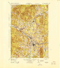 1943 Hyde Park1943 Print · USGSLamoille County during the mid-1940s shows a landscape of river-valley industry and upland hill farms. Researchers can locate dozens of country schoolhouses like Wiswell Sch and trace local mining history at the Talc Mine or the Lower Diggings.
 - 1943 Map of Jay Peak, 1946 Print
 1943 Jay Peak1946 Print · USGSThe Vermont high country comes into focus in the mid-1940s, showing a rugged landscape of rail junctions and mountain industries. Genealogists and historians can locate remote mountain schools like Woodward Sch, the industrial Asbestos Mine, and the mill sites of Hectorville.
Showing maps 1-25 of 84
Top cities of Lamoille County
- Stowe historical maps
- Johnson historical maps
- Hyde Park historical maps
- Morristown historical maps
- Wolcott historical maps
- Eden historical maps
See more
Frequently asked questions
- What are the different types of historical maps available for Lamoille County?
- What is the oldest map of Lamoille County?
- Where can I purchase historical maps of Lamoille County for my home or office?
- Where can I download high-res historical maps of Lamoille County?
- Are there historical topographic maps available for Lamoille County?
- Is there historical aerial imagery available for Lamoille County?
- Where are historical maps of Lamoille County sourced from?