2000s (21st Century) Maps of Lamoille County, Vermont
Explore 19 historic maps of Lamoille County from the 2000s (21st Century). These maps offer a rare glimpse into what life looked like during the 2000s — showing old roads, neighborhoods, homes, and landmarks that have changed or disappeared over time.
Whether you're researching your family's past, planning a metal detecting trip, or studying how Lamoille County's landscape evolved across the 2000s, these high-resolution maps are a powerful tool for exploring the history of this region.
- Focus on a specific era: All maps on this page are from the 2000s, giving you a focused view of this time period.
- See what’s changed: Compare century-old streets, trails, and buildings to today's modern landscape using overlays and satellite layers.
- Research with precision: Use these maps for genealogy, historical research, land use analysis, or educational projects.
- View, download, or print: Maps are fully viewable online in high resolution, and can be downloaded or printed for your own records.
Start exploring Lamoille County's history through authentic maps from the 2000s. This is your window into the past.
Lamoille County, VT maps
(19)- 2024 Map of Sterling Mountain, 2024 Print
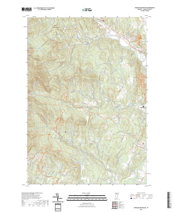 2024 Sterling Mountain2024 Print · USGSThe high ridges of the Green Mountains near Morristown are captured here in the 2020s, showing a terrain defined by both wilderness and old valley settlements. Genealogists and hikers can trace family-named sites like French Hill Cem, West Settlement, and the storied path of the Long Trl.
 - 2024 Map of Morrisville, 2024 Print
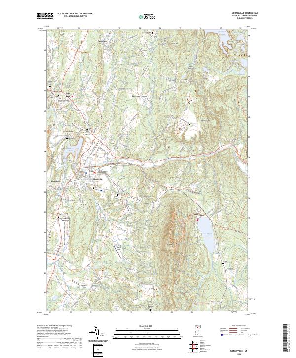 2024 Morrisville2024 Print · USGSLamoille County's river valleys and mountain foothills are captured here in the mid-2020s, centered on the historic seats of Morrisville and Hyde Park. Researchers can trace local heritage through numerous sites like the Lamoille County Courthouse, Riverbank Cem, and Lower Diggings.
 - 2024 Map of Bolton Mountain, 2024 Print
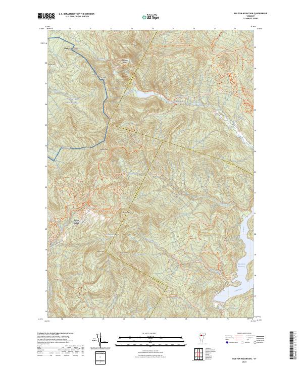 2024 Bolton Mountain2024 Print · USGSThe high peaks of the Green Mountains are captured in this 2024 survey, showing the development of Bolton Valley and the vast trail networks around Bolton Mtn. Trace the paths of the Long Trl and Catamount Trl through Nebraska Notch.
 - 2024 Map of Johnson, 2024 Print
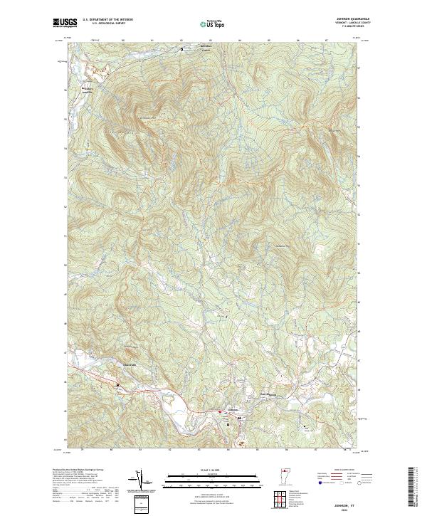 2024 Johnson2024 Print · USGSLamoille County's river valleys and mountain ridges are captured here in the mid-2020s, centered on the historic village of Johnson. Genealogists and historians can trace local family lineages through sites like Evergreen Ledge Cem, Plot Cem, and Johnson State College.
 - 2024 Map of Wolcott, 2024 Print
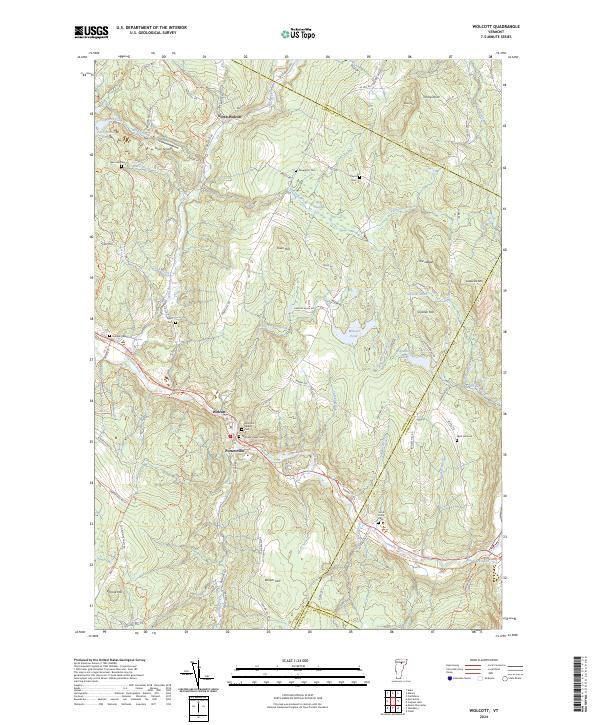 2024 Wolcott2024 Print · USGSThe Lamoille River valley serves as the heart of this Vermont township, documented here in its contemporary landscape. Researchers can trace ancestral locations through numerous burial grounds like Hubbell Cemetery or locate the village of Pottersville.
 - 2024 Map of Mount Worcester, 2024 Print
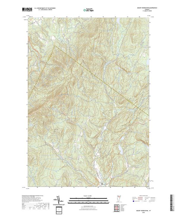 2024 Mount Worcester2024 Print · USGSThe Worcester Mountains define this part of Washington County in the 2020s, showing a landscape shaped by high ridges and the North Branch Winooski River. Researchers can locate ancestral sites at Mountain Cem or trace old upland routes like McCall Pasture Rd and Hardwood Flats Rd.
 - 2024 Map of Caspian Lake, 2024 Print
 2024 Caspian Lake2024 Print · USGSThe Greensboro and Hardwick area comes into focus through this modern survey of Vermont's lakeside and rail corridors. Genealogists can locate several family burial sites including Lincoln Noyes Cem and Sanborn Cem, or trace the path of the Lamoille Valley Rail Trl.
 - 2024 Map of Stowe, 2024 Print
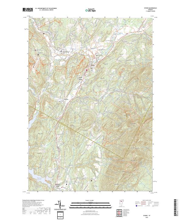 2024 Stowe2024 Print · USGSThe Lamoille County highlands surrounding Stowe appear in modern detail, capturing the valley's evolution into a premier mountain destination. Researchers can trace historic family burial sites like Trapp Family Cem or locate the old crossroads at Moscow and Waterbury Center.
 - 2024 Map of Cold Hollow Mountains, 2024 Print
 2024 Cold Hollow Mountains2024 Print · USGSNorthern Vermont's high country is documented here in recent years, showing the intersection of Franklin and Lamoille Counties. Researchers can trace rural lineages through the West Hill Cem and Chamberlain Cem or explore the rugged Cold Hollow Mountains.
 - 2024 Map of Mount Mansfield, 2024 Print
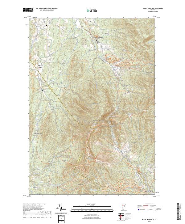 2024 Mount Mansfield2024 Print · USGSThe Green Mountains in the early twenty-first century are defined here by high peaks and valley hamlets. Researchers can trace historic burial sites like Hopkins Cem and navigate the high passes of Smugglers Notch and Chilcoot Pass.
 - 2024 Map of Eden, 2024 Print
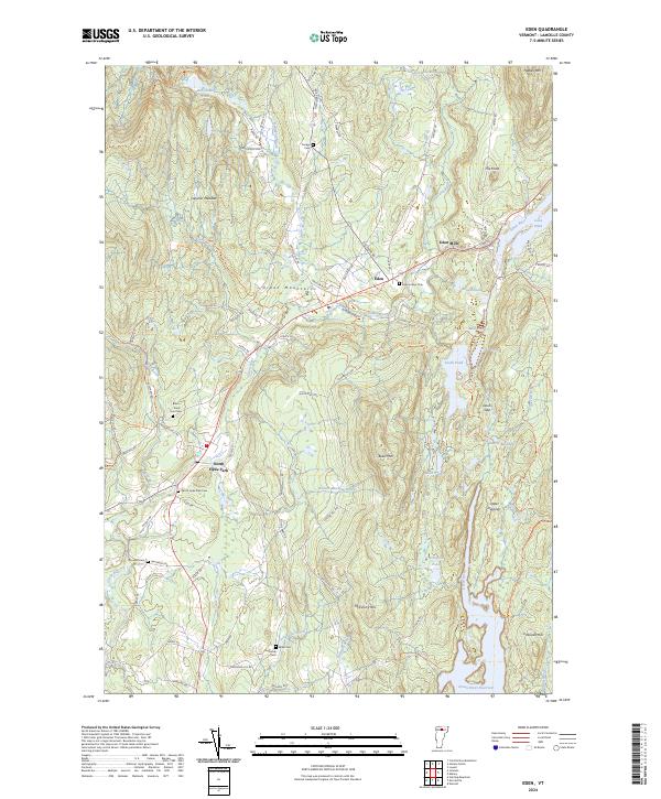 2024 Eden2024 Print · USGSThe Lamoille County highlands come into focus in this contemporary survey of the Green Mountains. Researchers can locate numerous historic burial sites such as Eden Corner Cem and North Hyde Park Cem while tracing the Gihon River.
 - 2024 Map of Hazens Notch, 2024 Print
 2024 Hazens Notch2024 Print · USGSVermont's Green Mountains reveal a landscape of high peaks and historic crossings during the twenty-first century. Genealogists and hikers can trace the paths around Hazens Notch, locating Roegan Road Cem and the site of Tillotson Mill.
 - 2024 Map of Gilson Mountain, 2024 Print
 2024 Gilson Mountain2024 Print · USGSNorthern Vermont's rural character is preserved in this modern survey of the hills and valleys at the edge of the Green Mountains. Researchers can trace generations of families through numerous burial sites like Mudgett Cem and Spafford Cem near Binghamville.
 - 2024 Map of Jeffersonville, 2024 Print
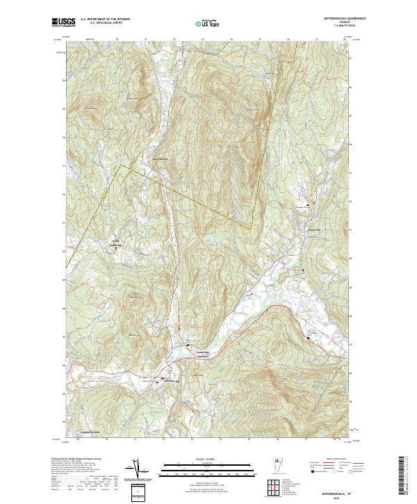 2024 Jeffersonville2024 Print · USGSNorthern Vermont mountain life and river valley settlements are documented here in recent detail. Researchers can trace family roots at Page Burial Plot and Smiley Cem, or explore the crossroads at Cambridge Junction and Jeffersonville.
 - 2024 Map of Underhill, 2024 Print
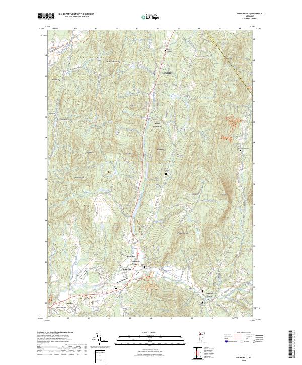 2024 Underhill2024 Print · USGSChittenden County’s foothill villages and mountain gaps are captured in this modern survey of the Green Mountains area. Researchers can locate many local landmarks like the Irish Settlement Cem, Underhill Flats, and the rural Davis Airport.
 - 2024 Map of Bakersfield, 2024 Print
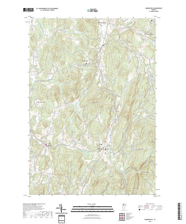 2024 Bakersfield2024 Print · USGSBakersfield and the surrounding highlands of Franklin County are shown here in recent detail, capturing a landscape of family-named ridges and valley hamlets. Genealogists can locate several local burial sites such as Saint Georges Cem and Bordoville Advent Cem, or trace the waters of The Branch.
 - 2024 Map of Lowell, 2024 Print
 2024 Lowell2024 Print · USGSOrleans County is shown in detail during the twenty-first century, centered on the mountain-ringed village of Lowell. Researchers can trace local genealogy through several burial grounds like Old Catholic Cem and locate landmarks such as Leland Hill and McAllister Pond.
 - 2024 Map of Albany, 2024 Print
 2024 Albany2024 Print · USGSIn the highlands of north-central Vermont, this modern survey captures the rural landscape at the edge of the Lowell Mountains. Genealogists and historians can locate family burial sites at Albany Village Cem or trace the early path of the Bailey Hazen RD through Eden Notch.
 - 2024 Map of Woodbury, 2024 Print
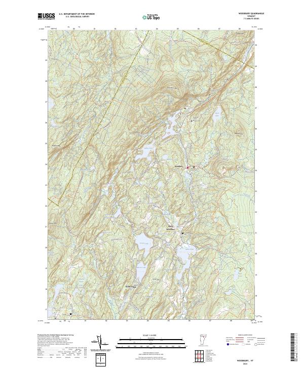 2024 Woodbury2024 Print · USGSUpper Washington County is revealed in the early twenty-first century as a landscape of interconnected ponds and hill-country settlements. Genealogists can locate family burial sites at Ainsworth - North - Bradish Cem and trace the quarrying history along Woodbury Quarry Rd.
End of results
Showing maps 1-19 of 19
Top cities of Lamoille County
- Stowe historical maps
- Johnson historical maps
- Hyde Park historical maps
- Morristown historical maps
- Wolcott historical maps
- Eden historical maps
See more
Frequently asked questions
- What are the different types of historical maps available for Lamoille County?
- What is the oldest map of Lamoille County?
- Where can I purchase historical maps of Lamoille County for my home or office?
- Where can I download high-res historical maps of Lamoille County?
- Are there historical topographic maps available for Lamoille County?
- Is there historical aerial imagery available for Lamoille County?
- Where are historical maps of Lamoille County sourced from?