1940s Maps of Lamoille County, Vermont
Explore 15 historic maps of Lamoille County from the 1940s. These maps offer a rare glimpse into what life looked like during the 1940s — showing old roads, neighborhoods, homes, and landmarks that have changed or disappeared over time.
Whether you're researching your family's past, planning a metal detecting trip, or studying how Lamoille County's landscape evolved across the 1940s, these high-resolution maps are a powerful tool for exploring the history of this region.
- Focus on a specific era: All maps on this page are from the 1940s, giving you a focused view of this time period.
- See what’s changed: Compare century-old streets, trails, and buildings to today's modern landscape using overlays and satellite layers.
- Research with precision: Use these maps for genealogy, historical research, land use analysis, or educational projects.
- View, download, or print: Maps are fully viewable online in high resolution, and can be downloaded or printed for your own records.
Start exploring Lamoille County's history through authentic maps from the 1940s. This is your window into the past.
Lamoille County, VT maps
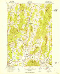
(15)- 1940 Map of Plainfield, 1953 Print
 1940 Plainfield1953 Print · USGSVermont's hill country is captured here just before the war, showing a landscape defined by small farms and upland schools. Genealogists can locate family landmarks at Maple Cors Calais PO, Old West Ch, and the St Johnsbury and Lake Champlain RR.2 unique versions available
 - 1943 Map of Plainfield
 1943 Plainfield1943 Print · USGSVermont's highland farming and rail communities are captured here in the 1940s as the state's rural landscape remained densely settled. Genealogists can locate family-named landmarks like Hollister Hill Sch, trace the Montpelier and Wells River RR, or find the Old West Ch near Kent Cors.2 unique versions available
 - 1943 Map of Hyde Park
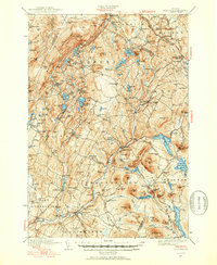
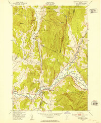
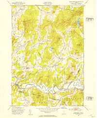
 1943 Hyde Park1943 Print · USGSLamoille County during the mid-1940s shows a landscape of river-valley industry and upland hill farms. Researchers can locate dozens of country schoolhouses like Wiswell Sch and trace local mining history at the Talc Mine or the Lower Diggings.
 - 1943 Map of Jay Peak, 1946 Print
 1943 Jay Peak1946 Print · USGSThe Vermont high country comes into focus in the mid-1940s, showing a rugged landscape of rail junctions and mountain industries. Genealogists and historians can locate remote mountain schools like Woodward Sch, the industrial Asbestos Mine, and the mill sites of Hectorville.
 - 1944 Map of Montpelier
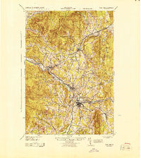
 1944 Montpelier1944 Print · USGSCentral Vermont in the mid-1940s is mapped here with a focus on its mountain settlements and river valley corridors. Genealogists can trace family roots through numerous district schools like Loomis Hill Sch and the location of the Talc Mine.
 - 1944 Map of Mount Mansfield
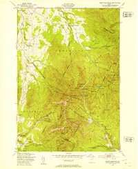
 1944 Mount Mansfield1944 Print · USGSNorthern Vermont in the mid-1940s is defined here by high mountain peaks and a dense network of rural school districts. Genealogists can trace family footprints through numerous local landmarks like Irish Settlement Sch, Marses Mill, and the high-altitude Mt Mansfield Hotel.
 - 1944 Map of Camels Hump
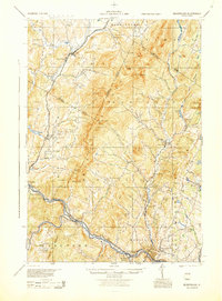
 1944 Camels Hump1944 Print · USGSThe Green Mountains at the height of the war era show a landscape defined by valley settlements and military expansion. You can trace the Central Vermont rail line through Bolton or find vanished rural schoolhouses like Ricker Sch and Phillips Sch.
 - 1944 Map of Enosburg Falls
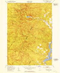
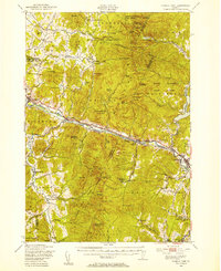
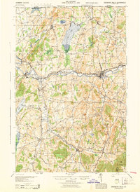 1944 Enosburg Falls1944 Print · USGSNorthern Vermont during the mid-1940s was a landscape of river-valley rail towns and upland dairy farms centered on the Missisquoi River. Researchers can trace the path of the Central Vermont railroad and find defunct local landmarks like Gilberts Tannery or the many numbered schoolhouses like School No 5.
 - 1948 Map of Jeffersonville, 1953 Print
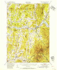
 1948 Jeffersonville1953 Print · USGSVermont's Lamoille Valley in the late 1940s shows a landscape of river-bottom farming and mountain timbering. Trace the path of the St Johnsbury and Lamoille County railroad through Jeffersonville and Cambridge Junction.4 unique versions available
 - 1948 Map of Mount Mansfield, 1953 Print
 1948 Mount Mansfield1953 Print · USGSMount Mansfield and the Sterling Range appear here in the late 1940s, showcasing early Vermont ski culture and mountain hiking. Researchers can trace the original path of The Long Trail as it passes Taft Lodge, the Mount Mansfield Hotel, and the State Ski Dormitory.6 unique versions available
 - 1948 Map of Bolton Mountain, 1953 Print
 1948 Bolton Mountain1953 Print · USGSThe Green Mountains in the late 1940s served as both a recreational escape and a training ground for the military. You can trace the trails to high-altitude shelters like Taylor Lodge or locate the extensive Artillery Target Range within the Fort Ethan Allen Military Reservation.5 unique versions available
 - 1948 Map of Underhill, 1953 Print
 1948 Underhill1953 Print · USGSChittenden County in the late 1940s reveals a network of tight-knit rural school districts and river valley hamlets. Researchers can trace historic family-named landmarks and upland outposts like English Settlement Sch, Cloverdale, and Stevensville.4 unique versions available
 - 1948 Map of Gilson Mountain, 1953 Print
 1948 Gilson Mountain1953 Print · USGSVermont's rural landscape is captured here in the late 1940s, showcasing a network of small upland hamlets and mountain farms. Genealogists and historians can trace family roots through numerous landmarks like Sanderson Cem, Parsons Sch, and the village of Binghamville.4 unique versions available
 - 1948 Map of Mount Mansfield, 1954 Print
 1948 Mount Mansfield1954 Print · USGSThe Green Mountains of Vermont meet the Lamoille River valley here during the post-war era, showing a mix of mountain tourism and traditional farming. Genealogists can trace family lines through the Irish Settlement and numerous rural sites like Sanderson Cem and Buck Hollow Sch.5 unique versions available
 - 1948 Map of Camels Hump, 1954 Print
 1948 Camels Hump1954 Print · USGSThe Green Mountains of the late 1940s are defined by the Winooski River corridor and the high peaks of the range. Genealogists and local historians can trace the foundations of mountain life through Old Round Ch, the Machine Gun Sch, and the rail stops of the Central Vermont line.5 unique versions available
End of results
Showing maps 1-15 of 15
Top cities of Lamoille County
- Stowe historical maps
- Johnson historical maps
- Hyde Park historical maps
- Morristown historical maps
- Wolcott historical maps
- Eden historical maps
See more
Frequently asked questions
- What are the different types of historical maps available for Lamoille County?
- What is the oldest map of Lamoille County?
- Where can I purchase historical maps of Lamoille County for my home or office?
- Where can I download high-res historical maps of Lamoille County?
- Are there historical topographic maps available for Lamoille County?
- Is there historical aerial imagery available for Lamoille County?
- Where are historical maps of Lamoille County sourced from?