Old Maps of Barton Village, Barton for Hiking & Exploration
Hike through history with 24 historic maps of Barton Village. Explore old trails, ghost towns, and forgotten backroads — perfect for outdoor adventurers and local explorers.
- Rediscover forgotten places: Map out old mining camps, roads, and footpaths that no longer exist on modern maps.
- Layer with modern tools: Combine with LiDAR or satellite views to plan hikes through historical terrain.
- Made for exploration: Popular among hikers, overlanders, and local history lovers.
Use these maps to find adventure and explore the hidden past of Barton Village.
Barton Village, Barton maps
(24)- 1919 Map of Lake Memphremagog, 1920 Print
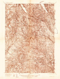
 1919 Lake Memphremagog1920 Print · USGSOrleans County, Vermont, sits at the international border following the Great War, showing a landscape defined by rail lines and lakefront commerce. Genealogists can locate family-named landmarks like Glines Corner, Hayes Corner, and the rural community of Brownington Village.
 - 1920 Map of Derby
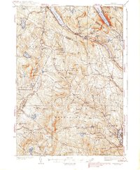
 1920 Derby1920 Print · USGSNorthern Vermont at the turn of the century shows a landscape of tight-knit border hamlets and lakeside rail hubs. Genealogists can trace family landmarks like Kingsbury Cor. and Hayes Corner or follow the tracks of the CANADIAN PACIFIC R.R. through Newport.
 - 1923 Map of Lake Memphremagog
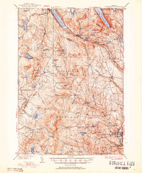
 1923 Lake Memphremagog1923 Print · USGSOrleans County sits along the international border in the early 1920s, showing a landscape of hill farms and granite works. Genealogists can locate dozens of specific rural school sites like Morgan Gore School and vanished stations such as Coventry Station.
 - 1925 Map of Memphremagog
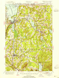
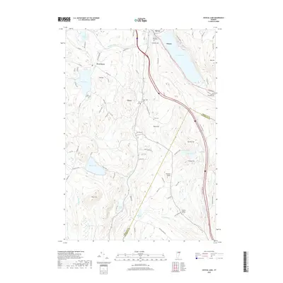
 1925 Memphremagog1925 Print · USGSThe international boundary and the shores of Lake Memphremagog define this Orleans County landscape in the mid-1920s. Researchers can trace the village life of Derby Line, find dozens of rural schools like Morgan Gore School, and locate the Willey Granite Quarry.4 unique versions available
 - 1935 Map of Lyndonville
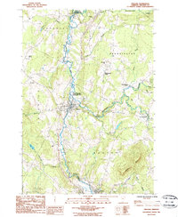
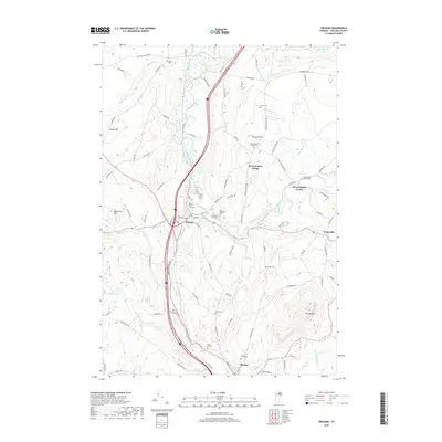
 1935 Lyndonville1935 Print · USGSThe Northeast Kingdom's rail-and-timber era comes to life in this survey of Caledonia County in the mid-1930s. Genealogists and historians can trace the Military Road, identify family plots at the Samuel Drown Burying Ground, and locate vanished rural schoolhouses like Squabble Hollow Sch.
 - 1939 Map of Lyndonville
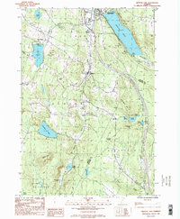
 1939 Lyndonville1939 Print · USGSUpper Caledonia and Orleans Counties are shown in high detail during the late thirties, when the Canadian Pacific railroad still defined the local economy. Genealogists can trace family roots through dozens of rural landmarks, including Glover Cem, South Wheelock Ch, and several dozen local schoolhouses like Old Red Sch.3 unique versions available
 - 1950 Map of Lake Champlain
 1950 Lake Champlain1950 Print · USGSThe Lake Champlain valley and its surrounding peaks are captured in detail during the late 1940s, showing the vital rail and road connections between New York and Vermont. Researchers can trace the routes of the Central Vermont Railway or locate old industrial centers like Mineville and Witherbee.2 unique versions available
 - 1951 Map of Lyndonville
 1951 Lyndonville1951 Print · USGSCaledonia and Orleans counties are shown here in the mid-twentieth century, featuring the deep glacial waters of the Northeast Kingdom. Genealogists and historians can trace local landmarks like Lyndon Teachers College, the Canadian Pacific line through Sutton Sta, and the West Look Cem.5 unique versions available
 - 1953 Map of Memphremagog, 1955 Print
 1953 Memphremagog1955 Print · USGSThe Vermont-Quebec borderlands come alive in this mid-century survey of the Northeast Kingdom, showing the region's rail-and-water commerce. Researchers can trace family roots at Brownington Village, find the Willey Granite Quarry, or locate the St Theresa Ch in Barton.5 unique versions available
 - 1958 Map of Lake Champlain
 1958 Lake Champlain1958 Print · USGSThe Champlain Valley and surrounding high peaks are captured here in the late fifties, showcasing the cross-border region from the Adirondacks to the Green Mountains. Researchers can trace historic rail routes like the Rutland Railway or locate old valley settlements such as Keeseville and Vergennes.2 unique versions available
 - 1962 Map of Lake Champlain, 1975 Print
 1962 Lake Champlain1975 Print · USGSLake Champlain and the high peaks of the Adirondacks and Green Mountains are captured here during the mid-twentieth century. Researchers can trace the industrial legacy of the Lyon Mountain Mine and the rail corridors of the Central Vermont RR and Delaware & Hudson RR.3 unique versions available
 - 1986 Map of Orleans
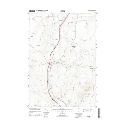
 1986 Orleans1986 Print · USGSOrleans County in the mid-eighties shows a landscape of river-valley settlements and dairy-country hills. Genealogists and hikers can trace the geography of Orleans, Brownington Village, and the slopes of Barton Mtn near the Willoughby River.
 - 1986 Map of Crystal Lake, 1987 Print
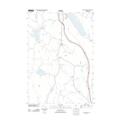
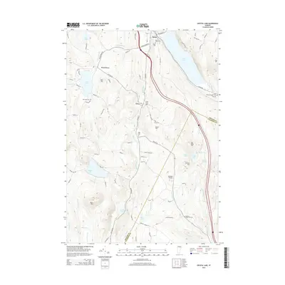
 1986 Crystal Lake1987 Print · USGSOrleans County is captured in the mid-1980s during a period of steady rural life among the hills and glacial ponds. Genealogists can trace the settlements of Barton, Glover, and West Glover while locating landmarks like Lake Parker, Shadow Lake, and Simpson Hill.2 unique versions available
 - 1989 Map of Mount Mansfield
 1989 Mount Mansfield1989 Print · USGSNorthern Vermont in the late eighties remains a landscape of deep forests and isolated mountain villages. Genealogists and hikers can trace the old rail lines of the Canadian Pacific RR or locate family sites near Lake Willoughby and Brownington Village.
 - 2012 Map of Crystal Lake, 2012 Print
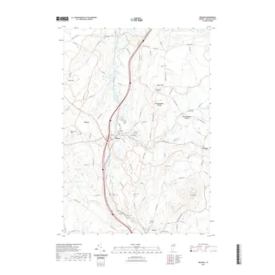
 2012 Crystal Lake2012 Print · USGSCovers Barton Village, including Barton, Glover, and other nearby areas
 - 2012 Map of Orleans, 2012 Print
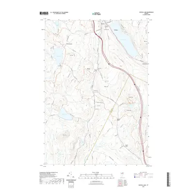
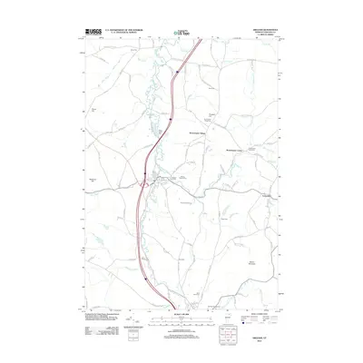 2012 Orleans2012 Print · USGSCovers Barton Village, including Barton, Irasburg, and other nearby areas
 - 2015 Map of Crystal Lake, 2015 Print
 2015 Crystal Lake2015 Print · USGSCovers Barton Village, including Barton, Glover, and other nearby areas
 - 2015 Map of Orleans, 2015 Print
 2015 Orleans2015 Print · USGSCovers Barton Village, including Barton, Irasburg, and other nearby areas
 - 2018 Map of Crystal Lake, 2018 Print
 2018 Crystal Lake2018 Print · USGSCovers Barton Village, including Barton, Glover, and other nearby areas
 - 2018 Map of Orleans, 2018 Print
 2018 Orleans2018 Print · USGSCovers Barton Village, including Barton, Irasburg, and other nearby areas
 - 2021 Map of Orleans, 2021 Print
 2021 Orleans2021 Print · USGSCovers Barton Village, including Barton, Irasburg, and other nearby areas
 - 2021 Map of Crystal Lake, 2021 Print
 2021 Crystal Lake2021 Print · USGSCovers Barton Village, including Barton, Glover, and other nearby areas
 - 2024 Map of Orleans, 2024 Print
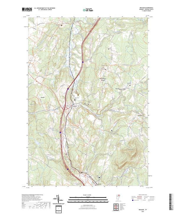 2024 Orleans2024 Print · USGSOrleans County is captured in the modern era, showing the enduring village structures and river valley corridors of Vermont's Northeast Kingdom. Researchers can locate family sites at the Brownington Center Cem and trace the paths of Alder Brook and the Barton River.
 - 2024 Map of Crystal Lake, 2024 Print
 2024 Crystal Lake2024 Print · USGSThe Northeast Kingdom hills of Orleans County appear here in a recent survey, showing the enduring village layouts of Barton and Glover. Genealogists can trace family sites at Welcome O Brown Cem and the remote Sheffield Heights - Cass Cem.
End of results
Showing maps 1-24 of 24
Top cities near Barton Village
- Newport historical maps
- Newport City historical maps
- Hardwick historical maps
- Barton historical maps
- Wolcott historical maps
- Craftsbury historical maps
See more
Top neighborhoods of Barton Village
Frequently asked questions
- What are the different types of historical maps available for Barton Village?
- What is the oldest map of Barton Village?
- Where can I purchase historical maps of Barton Village for my home or office?
- Where can I download high-res historical maps of Barton Village?
- Are there historical topographic maps available for Barton Village?
- Is there historical aerial imagery available for Barton Village?
- Where are historical maps of Barton Village sourced from?