Old Maps of Beebe Plain, Derby for Metal Detecting
Plan your next treasure hunt with 6 historic maps of Beebe Plain. Find old homesites, ghost towns, trails, and gathering spots that may be lost to time — perfect for identifying promising metal detecting locations.
- Locate forgotten sites: Uncover places like long-lost settlements, abandoned rail lines, or gathering spots.
- Plan better hunts: Use map overlays combined with LiDAR or satellite views to narrow in on historically rich areas.
- Made for detectorists: Thousands of hobbyists use these maps to discover relics, coins, and hidden history.
Use these historic maps to boost your research and find new opportunities beneath the surface of Beebe Plain.
Beebe Plain, Derby maps
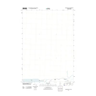
(6)- 1978 Map of Beebe Plain Station
 1978 Beebe Plain Station1978 Print · USGSIn the late seventies, the borderlands between Vermont and Quebec reveal a landscape deeply integrated across the international line. Researchers can trace the unique proximity of Beebe Plain Station U S Customs to the Quebec Central rail line and Comestock Mills.
 - 2012 Map of Newport OE N, 2012 Print
 2012 Newport OE N2012 Print · USGSCovers Beebe Plain, including Stanstead (Ville), Derby, and other nearby areas
 - 2015 Map of Newport OE N, 2015 Print
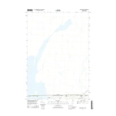 2015 Newport OE N2015 Print · USGSCovers Beebe Plain, including Stanstead (Ville), Derby, and other nearby areas
 - 2018 Map of Newport OE N, 2018 Print
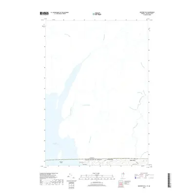 2018 Newport OE N2018 Print · USGSCovers Beebe Plain, including Stanstead (Ville), Derby, and other nearby areas
 - 2021 Map of Newport OE N, 2021 Print
 2021 Newport OE N2021 Print · USGSCovers Beebe Plain, including Stanstead (Ville), Derby, and other nearby areas
 - 2024 Map of Newport OE N, 2024 Print
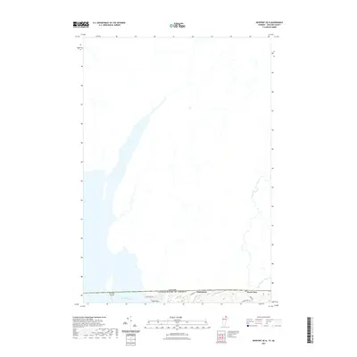
 2024 Newport OE N2024 Print · USGSThe international border between Vermont and Quebec defines this landscape, showing where North Derby and Beebe Plain sit right on the line. You can trace the Beebe Spur Rail Trl, family-named brooks like Ruisseau Dustin, and the island-dotted waters of Lake Memphremagog.
End of results
Showing maps 1-6 of 6
Top cities near Beebe Plain
- Newport City historical maps
- Newport historical maps
- Barton historical maps
- Irasburg historical maps
- Coventry historical maps
- Orleans historical maps
See more
Frequently asked questions
- What are the different types of historical maps available for Beebe Plain?
- What is the oldest map of Beebe Plain?
- Where can I purchase historical maps of Beebe Plain for my home or office?
- Where can I download high-res historical maps of Beebe Plain?
- Are there historical topographic maps available for Beebe Plain?
- Is there historical aerial imagery available for Beebe Plain?
- Where are historical maps of Beebe Plain sourced from?