2020s Maps of Jamaica, Vermont
Explore 4 historic maps of Jamaica from the 2020s. These maps offer a rare glimpse into what life looked like during the 2020s — showing old roads, neighborhoods, homes, and landmarks that have changed or disappeared over time.
Whether you're researching your family's past, planning a metal detecting trip, or studying how Jamaica's landscape evolved across the 2020s, these high-resolution maps are a powerful tool for exploring the history of this region.
- Focus on a specific era: All maps on this page are from the 2020s, giving you a focused view of this time period.
- See what’s changed: Compare century-old streets, trails, and buildings to today's modern landscape using overlays and satellite layers.
- Research with precision: Use these maps for genealogy, historical research, land use analysis, or educational projects.
- View, download, or print: Maps are fully viewable online in high resolution, and can be downloaded or printed for your own records.
Start exploring Jamaica's history through authentic maps from the 2020s. This is your window into the past.
Jamaica, VT maps
(4)- 2024 Map of Windham, 2024 Print
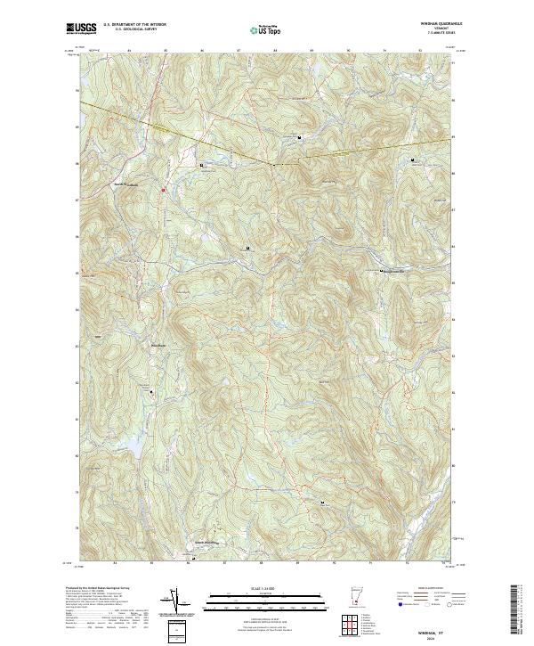 2024 Windham2024 Print · USGSWindham and its surrounding peaks are captured in this contemporary topographic portrait of the Vermont high country. Researchers can trace family ties at the Windham Center Cem or explore the uniquely named Popple Dungeon and Houghtonville.
 - 2024 Map of Jamaica, 2024 Print
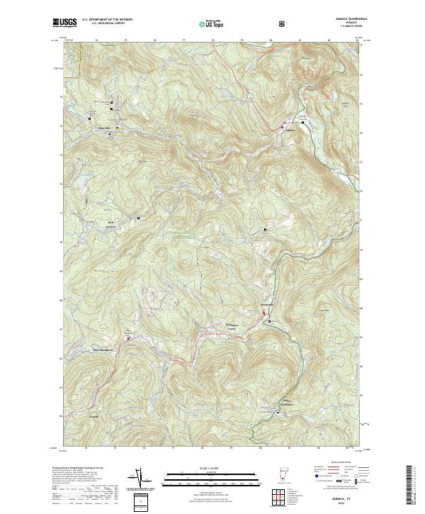 2024 Jamaica2024 Print · USGSWindham County at the present day retains its traditional settlement character throughout the Green Mountains. Researchers can locate numerous family burial sites like Wilder Cem and Mundell-Bourne Cem, alongside the village centers of Jamaica and Wardsboro.
 - 2024 Map of Townshend, 2024 Print
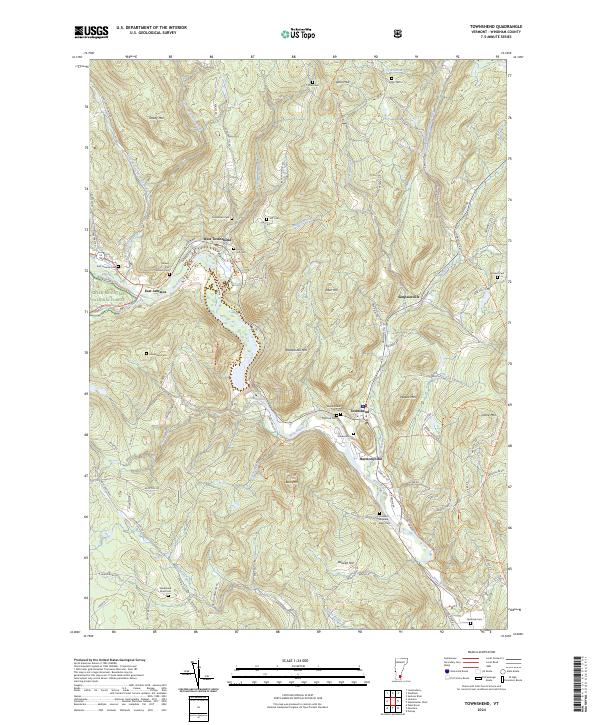 2024 Townshend2024 Print · USGSWindham County's river valleys and upland peaks are captured in this modern survey of south-central Vermont. Genealogists can trace family heritage through numerous remote burial sites like Holland-Brigham-Bixby Cem and settlements such as Harmonyville.
 - 2024 Map of Londonderry, 2024 Print
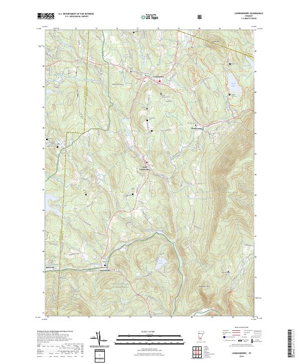 2024 Londonderry2024 Print · USGSVermont's mountain valleys and river bends are captured here in a period of modern conservation and historic preservation. Genealogists can locate over a dozen burial sites including Middletown Cem and Stevens Cem, while tracing the waters of the West River near South Londonderry.
End of results
Showing maps 1-4 of 4
Top cities near Jamaica
- Brattleboro historical maps
- Westminster historical maps
- Ludlow historical maps
- Manchester historical maps
- Dorset historical maps
- East Dorset historical maps
See more
Top neighborhoods of Jamaica
- Pikes Falls historical maps
- Rawsonville historical maps
- East Jamaica historical maps
- West Jamaica historical maps
Frequently asked questions
- What are the different types of historical maps available for Jamaica?
- What is the oldest map of Jamaica?
- Where can I purchase historical maps of Jamaica for my home or office?
- Where can I download high-res historical maps of Jamaica?
- Are there historical topographic maps available for Jamaica?
- Is there historical aerial imagery available for Jamaica?
- Where are historical maps of Jamaica sourced from?