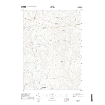
2021 Map of Windham
USGS Topo · Published 2021About this map
Windham and its surrounding hamlets sit within a high-elevation landscape defined by the drainage basins of the Saxtons River and the S Br Williams River. This 2021 survey details the tight-knit settlement patterns of North Windham, South Windham, and Houghtonville, where development remains clustered along valley roads like Windham Hill Rd and Houghtonville Rd. The topography is marked by prominent peaks such as Glebe Mtn and Timber Ridge Mtn, which separate the various brook valleys. Genealogists will find a high density of burial grounds throughout these uplands, including the centrally located Windham Center Cem and more isolated sites like the Popple Dungeon Cem and Stiles Cem. The map effectively illustrates the enduring rural character of this part of Windham County, showing how historic family names are preserved in landmarks like Burt Hill and Blake Hill.
Find a feature on this map
83 named features on this map. Tap any name to fly to it.
Don’t see what you’re looking for? This feature index may not catch every label — zoom into the map to look around manually.
Map Details
Editions of this 2021 Windham Map
This is the sole edition of this map. No revisions or reprints were ever made.
Other maps of this area

1893 · Wallingford
USGS Topo · 1:62,500

1894 · Londonderry
USGS Topo · 1:62,500

1899 · Londonderry
USGS Topo · 1:62,500

1928 · Ludlow
USGS Topo · 1:48,000

1929 · Ludlow
USGS Topo · 1:62,500

1930 · Saxtons River
USGS Topo · 1:48,000

1932 · Ludlow
USGS Topo · 1:62,500

1933 · Saxtons River
USGS Topo · 1:62,500

1950 · Glens Falls
USGS Topo · 1:250,000

1955 · Wallingford
USGS Topo · 1:62,500