
1932 Map of Ludlow
USGS Topo · Published 1932About this map
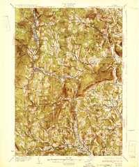
The Rutland Railroad winds through this section of the Green Mountains, following the narrow valleys carved by the Black River and the Williams River. In the early 1930s, this landscape was defined by its numerous small school districts and isolated mountain settlements like Plymouth Kingdom and Spoonerville. The map documents a dense network of rural infrastructure, including many local schools such as Sawyer Stand Sch, Baltimore Sch, and the Cavendish Center Sch.
Find a feature on this map
120 named features on this map. Tap any name to fly to it.
Don’t see what you’re looking for? This feature index may not catch every label — zoom into the map to look around manually.
Map Details
Editions of this 1932 Ludlow Map
4 editions found
Other maps of this area

1891 · Rutland
USGS Topo · 1:62,500

1893 · Wallingford
USGS Topo · 1:62,500

1893 · Rutland
USGS Topo · 1:62,500

1894 · Londonderry
USGS Topo · 1:62,500

1899 · Londonderry
USGS Topo · 1:62,500

1906 · Hanover
USGS Topo · 1:62,500

1908 · Hanover
USGS Topo · 1:62,500

1911 · Woodstock
USGS Topo · 1:62,500

1913 · Woodstock
USGS Topo · 1:62,500

1926 · Claremont
USGS Topo · 1:62,500