1800s (19th Century) Maps of Somerset, Vermont
Explore 8 historic maps of Somerset from the 1800s (19th Century). These maps offer a rare glimpse into what life looked like during the 1800s — showing old roads, neighborhoods, homes, and landmarks that have changed or disappeared over time.
Whether you're researching your family's past, planning a metal detecting trip, or studying how Somerset's landscape evolved across the 1800s, these high-resolution maps are a powerful tool for exploring the history of this region.
- Focus on a specific era: All maps on this page are from the 1800s, giving you a focused view of this time period.
- See what’s changed: Compare century-old streets, trails, and buildings to today's modern landscape using overlays and satellite layers.
- Research with precision: Use these maps for genealogy, historical research, land use analysis, or educational projects.
- View, download, or print: Maps are fully viewable online in high resolution, and can be downloaded or printed for your own records.
Start exploring Somerset's history through authentic maps from the 1800s. This is your window into the past.
Somerset, VT maps
(8)- 1889 Map of Wilmington
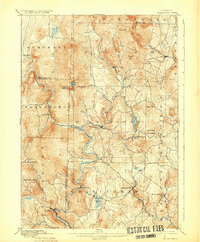
 1889 Wilmington1889 Print · USGSSouthern Vermont in the late nineteenth century was a landscape of steep mountain ridges and river-driven commerce. Genealogists can trace family names and small hamlets like Heartwellville, Davis Bridge, and the Hoosac Tunnel and Wilmington R.R.7 unique versions available
 - 1891 Map of Wilmington
 1891 Wilmington1891 Print · USGSSouthern Vermont in the early 1890s was a landscape of mountain hamlets and river-valley industry. You can trace the Hoosac Tunnel and Wilmington R.R. or locate historic settlements like Readsboro Falls, Jacksonville, and West Dover.
 - 1894 Map of Londonderry
 1894 Londonderry1894 Print · USGSSouthern Vermont in the 1890s was a land of high ridges and isolated mountain hollows. Researchers can trace the early layout of South Londonderry and find now-quiet settlements like Bucketville and Wardsboro Center.
 - 1894 Map of Equinox, 1964 Print
 1894 Equinox1964 Print · USGSBennington County's river valleys and mountain peaks are captured here in the late nineteenth century as timber and rail defined the local economy. Genealogists and historians can trace the early layouts of Arlington, Manchester, and vanished settlements like Kansas or Fayville.2 unique versions available
 - 1896 Map of Equinox
 1896 Equinox1896 Print · USGSBennington County’s mountain valleys and river corridors are captured here in the late nineteenth century during a period of robust rail expansion. Genealogists and local historians can trace family locations near Manchester Center, find remote settlements like Kelley Stand, or follow the Bennington and Rutland R. R. line.
 - 1898 Map of Bennington
 1898 Bennington1898 Print · USGSVermont's southwestern valleys and industrial corridors are documented here in the late nineteenth century. Genealogists and historians can trace rail lines like the Rutland R R through early settlements including Papermill Village and Shaftsbury Center.10 unique versions available
 - 1899 Map of Londonderry
 1899 Londonderry1899 Print · USGSThe Green Mountains in the late nineteenth century were defined by the deep valleys of the West River and the Central Vermont R.R. Genealogists can locate family homes in villages like Jamaica, South Londonderry, and the vanished Bucketville.8 unique versions available
 - 1899 Map of Wilmington, 1931 Print
 1899 Wilmington1931 Print · USGSSouthern Vermont's mountain valleys were defined by timber and rail at the turn of the century. You can trace the route of the Hoosac Tunnel and Wilmington R.R. and locate family-named landmarks from Davis Bridge to Heartwellville.3 unique versions available
End of results
Showing maps 1-8 of 8
Top cities near Somerset
- Bennington historical maps
- Manchester historical maps
- Shaftsbury historical maps
- Pownal historical maps
- Manchester Center historical maps
- Manchester historical maps
See more
Frequently asked questions
- What are the different types of historical maps available for Somerset?
- What is the oldest map of Somerset?
- Where can I purchase historical maps of Somerset for my home or office?
- Where can I download high-res historical maps of Somerset?
- Are there historical topographic maps available for Somerset?
- Is there historical aerial imagery available for Somerset?
- Where are historical maps of Somerset sourced from?