Old Maps of Springfield, Vermont for Hiking & Exploration
Hike through history with 43 historic maps of Springfield. Explore old trails, ghost towns, and forgotten backroads — perfect for outdoor adventurers and local explorers.
- Rediscover forgotten places: Map out old mining camps, roads, and footpaths that no longer exist on modern maps.
- Layer with modern tools: Combine with LiDAR or satellite views to plan hikes through historical terrain.
- Made for exploration: Popular among hikers, overlanders, and local history lovers.
Use these maps to find adventure and explore the hidden past of Springfield.
Springfield, VT maps
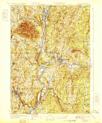
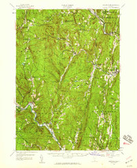
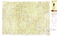
(43)- 1926 Map of Claremont, 1955 Print
 1926 Claremont1955 Print · USGSThe Connecticut River valley thrives in the mid-twenties as a hub of industry and transit between Vermont and New Hampshire. Tracing these hills reveals historic crossings like Cornish Bridge, the Sullivan County Farm, and the early Claremont Airport.
 - 1927 Map of Bellows Falls
 1927 Bellows Falls1927 Print · USGSThe borderlands of the Connecticut River valley are captured in the late 1920s, showing the vital rail links between Vermont and New Hampshire. Genealogists and local historians can trace rural schoolhouse districts like Mica Mine Sch, the grounds of the Kern-Hattin Home, and the layout of Westmoreland Depot.4 unique versions available
 - 1928 Map of Ludlow
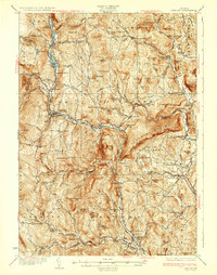
 1928 Ludlow1928 Print · USGSWindsor County's industrial river valleys and upland hill farms are captured here in the late twenties just as early aviation arrived. Trace family roots through numerous district schools like Baltimore Sch and vanished post offices at Peaseville.
 - 1929 Map of Claremont
 1929 Claremont1929 Print · USGSThe Upper Connecticut River Valley thrives in the late twenties as a hub of manufacturing and mountain farming. You can trace early rail-and-river industrial sites at Claremont and Windsor, or locate ancestral rural schoolhouses like Brick Sch and Red Sch.4 unique versions available
 - 1929 Map of Ludlow, 1961 Print
 1929 Ludlow1961 Print · USGSThe Black River valley and its busy rail corridor define this Vermont landscape in the late 1920s. Researchers can trace the legacy of rural education at Sawyer Stand Sch and locate vanished local landmarks like Baileys Mills or Grout Cem.2 unique versions available
 - 1930 Map of Saxtons River
 1930 Saxtons River1930 Print · USGSWindham County villages were still centers of rural life in the late 1920s as the Rutland RR steamed through the river valleys. Genealogists and historians can locate dozens of local schoolhouses like Round Sch (Dist No 1) and Walker Sch or trace family lands near Grafton and Newfane.2 unique versions available
 - 1930 Map of Bellows Falls
 1930 Bellows Falls1930 Print · USGSThe Connecticut River valley thrives between Vermont and New Hampshire in the late twenties, anchored by the rail hub at Bellows Falls. Researchers can trace old district schools like Derry Hill Sch and find family-named landmarks such as Dodge Tavern.7 unique versions available
 - 1932 Map of Ludlow
 1932 Ludlow1932 Print · USGSWindsor County in the early thirties features a landscape of mountain hamlets and busy river valleys connected by the Rutland Railroad. Trace genealogy and local history through numerous rural landmarks like Plymouth Kingdom, Baileys Mills, and the Sawyer Stand School.4 unique versions available
 - 1933 Map of Saxtons River
 1933 Saxtons River1933 Print · USGSWindham County villages and upland farms are captured in the early 1930s as the regional economy centered on the river valleys. Genealogists can locate family landmarks like Burgess Cem and numerous district schools including No 12 Sch and Easton Sch.4 unique versions available
 - 1950 Map of Glens Falls
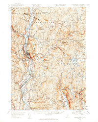
 1950 Glens Falls1950 Print · USGSThe Adirondacks and the Green Mountains meet in this mid-century survey of the New York and Vermont borderlands. Researchers can trace the industrial rail corridors of the Rutland RR and Delaware & Hudson RR connecting Glens Falls, Rutland, and the shores of Lake George.
 - 1956 Map of Glens Falls, 1968 Print
 1956 Glens Falls1968 Print · USGSUpper New York and the Vermont mountains are captured here in the mid-fifties, showing the rugged rail-and-river network of the Northeast. Researchers can trace the paths of the Delaware and Hudson RR and Rutland RR as they wind through valley towns like Poultney and Whitehall.3 unique versions available
 - 1957 Map of Saxtons River, 1959 Print
 1957 Saxtons River1959 Print · USGSSoutheastern Vermont's river valleys and upland villages are captured in the late fifties, showing the region's transition into the mid-century. Researchers can locate family sites and local institutions like Easton Sch, Riverside Cem, and the tracks of the Rutland Railroad.3 unique versions available
 - 1957 Map of Claremont, 1960 Print
 1957 Claremont1960 Print · USGSThe Connecticut River valley thrives during the late fifties, showcasing a robust industrial landscape shaped by the Sugar and Black Rivers. Genealogists and local historians can trace family roots through riverside settlements like Weathersfield Bow, rural outposts like Quaker City, and landmarks such as the Cornish Bridge.3 unique versions available
 - 1957 Map of Bellows Falls, 1960 Print
 1957 Bellows Falls1960 Print · USGSThe Connecticut River valley and its border communities were defined by industry and rail at mid-century. Genealogists and historians can trace the paths of the Boston and Maine railroad, locate the Kurn Hattin Home, or find the historic Dodge Tavern.4 unique versions available
 - 1959 Map of Glens Falls
 1959 Glens Falls1959 Print · USGSUpper New York and Vermont are captured here during the late 1950s, a period of transition for these mountain communities. Researchers can trace the legacy of the region's river-and-rail economy through landmarks like Lake George, Saratoga Springs, and Killington Peak.2 unique versions available
 - 1964 Map of Glens Falls
 1964 Glens Falls1964 Print · USGSThe tri-state borderlands of New York, Vermont, and New Hampshire appear here in the mid-1960s. Researchers can trace the rail routes of the Rutland RR and find historic sites like Ticonderoga and Saratoga National Historical Park.
 - 1972 Map of Chester, 1975 Print
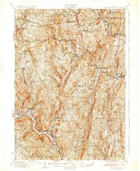
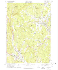 1972 Chester1975 Print · USGSWindsor County's river valleys and upland forests are captured in the early 1970s as industrial sites and modern infrastructure began to blend with historic Vermont settlements. Researchers can trace family roots at Brookside Cem or locate vanished local hubs like Old Shincracker and Baileys Mills.2 unique versions available
 - 1984 Map of Saxtons River
 1984 Saxtons River1984 Print · USGSSoutheast Vermont in the 1980s was a landscape of deep river valleys and small villages tucked between the hills. Researchers can trace historic family burial sites at Middletown Cem, follow old roads through Lawrence Four Corners, and locate former mills at Brockways Mills.2 unique versions available
 - 1984 Map of Springfield
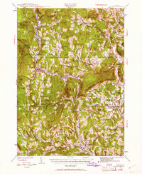
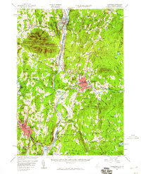
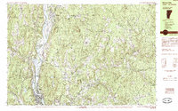
 1984 Springfield1984 Print · USGSThe Upper Connecticut River Valley in the mid-eighties shows a landscape of river-driven industry and upland settlements. Genealogists can locate family landmarks like Goulds Mill, Oak Hill Cem, and the Farwell Sch along the border hills.
 - 1985 Map of Bellows Falls
 1985 Bellows Falls1985 Print · USGSThe Connecticut River valley comes alive in the mid-eighties as it passes through the industrial hubs and riverside meadows of the Vermont-New Hampshire border. Trace the rail lines of the Boston and Maine or locate family landmarks near Pine Grove Cem and South Acworth.2 unique versions available
 - 1985 Map of Claremont, 1986 Print
 1985 Claremont1986 Print · USGSUpper Valley and Green Mountain life are captured here in the mid-eighties, centered on the river-linked hubs of Claremont and Springfield. Trace old family routes and rail lines like the Boston & Maine RR, or locate properties near Lake Sunapee and Mount Ascutney State Park.2 unique versions available
 - 1998 Map of Springfield, 2002 Print
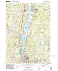
 1998 Springfield2002 Print · USGSThe Connecticut River valley at the close of the twentieth century shows a region of industrial towns and conserved forests. Researchers can trace local genealogy and rail history through Eureka Cem, the Claremont & Concord RR, and Goulds Mill.
 - 1998 Map of Bellows Falls, 2002 Print
 1998 Bellows Falls2002 Print · USGSThe borderlands of Vermont and New Hampshire come alive in the 1990s as the river economy transitions toward modern infrastructure. Trace family names and landmarks from Bellows Falls to Charlestown, finding sites like Bates Mill Pond and the Mt Kilburn Tower.
 - 2012 Map of Chester, 2012 Print
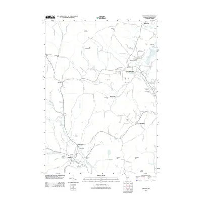 2012 Chester2012 Print · USGSCovers Springfield, including Chester, North Springfield, and other nearby areas
 - 2012 Map of Springfield, 2012 Print
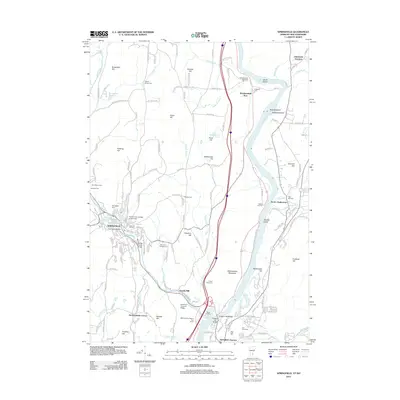 2012 Springfield2012 Print · USGSCovers Springfield, including Claremont, Charlestown, and other nearby areas
Showing maps 1-25 of 43
Top cities near Springfield
- Claremont historical maps
- Brockways Mills historical maps
- Newport historical maps
- Walpole historical maps
- Rockingham historical maps
- Bellows Falls historical maps
See more
Top neighborhoods of Springfield
- Hardscrabble Corner historical maps
- Spoonerville historical maps
- West Springfield historical maps
- North Springfield historical maps
Frequently asked questions
- What are the different types of historical maps available for Springfield?
- What is the oldest map of Springfield?
- Where can I purchase historical maps of Springfield for my home or office?
- Where can I download high-res historical maps of Springfield?
- Are there historical topographic maps available for Springfield?
- Is there historical aerial imagery available for Springfield?
- Where are historical maps of Springfield sourced from?