Old Maps of Kendricks Corner, Weathersfield for Metal Detecting
Plan your next treasure hunt with 14 historic maps of Kendricks Corner. Find old homesites, ghost towns, trails, and gathering spots that may be lost to time — perfect for identifying promising metal detecting locations.
- Locate forgotten sites: Uncover places like long-lost settlements, abandoned rail lines, or gathering spots.
- Plan better hunts: Use map overlays combined with LiDAR or satellite views to narrow in on historically rich areas.
- Made for detectorists: Thousands of hobbyists use these maps to discover relics, coins, and hidden history.
Use these historic maps to boost your research and find new opportunities beneath the surface of Kendricks Corner.
Kendricks Corner, Weathersfield maps
(14)- 1928 Map of Ludlow
 1928 Ludlow1928 Print · USGSWindsor County's industrial river valleys and upland hill farms are captured here in the late twenties just as early aviation arrived. Trace family roots through numerous district schools like Baltimore Sch and vanished post offices at Peaseville.
 - 1929 Map of Ludlow, 1961 Print
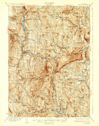
 1929 Ludlow1961 Print · USGSThe Black River valley and its busy rail corridor define this Vermont landscape in the late 1920s. Researchers can trace the legacy of rural education at Sawyer Stand Sch and locate vanished local landmarks like Baileys Mills or Grout Cem.2 unique versions available
 - 1932 Map of Ludlow
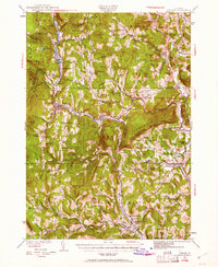
 1932 Ludlow1932 Print · USGSWindsor County in the early thirties features a landscape of mountain hamlets and busy river valleys connected by the Rutland Railroad. Trace genealogy and local history through numerous rural landmarks like Plymouth Kingdom, Baileys Mills, and the Sawyer Stand School.4 unique versions available
 - 1950 Map of Glens Falls
 1950 Glens Falls1950 Print · USGSThe Adirondacks and the Green Mountains meet in this mid-century survey of the New York and Vermont borderlands. Researchers can trace the industrial rail corridors of the Rutland RR and Delaware & Hudson RR connecting Glens Falls, Rutland, and the shores of Lake George.
 - 1956 Map of Glens Falls, 1968 Print
 1956 Glens Falls1968 Print · USGSUpper New York and the Vermont mountains are captured here in the mid-fifties, showing the rugged rail-and-river network of the Northeast. Researchers can trace the paths of the Delaware and Hudson RR and Rutland RR as they wind through valley towns like Poultney and Whitehall.3 unique versions available
 - 1959 Map of Glens Falls
 1959 Glens Falls1959 Print · USGSUpper New York and Vermont are captured here during the late 1950s, a period of transition for these mountain communities. Researchers can trace the legacy of the region's river-and-rail economy through landmarks like Lake George, Saratoga Springs, and Killington Peak.2 unique versions available
 - 1964 Map of Glens Falls
 1964 Glens Falls1964 Print · USGSThe tri-state borderlands of New York, Vermont, and New Hampshire appear here in the mid-1960s. Researchers can trace the rail routes of the Rutland RR and find historic sites like Ticonderoga and Saratoga National Historical Park.
 - 1972 Map of Chester, 1975 Print
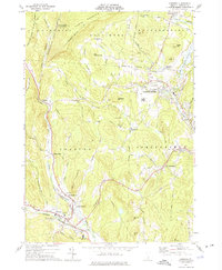 1972 Chester1975 Print · USGSWindsor County's river valleys and upland forests are captured in the early 1970s as industrial sites and modern infrastructure began to blend with historic Vermont settlements. Researchers can trace family roots at Brookside Cem or locate vanished local hubs like Old Shincracker and Baileys Mills.2 unique versions available
 - 1985 Map of Claremont, 1986 Print
 1985 Claremont1986 Print · USGSUpper Valley and Green Mountain life are captured here in the mid-eighties, centered on the river-linked hubs of Claremont and Springfield. Trace old family routes and rail lines like the Boston & Maine RR, or locate properties near Lake Sunapee and Mount Ascutney State Park.2 unique versions available
 - 2012 Map of Chester, 2012 Print
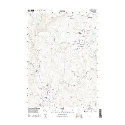
 2012 Chester2012 Print · USGSCovers Kendricks Corner, including Springfield, Chester, and other nearby areas
 - 2015 Map of Chester, 2015 Print
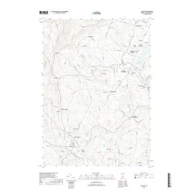
 2015 Chester2015 Print · USGSCovers Kendricks Corner, including Springfield, Chester, and other nearby areas
 - 2018 Map of Chester, 2018 Print
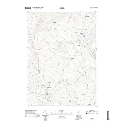
 2018 Chester2018 Print · USGSCovers Kendricks Corner, including Springfield, Chester, and other nearby areas
 - 2021 Map of Chester, 2021 Print
 2021 Chester2021 Print · USGSCovers Kendricks Corner, including Springfield, Chester, and other nearby areas
 - 2024 Map of Chester, 2024 Print
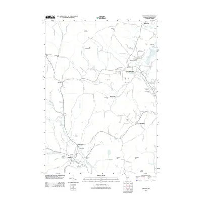
 2024 Chester2024 Print · USGSWindsor County, Vermont, reveals its settlement patterns along the Williams River and Black River valleys in this recent topographical study. Genealogists can locate several historic burial grounds, including Brookside and Baileys Mills Cemeteries, or trace family sites in North Chester and Gassetts.
End of results
Showing maps 1-14 of 14
Top cities near Kendricks Corner
- Claremont historical maps
- Brockways Mills historical maps
- Springfield historical maps
- Walpole historical maps
- Hartland historical maps
- Bellows Falls historical maps
See more
Frequently asked questions
- What are the different types of historical maps available for Kendricks Corner?
- What is the oldest map of Kendricks Corner?
- Where can I purchase historical maps of Kendricks Corner for my home or office?
- Where can I download high-res historical maps of Kendricks Corner?
- Are there historical topographic maps available for Kendricks Corner?
- Is there historical aerial imagery available for Kendricks Corner?
- Where are historical maps of Kendricks Corner sourced from?