Old Maps of Windsor, Vermont for Academic Research
Study the evolution of Windsor with 25 high-resolution historic maps. Whether you're teaching, researching, or modeling changes in land use, these maps provide essential visual documentation of urban, environmental, and geographic change.
- Analyze long-term change: Track patterns in development, transportation, and natural features.
- Ideal for environmental or urban studies: Support academic projects with primary historical map data.
- Use in the classroom or lab: Educators and researchers rely on these maps to bring historical context to life.
These maps are a powerful tool for teaching, research, and visualizing how Windsor has changed over the decades.
Windsor, VT maps
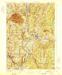
(25)- 1906 Map of Hanover, 1956 Print
 1906 Hanover1956 Print · USGSThe Upper Connecticut River Valley at the turn of the century is a hub of rail activity and collegiate life. Researchers can trace the early footprints of Dartmouth College or locate vanished rail infrastructure at White River Junction and Deweys Mills.2 unique versions available
 - 1908 Map of Hanover
 1908 Hanover1908 Print · USGSThe Upper Valley at the dawn of the twentieth century was a vital junction of Vermont and New Hampshire rail lines and river commerce. Researchers can trace the early layout of Dartmouth College, the rail yards of White River Junction, and numerous rural schoolhouses like Podunk School.7 unique versions available
 - 1926 Map of Claremont, 1955 Print
 1926 Claremont1955 Print · USGSThe Connecticut River valley thrives in the mid-twenties as a hub of industry and transit between Vermont and New Hampshire. Tracing these hills reveals historic crossings like Cornish Bridge, the Sullivan County Farm, and the early Claremont Airport.
 - 1929 Map of Claremont
 1929 Claremont1929 Print · USGSThe Upper Connecticut River Valley thrives in the late twenties as a hub of manufacturing and mountain farming. You can trace early rail-and-river industrial sites at Claremont and Windsor, or locate ancestral rural schoolhouses like Brick Sch and Red Sch.4 unique versions available
 - 1950 Map of Glens Falls
 1950 Glens Falls1950 Print · USGSThe Adirondacks and the Green Mountains meet in this mid-century survey of the New York and Vermont borderlands. Researchers can trace the industrial rail corridors of the Rutland RR and Delaware & Hudson RR connecting Glens Falls, Rutland, and the shores of Lake George.
 - 1956 Map of Glens Falls, 1968 Print
 1956 Glens Falls1968 Print · USGSUpper New York and the Vermont mountains are captured here in the mid-fifties, showing the rugged rail-and-river network of the Northeast. Researchers can trace the paths of the Delaware and Hudson RR and Rutland RR as they wind through valley towns like Poultney and Whitehall.3 unique versions available
 - 1957 Map of Claremont, 1960 Print
 1957 Claremont1960 Print · USGSThe Connecticut River valley thrives during the late fifties, showcasing a robust industrial landscape shaped by the Sugar and Black Rivers. Genealogists and local historians can trace family roots through riverside settlements like Weathersfield Bow, rural outposts like Quaker City, and landmarks such as the Cornish Bridge.3 unique versions available
 - 1959 Map of Glens Falls
 1959 Glens Falls1959 Print · USGSUpper New York and Vermont are captured here during the late 1950s, a period of transition for these mountain communities. Researchers can trace the legacy of the region's river-and-rail economy through landmarks like Lake George, Saratoga Springs, and Killington Peak.2 unique versions available
 - 1959 Map of Hartland, 1961 Print
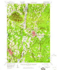
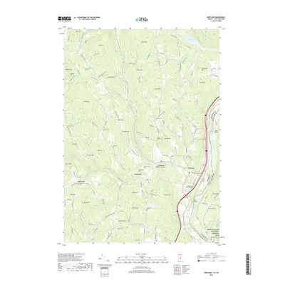
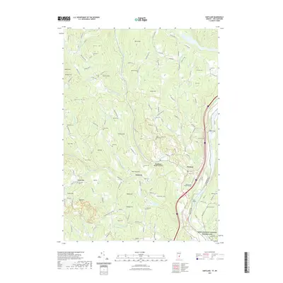
 1959 Hartland1961 Print · USGSThe Connecticut River valley south of White River Junction shows its mid-century character, from the State Prison Farm to the North Hartland Reservoir. Researchers can trace old family names at Quaker Village Cem and locate historic sites like Jenneville and the Covered Bridge.4 unique versions available
 - 1964 Map of Glens Falls
 1964 Glens Falls1964 Print · USGSThe tri-state borderlands of New York, Vermont, and New Hampshire appear here in the mid-1960s. Researchers can trace the rail routes of the Rutland RR and find historic sites like Ticonderoga and Saratoga National Historical Park.
 - 1984 Map of Mt. Ascutney
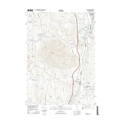
 1984 Mt. Ascutney1984 Print · USGSThe Vermont and New Hampshire borderlands are captured here in the early eighties, centered on the Connecticut River and the heights of Mt Ascutney. Genealogists can locate family landmarks like Child Cem and Mountainview Cem or the historic Saint-Gaudens National Historic Site.2 unique versions available
 - 1985 Map of Claremont, 1986 Print
 1985 Claremont1986 Print · USGSUpper Valley and Green Mountain life are captured here in the mid-eighties, centered on the river-linked hubs of Claremont and Springfield. Trace old family routes and rail lines like the Boston & Maine RR, or locate properties near Lake Sunapee and Mount Ascutney State Park.2 unique versions available
 - 1985 Map of Rutland, 1988 Print
 1985 Rutland1988 Print · USGSThe Upper Valley of the mid-1980s comes to life along the winding Connecticut River as it divides the Green Mountain and Granite states. Historians can trace the industrial rail hubs of White River Junction and the paths of the Appalachian Trail and Long Trail.
 - 1998 Map of Hartland, 1999 Print
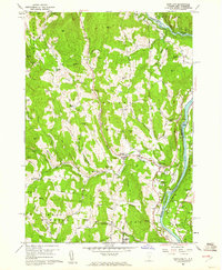
 1998 Hartland1999 Print · USGSLate twentieth-century Windsor County reveals a landscape of high hills and river junctions along the New Hampshire border. Genealogists can trace family names across Hoisington Cem, Aldrich Cem, and historic hamlets like Quakers Village.
 - 1998 Map of Windsor, 2002 Print
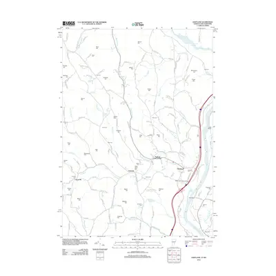
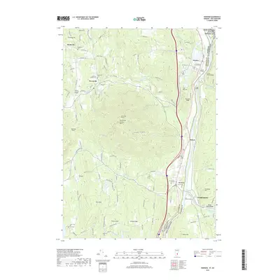
 1998 Windsor2002 Print · USGSWindsor and the Connecticut River Valley are captured here in the late nineties, showing the region's transition between conserved highlands and riverfront industry. Trace local landmarks like the Cornish Bridge, the Central Vermont rail line, and the slopes of Mt Ascutney.
 - 2012 Map of Windsor, 2012 Print
 2012 Windsor2012 Print · USGSCovers Windsor, including Claremont, Cornish, and other nearby areas
 - 2012 Map of Hartland, 2012 Print
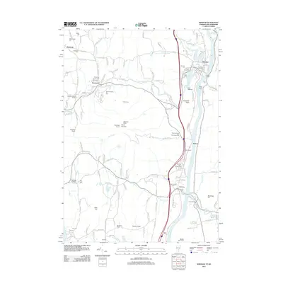
 2012 Hartland2012 Print · USGSCovers Windsor, including Hartford, Hartland, and other nearby areas
 - 2015 Map of Windsor, 2015 Print
 2015 Windsor2015 Print · USGSCovers Windsor, including Claremont, Cornish, and other nearby areas
 - 2015 Map of Hartland, 2015 Print
 2015 Hartland2015 Print · USGSCovers Windsor, including Hartford, Hartland, and other nearby areas
 - 2018 Map of Hartland, 2018 Print
 2018 Hartland2018 Print · USGSCovers Windsor, including Hartford, Hartland, and other nearby areas
 - 2018 Map of Windsor, 2018 Print
 2018 Windsor2018 Print · USGSCovers Windsor, including Claremont, Cornish, and other nearby areas
 - 2021 Map of Hartland, 2021 Print
 2021 Hartland2021 Print · USGSCovers Windsor, including Hartford, Hartland, and other nearby areas
 - 2021 Map of Windsor, 2021 Print
 2021 Windsor2021 Print · USGSCovers Windsor, including Claremont, Cornish, and other nearby areas
 - 2024 Map of Hartland, 2024 Print
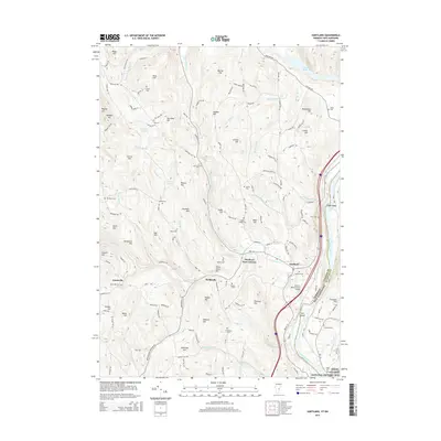
 2024 Hartland2024 Print · USGSThe Upper Connecticut River Valley at the Vermont-New Hampshire border is shown here with its network of rural settlements. Researchers can trace family history through local landmarks like Hartland Four Corners, Hoisington Cem, and the Saint-Gaudens National Historic Site.
 - 2024 Map of Windsor, 2024 Print
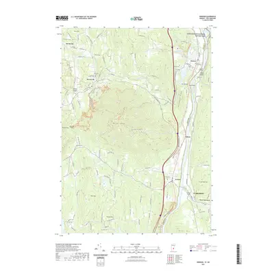
 2024 Windsor2024 Print · USGSThe Upper Connecticut River Valley at the Vermont-New Hampshire border reveals a landscape shaped by high peaks and river-port history. Genealogists and hikers can trace historical sites from Old South Church Cem to the trails surrounding Mt Ascutney and Gerrys Falls.
End of results
Showing maps 1-25 of 25
Top cities near Windsor
- Lebanon historical maps
- Claremont historical maps
- Hanover historical maps
- Hartford historical maps
- Newport historical maps
- Enfield historical maps
See more
Top neighborhoods of Windsor
Frequently asked questions
- What are the different types of historical maps available for Windsor?
- What is the oldest map of Windsor?
- Where can I purchase historical maps of Windsor for my home or office?
- Where can I download high-res historical maps of Windsor?
- Are there historical topographic maps available for Windsor?
- Is there historical aerial imagery available for Windsor?
- Where are historical maps of Windsor sourced from?