1940s Maps of Thomastown, Virginia
Explore 3 historic maps of Thomastown from the 1940s. These maps offer a rare glimpse into what life looked like during the 1940s — showing old roads, neighborhoods, homes, and landmarks that have changed or disappeared over time.
Whether you're researching your family's past, planning a metal detecting trip, or studying how Thomastown's landscape evolved across the 1940s, these high-resolution maps are a powerful tool for exploring the history of this region.
- Focus on a specific era: All maps on this page are from the 1940s, giving you a focused view of this time period.
- See what’s changed: Compare century-old streets, trails, and buildings to today's modern landscape using overlays and satellite layers.
- Research with precision: Use these maps for genealogy, historical research, land use analysis, or educational projects.
- View, download, or print: Maps are fully viewable online in high resolution, and can be downloaded or printed for your own records.
Start exploring Thomastown's history through authentic maps from the 1940s. This is your window into the past.
Thomastown, VA maps
(3)- 1946 Map of Warm Springs, 1962 Print
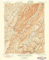
 1946 Warm Springs1962 Print · USGSBath County and the Allegheny borderlands are captured here in the mid-1940s, showing the early infrastructure of this resort and timber region. Researchers can trace family sites at Mountain Grove, rural pulpits like Mt Hope Ch, and the crossing at Moclintic Bridge.2 unique versions available
 - 1949 Map of Charlottesville
 1949 Charlottesville1949 Print · USGSThe Shenandoah Valley and Blue Ridge appear in the late 1940s as a thriving corridor of rail and river commerce. Researchers can trace the mid-century footprints of Harrisonburg, Staunton, and Culpeper alongside the historic routes of the Southern Railway.2 unique versions available
 - 1949 Map of Warm Springs
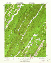
 1949 Warm Springs1949 Print · USGSThe Virginia and West Virginia borderlands are documented here in the late 1940s, highlighting the famous resort springs and rugged Appalachian ridges. Genealogists can trace family locations near Warm Springs, Bacova, and the Chimney Run Ch or Zion Hill Ch.2 unique versions available
End of results
Showing maps 1-3 of 3
Top cities near Thomastown
- Covington historical maps
- Clifton Forge historical maps
- Hot Springs historical maps
- Low Moor historical maps
- Iron Gate historical maps
- Selma historical maps
See more
Frequently asked questions
- What are the different types of historical maps available for Thomastown?
- What is the oldest map of Thomastown?
- Where can I purchase historical maps of Thomastown for my home or office?
- Where can I download high-res historical maps of Thomastown?
- Are there historical topographic maps available for Thomastown?
- Is there historical aerial imagery available for Thomastown?
- Where are historical maps of Thomastown sourced from?