Old Maps of Botetourt County, Virginia for Genealogy
Trace your family roots with 167 historic maps of Botetourt County. These high-res maps reveal old neighborhoods, homesites, landmarks, and streets — helping you uncover where your ancestors lived and how the area evolved over time.
- Explore historic neighborhoods: Identify where your relatives may have lived in the 1800s or 1900s.
- Compare maps over time: Trace the changes in streets, buildings, and landmarks for multi-generational research.
- Perfect for genealogy & ancestry research: Used by family historians and researchers to map out lineage and migration.
These maps are an incredible resource for exploring your personal connection to Botetourt County's past.
Botetourt County, VA maps
(167)- 1887 Map of Lewisburg
 1887 Lewisburg1887 Print · USGSThe Greenbrier Valley and the Virginia borderlands are captured here in the late nineteenth century during a period of significant rail expansion. Genealogists and historians can trace early mountain settlements like White Sulphur Springs and Ronceverte, or locate specific landmarks like Van Staverns Mill and the Half Way House.
 - 1890 Map of Roanoke
 1890 Roanoke1890 Print · USGSThe Roanoke Valley in the late nineteenth century was a growing rail and mining hub shaped by the Blue Ridge. Researchers can trace the early industrial footprint of the Rorer Mines or locate old community anchors like Dillons Mill and Hales Bridge.
 - 1890 Map of Christiansburg
 1890 Christiansburg1890 Print · USGSSouthwestern Virginia in the late nineteenth century centers on the emerging rail and resort economy. Trace the Norfolk and Western Railroad through Christiansburg and find historic resorts like Alleghany Springs.10 unique versions available
 - 1891 Map of Roanoke
 1891 Roanoke1891 Print · USGSVirginia's Blue Ridge and Roanoke Valley come alive in the late nineteenth century, showing a landscape defined by new rail lines and old river crossings. Genealogists and local researchers can trace family landmarks and forgotten transport nodes like Rorer Mines, Hollins Inst., and Blackwater Ford.8 unique versions available
 - 1891 Map of Lewisburg
 1891 Lewisburg1891 Print · USGSThe Virginia and West Virginia borderlands are captured here in the late 1880s, documenting a landscape of mountain ridges and burgeoning rail infrastructure. Genealogists and historians can trace family-named landmarks like Van Staverns Mill or follow the route of the Chesapeake and Ohio Railroad through the Alleghany Tunnel.8 unique versions available
 - 1894 Map of Natural Bridge, 1898 Print
 1894 Natural Bridge1898 Print · USGSThe Virginia ridges thrived with iron furnaces and mineral springs during the 1890s. Genealogists and historians can trace the early industrial footprint of Long Dale Furnace and Victoria Mines, or locate local landmarks like Lick Run Ferry and Rapps Mill.7 unique versions available
 - 1894 Map of Lexington, 1900 Print
 1894 Lexington1900 Print · USGSAmherst and the surrounding Blue Ridge foothills are captured in the late nineteenth century during a period of rural expansion and early rail development. Genealogists can locate family homesteads near Clifford P.O. or trace landmarks like Cornerstone Ch. and Massies Mill.7 unique versions available
 - 1894 Map of Natural Bridge, 1926 Print
 1894 Natural Bridge1926 Print · USGSThe Virginia highlands during the 1890s were a powerhouse of iron production and river commerce. You can trace the rail-and-river economy through landmarks like the Lick Run Ferry, Victoria Mines, and the Long Dale Furnace.
 - 1907 Map of Natural Bridge Special
 1907 Natural Bridge Special1907 Print · USGSThe James River corridor in Botetourt and Rockbridge counties is captured here just after the turn of the century. Genealogists can locate family landmarks like Rapps Mill, Dunkard Church, and the riverfront settlement of Buchanan along the Chesapeake and Ohio RR.4 unique versions available
 - 1913 Map of Eagle Rock
 1913 Eagle Rock1913 Print · USGSBotetourt County at the dawn of the twentieth century shows a landscape tied to the James River and iron-era industry. Genealogists can trace family roots through numerous local landmarks like Salisbury Furnace, Fincastle, and the Fair Grounds.2 unique versions available
 - 1915 Map of Eagle Rock
 1915 Eagle Rock1915 Print · USGSBotetourt and Alleghany counties are captured here during a transitional era of mountain industry and rail expansion. Genealogists can locate family landmarks like Kyles Mills and Comptons Bridge, or trace vanished communities at Lignite and Oriskany.3 unique versions available
 - 1929 Map of Roanoke
 1929 Roanoke1929 Print · USGSThe Roanoke Valley is shown just before the Great Depression, documenting the area's transition from rural townships to a developing urban center. Genealogists can locate family landmarks such as Forest Chapel Sch, Coyner Springs, and the early neighborhoods of Riverdale.3 unique versions available
 - 1929 Map of Salem
 1929 Salem1929 Print · USGSThe Roanoke River valley and surrounding mountain ridges are captured here in the late 1920s as the railroad and highway networks expanded. Genealogists and researchers can trace local landmarks like Catawba Sanatorium, Webb Mill, and old schoolhouses including Rubles Sch.2 unique versions available
 - 1932 Map of Salem
 1932 Salem1932 Print · USGSThe Roanoke Valley and the high ridges of the Blue Ridge meet in this early 1930s survey of the Salem area. Genealogists can locate family landmarks like Webbs Mill, the Catawba Sanatorium, and numerous rural churches including New Hope Church.3 unique versions available
 - 1933 Map of Roanoke
 1933 Roanoke1933 Print · USGSThe Roanoke Valley in the early thirties shows a thriving rail-and-river hub surrounded by a landscape of small crossroads schools and churches. Genealogists can trace family names through landmarks like Hollins College, Gravel Hill Sch, and Trinity church.3 unique versions available
 - 1935 Map of Buena Vista
 1935 Buena Vista1935 Print · USGSThe James River corridor in the mid-1930s reveals a landscape of hydroelectric power and deep-rooted mountain communities. Genealogists and historians can locate dozens of country schools and churches, from Ivory Hill Sch to Mt Zion Ch, alongside industrial sites like the LONE JACK QUARRY.
 - 1939 Map of Buena Vista
 1939 Buena Vista1939 Print · USGSThe James River corridor near Buena Vista was a bustling intersection of rail and water transport in the years before World War II. Researchers can trace the early Appalachian Trail and find rural community hubs like Pedlar Mills, CCC Camp No 10, and Buffalo Forge.
 - 1940 Map of Buena Vista
 1940 Buena Vista1940 Print · USGSThe industrial and rail corridor of the James River is captured here as the region's mountain economy evolved in the 1930s. Researchers can trace the dual rail lines serving Glasgow, find CCC Camp No 10, and locate rural landmarks like Buffalo Forge and Ben Salam Sch.2 unique versions available
 - 1945 Map of Clifton Forge, 1963 Print
 1945 Clifton Forge1963 Print · USGSThe rail and river corridors of Alleghany County are captured here at the end of the war, centered on the bustling junction of Clifton Forge. Genealogists and historians can trace old community landmarks like Union Chapel, the Rich Patch Mines, and the Deeds Sch among the ridgelines.2 unique versions available
 - 1945 Map of New Castle, 1964 Print
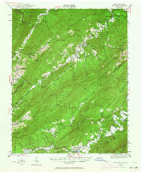 1945 New Castle1964 Print · USGSThe mountain gaps of Craig and Alleghany Counties are captured here at the end of the war, when mining and rail transport still defined the local economy. Researchers can trace the legacy of industry and faith at Jordan Mines, Lignite, and Shoafs Chapel.
 - 1946 Map of Millboro, 1957 Print
 1946 Millboro1957 Print · USGSThe Alleghany and Rockbridge county lines are mapped here in the mid-1940s, highlighting a rugged corridor of industry and nature. Researchers can trace the Chesapeake and Ohio RR through the Lick Run Tunnel or locate Long Dale Furnace and Rockbridge Alum Springs.2 unique versions available
 - 1947 Map of New Castle
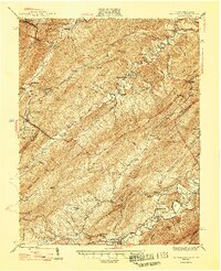 1947 New Castle1947 Print · USGSThe Virginia and West Virginia borderlands in the late 1940s reveal a landscape of mountain resorts and industrial remnants. You can trace the legacy of mineral spas at Sweet Springs and locate early community hubs like Jordan Mines and the Fenwick Mine.2 unique versions available
 - 1947 Map of Roanoke, 1948 Print
 1947 Roanoke1948 Print · USGSCentral Virginia in the late 1940s reveals a region defined by its great mountain ridges and the powerful river-and-rail economy connecting Roanoke to Lynchburg. Researchers can trace the path of the Virginian RR and locate historic county seats like Charlotte Court House.2 unique versions available
 - 1949 Map of Clifton Forge
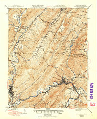 1949 Clifton Forge1949 Print · USGSThe industrial corridor of the Alleghany Highlands thrives in the late 1940s as rail and river networks converge. Researchers can trace historic family-named landmarks and mountain settlements like Carloover, Rich Patch Mines, and Union Chapel.3 unique versions available
 - 1949 Map of Millboro
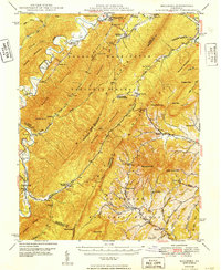 1949 Millboro1949 Print · USGSThe Virginia highlands between Bath and Rockbridge counties were still deeply defined by their iron-industry and railroad roots in the late 1940s. Genealogists and researchers can trace old family settlements at Nimrod Hall, visit historic sites like Long Dale Furnace, and locate rural landmarks such as Sharon Sch.2 unique versions available
Showing maps 1-25 of 167
Top cities of Botetourt County
- Cloverdale historical maps
- Daleville historical maps
- Buchanan historical maps
- Fincastle historical maps
- Troutville historical maps
- Eagle Rock historical maps
See more
Frequently asked questions
- What are the different types of historical maps available for Botetourt County?
- What is the oldest map of Botetourt County?
- Where can I purchase historical maps of Botetourt County for my home or office?
- Where can I download high-res historical maps of Botetourt County?
- Are there historical topographic maps available for Botetourt County?
- Is there historical aerial imagery available for Botetourt County?
- Where are historical maps of Botetourt County sourced from?