1960s Maps of Rowe, Virginia
Explore 2 historic maps of Rowe from the 1960s. These maps offer a rare glimpse into what life looked like during the 1960s — showing old roads, neighborhoods, homes, and landmarks that have changed or disappeared over time.
Whether you're researching your family's past, planning a metal detecting trip, or studying how Rowe's landscape evolved across the 1960s, these high-resolution maps are a powerful tool for exploring the history of this region.
- Focus on a specific era: All maps on this page are from the 1960s, giving you a focused view of this time period.
- See what’s changed: Compare century-old streets, trails, and buildings to today's modern landscape using overlays and satellite layers.
- Research with precision: Use these maps for genealogy, historical research, land use analysis, or educational projects.
- View, download, or print: Maps are fully viewable online in high resolution, and can be downloaded or printed for your own records.
Start exploring Rowe's history through authentic maps from the 1960s. This is your window into the past.
Rowe, VA maps
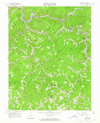
(2)- 1960 Map of Jenkins
 1960 Jenkins1960 Print · USGSEastern Kentucky and the West Virginia borderlands are captured at a mid-century peak of the coal and rail era. Trace the industrial corridors of the Chesapeake and Ohio RR through mountain hubs like Hazard and Jenkins.
 - 1963 Map of Vansant, 1965 Print
 1963 Vansant1965 Print · USGSBuchanan County's coal country and hollows are documented here during the early sixties, showing the vital link between the river and the rail. Researchers can locate many family-named burial sites and rural centers like Indian Grave Gap PO, Ratcliff Chapel, and Oakwood.2 unique versions available
End of results
Showing maps 1-2 of 2
Top cities near Rowe
- Richlands historical maps
- Lebanon historical maps
- Raven historical maps
- Honaker historical maps
- Grundy historical maps
- Vansant historical maps
See more
Frequently asked questions
- What are the different types of historical maps available for Rowe?
- What is the oldest map of Rowe?
- Where can I purchase historical maps of Rowe for my home or office?
- Where can I download high-res historical maps of Rowe?
- Are there historical topographic maps available for Rowe?
- Is there historical aerial imagery available for Rowe?
- Where are historical maps of Rowe sourced from?