1900s (20th Century) Maps of Altavista, Virginia
Explore 11 historic maps of Altavista from the 1900s (20th Century). These maps offer a rare glimpse into what life looked like during the 1900s — showing old roads, neighborhoods, homes, and landmarks that have changed or disappeared over time.
Whether you're researching your family's past, planning a metal detecting trip, or studying how Altavista's landscape evolved across the 1900s, these high-resolution maps are a powerful tool for exploring the history of this region.
- Focus on a specific era: All maps on this page are from the 1900s, giving you a focused view of this time period.
- See what’s changed: Compare century-old streets, trails, and buildings to today's modern landscape using overlays and satellite layers.
- Research with precision: Use these maps for genealogy, historical research, land use analysis, or educational projects.
- View, download, or print: Maps are fully viewable online in high resolution, and can be downloaded or printed for your own records.
Start exploring Altavista's history through authentic maps from the 1900s. This is your window into the past.
Altavista, VA maps
(11)- 1947 Map of Roanoke, 1948 Print
 1947 Roanoke1948 Print · USGSCentral Virginia in the late 1940s reveals a region defined by its great mountain ridges and the powerful river-and-rail economy connecting Roanoke to Lynchburg. Researchers can trace the path of the Virginian RR and locate historic county seats like Charlotte Court House.2 unique versions available
 - 1951 Map of Altavista, 1953 Print
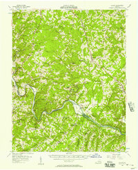
 1951 Altavista1953 Print · USGSThe Roanoke River valley in the early fifties shows a region defined by its rail-and-river economy and tight-knit rural communities. Genealogists and local historians can trace family roots through landmarks like Bethlehem Ch, Lynch Sta, and Greasy Sch.2 unique versions available
 - 1956 Map of Gladys, 1957 Print
 1956 Gladys1957 Print · USGSSouthern Campbell County in the mid-fifties is captured here as a landscape of rail-junction towns and river-bottom farms. Genealogists can trace family roots through numerous local landmarks like Mitchell Mill, Organ Chapel, and the Franklin Cem.2 unique versions available
 - 1959 Map of Roanoke
 1959 Roanoke1959 Print · USGSCentral Virginia and the Blue Ridge appear in great detail during the late fifties, showcasing the transition from mountain industry to Piedmont farmland. Trace the path of the Norfolk and Western railroad or find old river towns like Appomattox and Amelia Court House.
 - 1963 Map of Roanoke
 1963 Roanoke1963 Print · USGSCentral Virginia and the Blue Ridge front appear here in the early sixties, caught between their deep railroad roots and new postwar developments. Genealogists and historians can trace the rail lines of the Norfolk and Western through towns like Bedford and Altavista, or locate family landmarks near Smith Mountain Lake.
 - 1966 Map of Castle Craig, 1967 Print
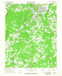
 1966 Castle Craig1967 Print · USGSCampbell County land and the river forks are captured here in the mid-1960s as rural life centered on crossroads and creek valleys. Genealogists can trace family roots through numerous local landmarks like Liberty Ch, Salem Ch, and Altavista Memorial Park.3 unique versions available
 - 1966 Map of Lynch Station, 1968 Print
 1966 Lynch Station1968 Print · USGSSouthern Campbell County is captured here in the mid-sixties, a landscape defined by the intersection of the Southern railroad and the Big Otter River. Genealogists and local historians can trace the foundations of rural life through numerous country churches like Mt Hermon Ch and the historic settlement at Lynch Station.4 unique versions available
 - 1966 Map of Altavista, 1968 Print
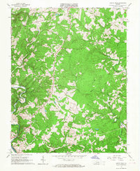
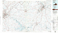
 1966 Altavista1968 Print · USGSThe Roanoke River valley in the mid-1960s shows a region defined by its rail-and-river economy and growing industrial towns. Genealogists and historians can trace the rural landscape surrounding Altavista through landmarks like Moriah Ch, Hill Grove, and Jasper Mountain.3 unique versions available
 - 1971 Map of Roanoke, 1977 Print
 1971 Roanoke1977 Print · USGSThe Virginia Piedmont and Blue Ridge mountains meet in this early 1970s landscape of river valleys and rail hubs. Researchers can trace historic transportation routes and landmarks like the Appomattox Court House Nat Hist Pk, the Peaks of Otter, and Amelia Court House.2 unique versions available
 - 1977 Map of Altavista, 1983 Print
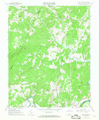
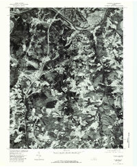 1977 Altavista1983 Print · USGSAltavista and the Roanoke River valley appear at a pivotal moment in the late seventies, captured in high-detail aerial photography. Genealogists and local historians can trace family land around Motley, Sycamore, and the drainage of Reed Creek.
 - 1985 Map of Roanoke, 1986 Print
 1985 Roanoke1986 Print · USGSMid-eighties Virginia comes into focus across the Blue Ridge and the upper Roanoke River valley during a period of steady regional growth. Genealogists and historians can trace family-named landmarks like Mt Moriah Ch, local hubs such as Cave Spring, and sites like the New London Airport (Drag Strip).2 unique versions available
End of results
Showing maps 1-11 of 11
Top cities near Altavista
- Timberlake historical maps
- Forest historical maps
- Bedford historical maps
- Rustburg historical maps
- Gretna historical maps
- Hurt historical maps
See more
Top neighborhoods of Altavista
- Gateway Park historical maps
- Main Street District historical maps
- Founder's Square historical maps
- Forest Hill historical maps
- Holly Hills South historical maps
- Moseley Heights historical maps
See more
Frequently asked questions
- What are the different types of historical maps available for Altavista?
- What is the oldest map of Altavista?
- Where can I purchase historical maps of Altavista for my home or office?
- Where can I download high-res historical maps of Altavista?
- Are there historical topographic maps available for Altavista?
- Is there historical aerial imagery available for Altavista?
- Where are historical maps of Altavista sourced from?