1930s Maps of Hillsville, Virginia
Explore 3 historic maps of Hillsville from the 1930s. These maps offer a rare glimpse into what life looked like during the 1930s — showing old roads, neighborhoods, homes, and landmarks that have changed or disappeared over time.
Whether you're researching your family's past, planning a metal detecting trip, or studying how Hillsville's landscape evolved across the 1930s, these high-resolution maps are a powerful tool for exploring the history of this region.
- Focus on a specific era: All maps on this page are from the 1930s, giving you a focused view of this time period.
- See what’s changed: Compare century-old streets, trails, and buildings to today's modern landscape using overlays and satellite layers.
- Research with precision: Use these maps for genealogy, historical research, land use analysis, or educational projects.
- View, download, or print: Maps are fully viewable online in high resolution, and can be downloaded or printed for your own records.
Start exploring Hillsville's history through authentic maps from the 1930s. This is your window into the past.
Hillsville, VA maps
(3)- 1930 Map of Max Meadows
 1930 Max Meadows1930 Print · USGSThe industrial and riverine corridor of Wythe and Carroll counties comes alive in the late 1920s, showcasing a network of mining towns and rail lines. Trace family roots and local history through landmarks like Fort Chiswell, the Boom Furnace, and the ferry crossing at Carter Ferry.3 unique versions available
 - 1931 Map of Galax
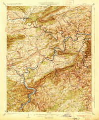
 1931 Galax1931 Print · USGSThe Blue Ridge foothills of Virginia and North Carolina come into focus during the early 1930s as the rail-and-river economy develops. Genealogists and researchers can trace family landmarks like Bishop Cem, McKnights Mill, and the early river crossings at Blair Ferry.
 - 1933 Map of Galax
 1933 Galax1933 Print · USGSCarroll County and the surrounding Blue Ridge highlands are captured in the early 1930s, showing a landscape defined by river ferries and rail spurs. Genealogists can trace early homesteads and community hubs like Pipers Gap PO, Lambsburg, and the Dixon Ferry crossing on the New River.3 unique versions available
End of results
Showing maps 1-3 of 3
Top cities near Hillsville
- Mount Airy historical maps
- Galax historical maps
- Woodlawn historical maps
- Cana historical maps
- Fort Chiswell historical maps
- Max Meadows historical maps
See more
Top neighborhoods of Hillsville
Frequently asked questions
- What are the different types of historical maps available for Hillsville?
- What is the oldest map of Hillsville?
- Where can I purchase historical maps of Hillsville for my home or office?
- Where can I download high-res historical maps of Hillsville?
- Are there historical topographic maps available for Hillsville?
- Is there historical aerial imagery available for Hillsville?
- Where are historical maps of Hillsville sourced from?