Old Maps of River’s Rest Marina, Virginia for Hiking & Exploration
Hike through history with 16 historic maps of River’s Rest Marina. Explore old trails, ghost towns, and forgotten backroads — perfect for outdoor adventurers and local explorers.
- Rediscover forgotten places: Map out old mining camps, roads, and footpaths that no longer exist on modern maps.
- Layer with modern tools: Combine with LiDAR or satellite views to plan hikes through historical terrain.
- Made for exploration: Popular among hikers, overlanders, and local history lovers.
Use these maps to find adventure and explore the hidden past of River’s Rest Marina.
River’s Rest Marina, VA maps
(16)- 1917 Map of Toano, 1959 Print
 1917 Toano1959 Print · USGSCoastal Virginia during the early twentieth century shows a landscape where rail lines and steamboat routes intersect. Genealogists can trace family roots through numerous sites like Hickory Neck Church, One Eye School, and Barrets Ferry.
 - 1918 Map of Toano
 1918 Toano1918 Print · USGSThe Virginia Peninsula comes alive in the years following the Great War, showing a landscape of river landings and rail-side villages. Researchers can trace the path of the Chesapeake and Ohio through Toano or locate early rural schoolhouses like One Eye School and Brickbat School.3 unique versions available
 - 1943 Map of Richmond, 1972 Print
 1943 Richmond1972 Print · USGSCoastal Virginia and the state capital are shown in detail during the mid-century era of infrastructure expansion. Genealogists and historians can trace the grounds of Richmond Nat Battlefield Park, locate the Yorktown Nat Cem, or follow the many rural routes through Amelia Court House and Tappahannock.
 - 1949 Map of Richmond, 1951 Print
 1949 Richmond1951 Print · USGSCoastal Virginia in the years following World War II remained a landscape of historic river towns and expanding military bases. Genealogists and historians can trace the rail lines of the Southern Ry and locate established landmarks from Camp Lee to the remote reaches of Dragon Swamp.
 - 1952 Map of Brandon, 1957 Print
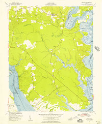 1952 Brandon1957 Print · USGSCharles City County and the James River shoreline are captured here in the early fifties, showing a landscape of riverfront landings and historic tidewater tracts. Researchers can locate Liberty Cem, the rural church at Mt Zion Ch, and old industrial sites like the Brick Kilns.
 - 1959 Map of Richmond
 1959 Richmond1959 Print · USGSMid-century Virginia is captured here at its most vital rail and river junctions, from the capital city to the Chesapeake Bay. Genealogists and historians can trace the development of colonial settlements like Williamsburg and military landmarks including Fort Monroe and Camp Lee.
 - 1964 Map of Richmond
 1964 Richmond1964 Print · USGSCoastal and central Virginia are mapped during the mid-twentieth century, showing the critical intersection of rail, river, and military life. Genealogists can trace family roots through rural county seats like Amelia or find vanished coastal neighborhoods near Phoebus and Hilton Village.
 - 1965 Map of Brandon, 1967 Print
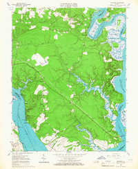 1965 Brandon1967 Print · USGSCoastal Virginia during the mid-sixties reveals a landscape of tidal marshes and riverfront settlements between the James and Chickahominy. Genealogists and historians can locate rural landmarks like Jerusalem Ch, the settlement of Holdcroft, and landing points at Brandon Point.3 unique versions available
 - 1973 Map of Richmond, 1974 Print
 1973 Richmond1974 Print · USGSThe Virginia Tidewater and Piedmont come alive in the early seventies, showcasing a region defined by its great rivers and massive military installations. Researchers can trace the mid-century growth of Richmond or locate family sites near Amelia Court House and Highland Springs.2 unique versions available
 - 1978 Map of Brandon, 1983 Print
 1978 Brandon1983 Print · USGSCharles City County in the late seventies is captured here in a period of rural stability between two major rivers. Genealogists and historians can trace property boundaries and old home sites near Cherry Hall, Rustic, and the historic Brandon area.
 - 1984 Map of Williamsburg, 1985 Print
 1984 Williamsburg1985 Print · USGSThe Virginia Peninsula and Chesapeake Bay shores are shown in the mid-1980s, revealing a landscape defined by colonial heritage and massive military installations. Researchers can trace the grounds of the College of William and Mary, the Yorktown National Cemetery, and the historic Jamestown Island.3 unique versions available
 - 2011 Map of Brandon, 2011 Print
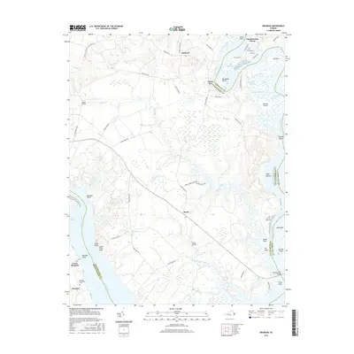
 2011 Brandon2011 Print · USGSCovers River’s Rest Marina, including Chickahominy Haven, Blanks Store, and other nearby areas
 - 2013 Map of Brandon, 2013 Print
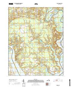
 2013 Brandon2013 Print · USGSCovers River’s Rest Marina, including Chickahominy Haven, Blanks Store, and other nearby areas
 - 2016 Map of Brandon, 2016 Print
 2016 Brandon2016 Print · USGSCovers River’s Rest Marina, including Chickahominy Haven, Blanks Store, and other nearby areas
 - 2019 Map of Brandon, 2019 Print
 2019 Brandon2019 Print · USGSCovers River’s Rest Marina, including Chickahominy Haven, Blanks Store, and other nearby areas
 - 2022 Map of Brandon, 2022 Print
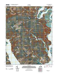
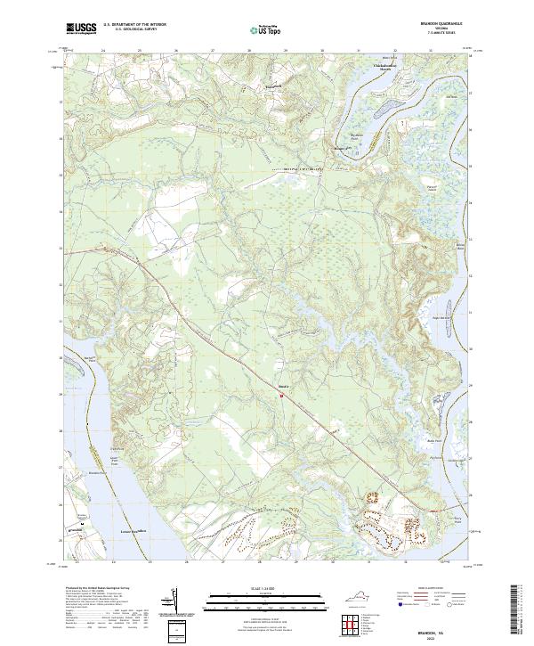 2022 Brandon2022 Print · USGSCoastal Charles City County is seen here in the 2020s, where the James and Chickahominy Rivers meet. Genealogists and local historians can trace the grounds of Brandon and Lower Brandon, or locate the Brandon Plantation Cem near the southern riverbend.
End of results
Showing maps 1-16 of 16
Top cities near River’s Rest Marina
- Williamsburg historical maps
- West Point historical maps
- Claremont historical maps
- Surry historical maps
- Charles City historical maps
Frequently asked questions
- What are the different types of historical maps available for River’s Rest Marina?
- What is the oldest map of River’s Rest Marina?
- Where can I purchase historical maps of River’s Rest Marina for my home or office?
- Where can I download high-res historical maps of River’s Rest Marina?
- Are there historical topographic maps available for River’s Rest Marina?
- Is there historical aerial imagery available for River’s Rest Marina?
- Where are historical maps of River’s Rest Marina sourced from?