1960s Maps of Chesterfield County, Virginia
Explore 19 historic maps of Chesterfield County from the 1960s. These maps offer a rare glimpse into what life looked like during the 1960s — showing old roads, neighborhoods, homes, and landmarks that have changed or disappeared over time.
Whether you're researching your family's past, planning a metal detecting trip, or studying how Chesterfield County's landscape evolved across the 1960s, these high-resolution maps are a powerful tool for exploring the history of this region.
- Focus on a specific era: All maps on this page are from the 1960s, giving you a focused view of this time period.
- See what’s changed: Compare century-old streets, trails, and buildings to today's modern landscape using overlays and satellite layers.
- Research with precision: Use these maps for genealogy, historical research, land use analysis, or educational projects.
- View, download, or print: Maps are fully viewable online in high resolution, and can be downloaded or printed for your own records.
Start exploring Chesterfield County's history through authentic maps from the 1960s. This is your window into the past.
Chesterfield County, VA maps
(19)- 1963 Map of Winterpock, 1965 Print
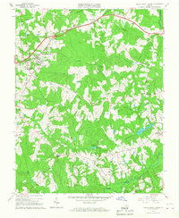
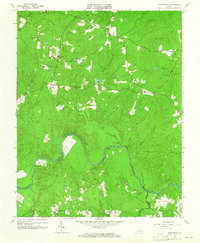 1963 Winterpock1965 Print · USGSChesterfield and Amelia counties are divided by the winding Appomattox River in this mid-century survey. Genealogists can trace family connections through local landmarks like Winterpock School, the Second Branch Church and Cemetery, and Whites Store.4 unique versions available
 - 1963 Map of Beach, 1965 Print
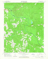
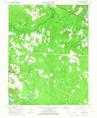
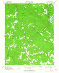 1963 Beach1965 Print · USGSChesterfield County during the early sixties is captured here as a landscape of dense state forests and scattered rural communities. Genealogists and historians can trace family locations near Mt Gilead Ch, Leon Chapel, and the historic Crosstick Millpond.5 unique versions available
 - 1963 Map of Sutherland, 1965 Print
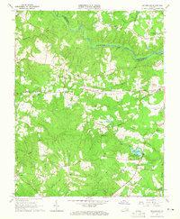 1963 Sutherland1965 Print · USGSDinwiddie County's rail-and-river landscape is captured in the early sixties as small settlements expanded alongside major transit corridors. Genealogists and local historians can locate family landmarks like Wesley Chapel, Olgers Cem, and the old Midway Sch near the Norfolk and Western RR.4 unique versions available
 - 1963 Map of Hallsboro, 1965 Print
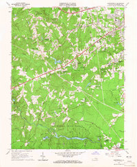
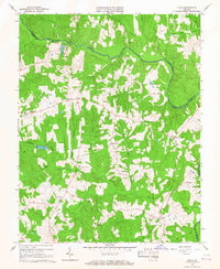
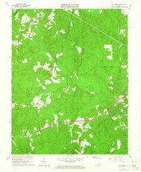 1963 Hallsboro1965 Print · USGSChesterfield County's rural character is well-preserved in the early sixties, showing the transition from agricultural landscapes to early motorsports. Researchers can trace family sites and community hubs like Winterpock, Mt Hermon Ch, and the Southside Speedway.5 unique versions available
 - 1963 Map of Chesterfield, 1965 Print
 1963 Chesterfield1965 Print · USGSChesterfield County during the early sixties shows a landscape of growing residential tracts and deep-woods parkland. Researchers can trace the development of Penn Acres and find local landmarks like Tomahawk Academy Sch and Spring Creek Ch.6 unique versions available
 - 1964 Map of Richmond
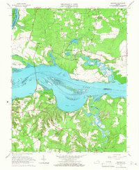
 1964 Richmond1964 Print · USGSCoastal and central Virginia are mapped during the mid-twentieth century, showing the critical intersection of rail, river, and military life. Genealogists can trace family roots through rural county seats like Amelia or find vanished coastal neighborhoods near Phoebus and Hilton Village.
 - 1964 Map of Bon Air, 1965 Print
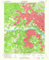 1964 Bon Air1965 Print · USGSMid-century Chesterfield and Henrico Counties show a mix of old rural sites and new suburban growth just as the Beltway era begins. Genealogists can trace family landmarks and parishes from Ziontown to Bon Air, or locate the Bellona Arsenal Ruins and Westhampton Memorial Park.8 unique versions available
 - 1964 Map of Midlothian, 1965 Print
 1964 Midlothian1965 Print · USGSMid-century Chesterfield and Goochland counties are captured here as suburban growth begins to reach outward from the river. Researchers can trace historic church sites like Manakin Ch (Cem) and rail corridors including the Chesapeake and Ohio.5 unique versions available
 - 1964 Map of Clayville, 1966 Print
 1964 Clayville1966 Print · USGSChesterfield and Powhatan counties are shown in the mid-1960s as the Appomattox River defined the rural landscape. Genealogists and historians can trace rail-side communities like Moseley and Mattoax or locate landmarks like Grange Hall Sch and Skinquarter Ch.3 unique versions available
 - 1964 Map of Mannboro, 1966 Print
 1964 Mannboro1966 Print · USGSAmelia and Chesterfield Counties meet along the river in the mid-sixties, a landscape of family-named creeks and rural crossroads. Local historians can trace the Goode Civil War Trench and find community landmarks like Amelia Academy and Mannboro.5 unique versions available
 - 1965 Map of Roxbury, 1967 Print
 1965 Roxbury1967 Print · USGSIn the mid-sixties, the Virginia Peninsula landscape around the Charles City and Henrico border remained a rural mosaic of timber and small farms. Genealogists and historians can trace family locations near Glendale National Cemetery, Nance, and the historic Ednas Mill.5 unique versions available
 - 1965 Map of Westover, 1967 Print
 1965 Westover1967 Print · USGSThe James River corridor in the mid-sixties reveals a landscape of historic landings and rural crossroads. Genealogists can locate family landmarks like Merchant Hope Ch, Rolands Mill, and the riverside grounds of Westover.3 unique versions available
 - 1966 Map of Chula, 1967 Print
 1966 Chula1967 Print · USGSAmelia and Powhatan counties appear in the mid-sixties as a landscape of rural crossroads and riverfront farms. Genealogists and historians can trace family locations near Chula, Fieldstown, and numerous country churches including Grub Hill Ch and Mattoax Ch.3 unique versions available
 - 1966 Map of Amelia Court House, 1968 Print
 1966 Amelia Court House1968 Print · USGSAmelia County and its historic seat come alive in the mid-sixties, showcasing a landscape of rural crossroads and community landmarks. Researchers can trace the roots of local families and institutions through sites like Pointons Store, Russell Grove High Sch, and Big Oak Cem.3 unique versions available
 - 1969 Map of Hopewell, 1971 Print
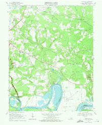
 1969 Hopewell1971 Print · USGSCoastal Virginia during the late sixties shows a mix of industrial growth and military presence at the historic river forks. Genealogists and historians can trace family-named sites like Birchett Estate, visit Bermuda Hundred, or locate local landmarks such as Enon Ch and Woodlawn Sch.4 unique versions available
 - 1969 Map of Drewrys Bluff, 1971 Print
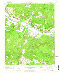
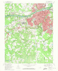
 1969 Drewrys Bluff1971 Print · USGSChesterfield County and South Richmond undergo significant industrial and suburban expansion in the late sixties along the winding James River. Genealogists and historians can trace military history at Fort Darling or locate family landmarks like Branch Ch and St James Cem.5 unique versions available
 - 1969 Map of Dutch Gap, 1971 Print
 1969 Dutch Gap1971 Print · USGSHenrico County in the late sixties shows a landscape where Civil War earthworks meet the jet age at Byrd Field. Genealogists and historians can locate Curles Neck Plantation, the Washington Memorial Cem, and Fort Harrison.4 unique versions available
 - 1969 Map of Petersburg, 1971 Print
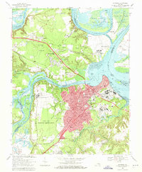
 1969 Petersburg1971 Print · USGSPetersburg and Colonial Heights are shown in the late sixties as the urban core expands alongside a landscape defined by Civil War history. Researchers can trace numerous fortifications like Fort Wadsworth and locate family sites at Blandford Cemetery or Smith Grove Ch.3 unique versions available
 - 1969 Map of Chester, 1971 Print
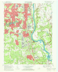
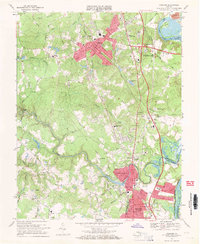 1969 Chester1971 Print · USGSThe corridor between Richmond and Petersburg was undergoing rapid suburban growth in the late sixties. Genealogists and local historians can trace family-named sites and vanished infrastructure from Lynch Siding and Bethesda Ch to the historic crossings at Branders Bridge.4 unique versions available
End of results
Showing maps 1-19 of 19
Top cities of Chesterfield County
- Chester historical maps
- Meadowbrook historical maps
- Bon Air historical maps
- Manchester historical maps
- Rockwood historical maps
- Bellwood historical maps
See more
Frequently asked questions
- What are the different types of historical maps available for Chesterfield County?
- What is the oldest map of Chesterfield County?
- Where can I purchase historical maps of Chesterfield County for my home or office?
- Where can I download high-res historical maps of Chesterfield County?
- Are there historical topographic maps available for Chesterfield County?
- Is there historical aerial imagery available for Chesterfield County?
- Where are historical maps of Chesterfield County sourced from?