Old Maps of Woodlake, Virginia for Genealogy
Trace your family roots with 16 historic maps of Woodlake. These high-res maps reveal old neighborhoods, homesites, landmarks, and streets — helping you uncover where your ancestors lived and how the area evolved over time.
- Explore historic neighborhoods: Identify where your relatives may have lived in the 1800s or 1900s.
- Compare maps over time: Trace the changes in streets, buildings, and landmarks for multi-generational research.
- Perfect for genealogy & ancestry research: Used by family historians and researchers to map out lineage and migration.
These maps are an incredible resource for exploring your personal connection to Woodlake's past.
Woodlake, VA maps
(16)- 1897 Map of Amelia
 1897 Amelia1897 Print · USGSThe rural interior of central Virginia comes into focus in the late nineteenth century, as the Appomattox River corridor transitions from a river-based economy to a rail-centered one. Researchers can trace ancestral property lines near Giles Mill, locate the rail hub at Mosley Junction, or find old river crossings like Goode Bridge.5 unique versions available
 - 1943 Map of Hallsboro
 1943 Hallsboro1943 Print · USGSCentral Virginia is seen here during the mid-forties, centered on the rural crossing at Hallsboro. Genealogists and local historians can trace family roots through landmarks like Tomahawk Church, the Southern rail line, and Cheathams Hatchery.2 unique versions available
 - 1943 Map of Richmond, 1972 Print
 1943 Richmond1972 Print · USGSCoastal Virginia and the state capital are shown in detail during the mid-century era of infrastructure expansion. Genealogists and historians can trace the grounds of Richmond Nat Battlefield Park, locate the Yorktown Nat Cem, or follow the many rural routes through Amelia Court House and Tappahannock.
 - 1949 Map of Richmond, 1951 Print
 1949 Richmond1951 Print · USGSCoastal Virginia in the years following World War II remained a landscape of historic river towns and expanding military bases. Genealogists and historians can trace the rail lines of the Southern Ry and locate established landmarks from Camp Lee to the remote reaches of Dragon Swamp.
 - 1959 Map of Richmond
 1959 Richmond1959 Print · USGSMid-century Virginia is captured here at its most vital rail and river junctions, from the capital city to the Chesapeake Bay. Genealogists and historians can trace the development of colonial settlements like Williamsburg and military landmarks including Fort Monroe and Camp Lee.
 - 1963 Map of Hallsboro, 1965 Print
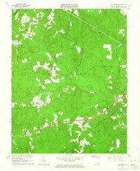 1963 Hallsboro1965 Print · USGSChesterfield County's rural character is well-preserved in the early sixties, showing the transition from agricultural landscapes to early motorsports. Researchers can trace family sites and community hubs like Winterpock, Mt Hermon Ch, and the Southside Speedway.5 unique versions available
 - 1964 Map of Richmond
 1964 Richmond1964 Print · USGSCoastal and central Virginia are mapped during the mid-twentieth century, showing the critical intersection of rail, river, and military life. Genealogists can trace family roots through rural county seats like Amelia or find vanished coastal neighborhoods near Phoebus and Hilton Village.
 - 1973 Map of Richmond, 1974 Print
 1973 Richmond1974 Print · USGSThe Virginia Tidewater and Piedmont come alive in the early seventies, showcasing a region defined by its great rivers and massive military installations. Researchers can trace the mid-century growth of Richmond or locate family sites near Amelia Court House and Highland Springs.2 unique versions available
 - 1974 Map of Hallsboro, 1977 Print
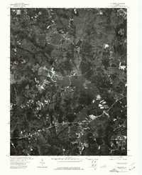 1974 Hallsboro1977 Print · USGSChesterfield County appears in high-detail aerial photography during the mid-seventies, just as the local landscape began to shift. Genealogists and local historians can trace property lines and early road networks around Hallsboro and the Swift Creek Reservoir.
 - 1984 Map of Petersburg, 1985 Print
 1984 Petersburg1985 Print · USGSCentral Virginia in the mid-eighties shows a complex landscape of growing suburban centers and significant military installations. Researchers can trace historic boundaries and civic sites from Amelia Court House to the Glendale Nat Cem and Virginia State College.2 unique versions available
 - 1994 Map of Hallsboro, 1996 Print
 1994 Hallsboro1996 Print · USGSChesterfield County during the mid-nineties shows a landscape of growing residential communities and traditional rural crossroads. Trace the development of Brandermill along the Swift Creek Reservoir or locate the Southside Speedway and Hallsboro.
 - 2010 Map of Hallsboro, 2010 Print
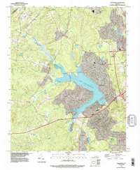
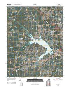 2010 Hallsboro2010 Print · USGSCovers Woodlake, including Brandermill, Hallsboro, and other nearby areas
 - 2013 Map of Hallsboro, 2013 Print
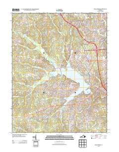 2013 Hallsboro2013 Print · USGSCovers Woodlake, including Brandermill, Hallsboro, and other nearby areas
 - 2016 Map of Hallsboro, 2016 Print
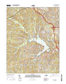 2016 Hallsboro2016 Print · USGSCovers Woodlake, including Brandermill, Hallsboro, and other nearby areas
 - 2019 Map of Hallsboro, 2019 Print
 2019 Hallsboro2019 Print · USGSCovers Woodlake, including Brandermill, Hallsboro, and other nearby areas
 - 2022 Map of Hallsboro, 2022 Print
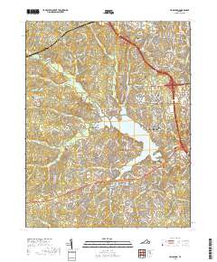
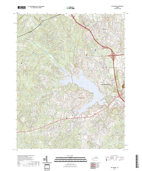 2022 Hallsboro2022 Print · USGSMid-Atlantic suburban growth meets traditional Virginia settlements in this recent survey of Chesterfield County. Trace local heritage and land boundaries through sites like Hallsboro, the Brown Grove Baptist Church Cem, and the Fuqua Cem.
End of results
Showing maps 1-16 of 16
Top cities near Woodlake
- Tuckahoe historical maps
- Meadowbrook historical maps
- Bon Air historical maps
- Manchester historical maps
- Lakeside historical maps
- Rockwood historical maps
See more
Frequently asked questions
- What are the different types of historical maps available for Woodlake?
- What is the oldest map of Woodlake?
- Where can I purchase historical maps of Woodlake for my home or office?
- Where can I download high-res historical maps of Woodlake?
- Are there historical topographic maps available for Woodlake?
- Is there historical aerial imagery available for Woodlake?
- Where are historical maps of Woodlake sourced from?