1970s Maps of Clarke County, Virginia
Explore 7 historic maps of Clarke County from the 1970s. These maps offer a rare glimpse into what life looked like during the 1970s — showing old roads, neighborhoods, homes, and landmarks that have changed or disappeared over time.
Whether you're researching your family's past, planning a metal detecting trip, or studying how Clarke County's landscape evolved across the 1970s, these high-resolution maps are a powerful tool for exploring the history of this region.
- Focus on a specific era: All maps on this page are from the 1970s, giving you a focused view of this time period.
- See what’s changed: Compare century-old streets, trails, and buildings to today's modern landscape using overlays and satellite layers.
- Research with precision: Use these maps for genealogy, historical research, land use analysis, or educational projects.
- View, download, or print: Maps are fully viewable online in high resolution, and can be downloaded or printed for your own records.
Start exploring Clarke County's history through authentic maps from the 1970s. This is your window into the past.
Clarke County, VA maps
(7)- 1970 Map of Ashby Gap, 1971 Print
 1970 Ashby Gap1971 Print · USGSThe Blue Ridge high country and the winding Shenandoah River dominate the landscape in the early seventies. Genealogists and historians can locate remote mountain landmarks like Ashby Gap, Mt Weather, and the Providence Chapel cemetery.4 unique versions available
 - 1970 Map of Round Hill, 1971 Print
 1970 Round Hill1971 Print · USGSCrossing the Blue Ridge in the early seventies, this survey shows the meeting of the Shenandoah Valley and the Virginia Piedmont. Genealogists and hikers can trace the Appalachian Trail past Wilson Gap or locate family sites in Meyerstown and Kabletown.3 unique versions available
 - 1970 Map of Bluemont, 1972 Print
 1970 Bluemont1972 Print · USGSLoudoun and Clarke counties meet along the crest of the Blue Ridge in the early 1970s. Researchers can trace the Appalachian Trail through Snickers Gap or locate historic local landmarks like Foxcroft Sch, Unison, and Ebenezer Ch.4 unique versions available
 - 1970 Map of Upperville, 1976 Print
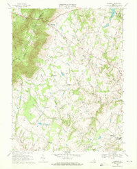
 1970 Upperville1976 Print · USGSNorthern Fauquier County and the Blue Ridge foothills are captured in the early seventies as the region maintained its rural character. Genealogists and historians can trace the locations of old country churches like Pleasant Vale Ch and rail stops at Markham or Delaplane.3 unique versions available
 - 1972 Map of Stephens City, 1977 Print
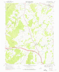
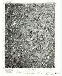 1972 Stephens City1977 Print · USGSStephens City and the surrounding Frederick County countryside are captured during the early 1970s as modern highways reshaped the valley. Trace the layout of family farms and the growth of Stephens City and Reliance through this detailed aerial photography.
 - 1972 Map of Linden, 1977 Print
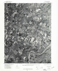
 1972 Linden1977 Print · USGSThe Blue Ridge foothills and Shenandoah Valley are revealed in this 1970s orthophotograph, capturing the area's rural character during a period of transition. Genealogists and local researchers can trace property lines and roads around Linden, Markham, and the Shenandoah River.
 - 1972 Map of Boyce, 1977 Print
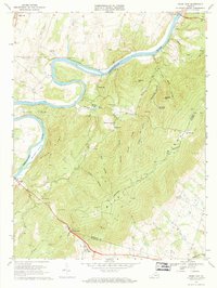
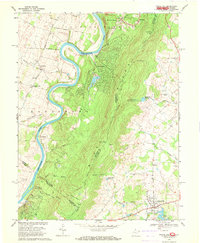
 1972 Boyce1977 Print · USGSThe rural Virginia landscape of the early seventies is revealed in this aerial study centered on Clarke County. Genealogists and local historians can trace property lines and the village layouts of Boyce and Millwood near the winding Shenandoah River.
End of results
Showing maps 1-7 of 7
Top cities of Clarke County
Frequently asked questions
- What are the different types of historical maps available for Clarke County?
- What is the oldest map of Clarke County?
- Where can I purchase historical maps of Clarke County for my home or office?
- Where can I download high-res historical maps of Clarke County?
- Are there historical topographic maps available for Clarke County?
- Is there historical aerial imagery available for Clarke County?
- Where are historical maps of Clarke County sourced from?