2000s (21st Century) Maps of Culpeper County, Virginia
Explore 18 historic maps of Culpeper County from the 2000s (21st Century). These maps offer a rare glimpse into what life looked like during the 2000s — showing old roads, neighborhoods, homes, and landmarks that have changed or disappeared over time.
Whether you're researching your family's past, planning a metal detecting trip, or studying how Culpeper County's landscape evolved across the 2000s, these high-resolution maps are a powerful tool for exploring the history of this region.
- Focus on a specific era: All maps on this page are from the 2000s, giving you a focused view of this time period.
- See what’s changed: Compare century-old streets, trails, and buildings to today's modern landscape using overlays and satellite layers.
- Research with precision: Use these maps for genealogy, historical research, land use analysis, or educational projects.
- View, download, or print: Maps are fully viewable online in high resolution, and can be downloaded or printed for your own records.
Start exploring Culpeper County's history through authentic maps from the 2000s. This is your window into the past.
Culpeper County, VA maps
(18)- 2022 Map of Remington, 2022 Print
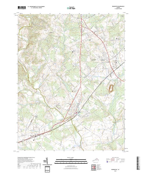 2022 Remington2022 Print · USGSThe Fauquier and Culpeper county line is traced by the Rappahannock River in this recent survey of Northern Virginia’s horse country and rural corridors. Genealogists and local historians can locate numerous family and church burial sites, including the Hollywood Cem, Saint Patrick Orthodox Cem, and the Wright James Graveyard.
 - 2022 Map of Rapidan, 2022 Print
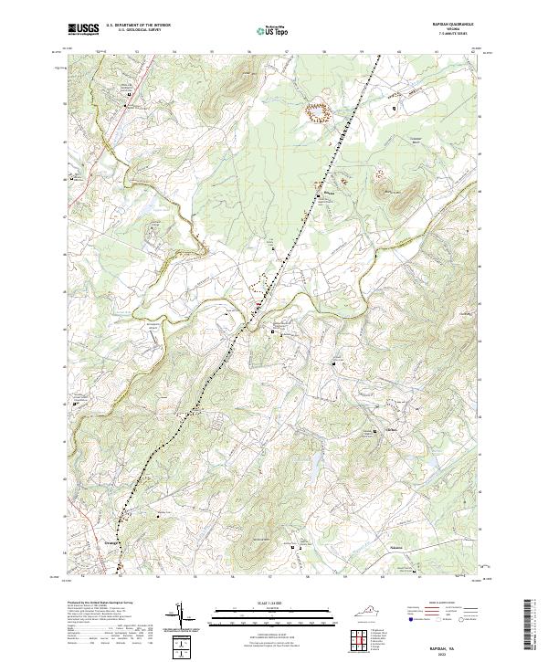 2022 Rapidan2022 Print · USGSThe Piedmont countryside at the meeting of Culpeper and Orange Counties remains a landscape of family legacy and river junctions. Researchers can trace ancestral roots through dozens of local sites like Jerdone Cem, Taylor-Quarles Family Cem, and the Waddell Memorial Presbyterian Church.
 - 2022 Map of Richardsville, 2022 Print
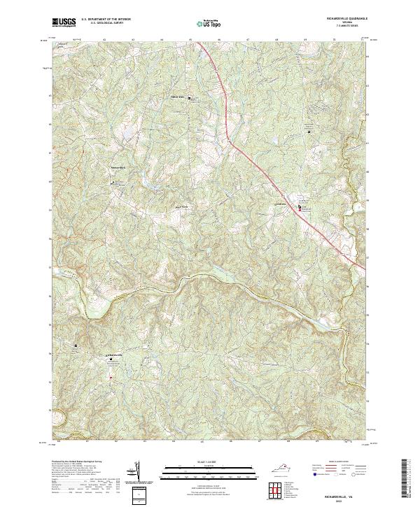 2022 Richardsville2022 Print · USGSThe confluence of the Rappahannock and Rapidun Rivers defines this Virginia countryside in the early twenty-first century. Researchers can trace family sites like Richardsville United Methodist Church Cem and old crossroads at Goldvein and Sumerduck.
 - 2022 Map of Massies Corner, 2022 Print
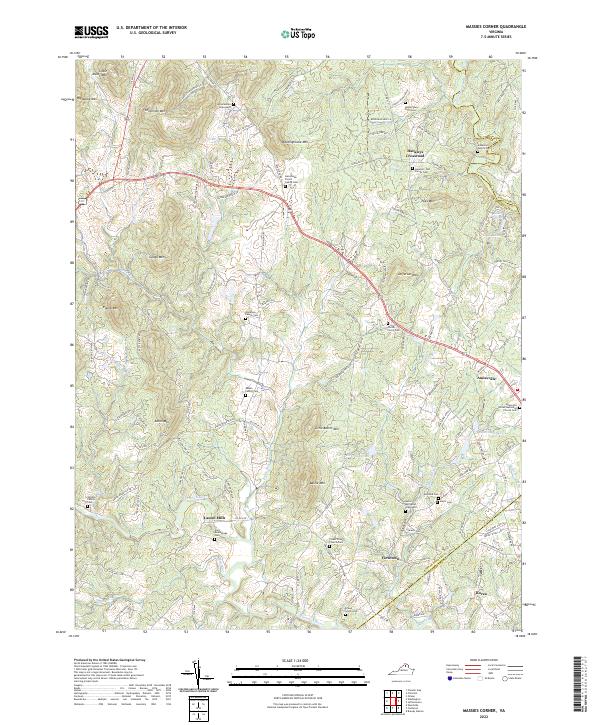 2022 Massies Corner2022 Print · USGSRappahannock County’s rolling piedmont landscape is captured here in the early twenty-first century, showing a region deeply tied to its family-named peaks and river valleys. Researchers can trace ancestral roots through dozens of private burial sites like the Amiss and Alsop Graveyard or the Corder - Pierce Cem near the banks of Battle Run.
 - 2022 Map of Unionville, 2022 Print
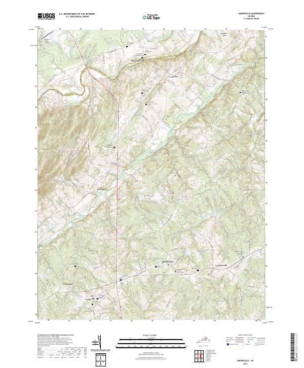 2022 Unionville2022 Print · USGSOrange County and the banks of the Rapidan River are captured here in a period of rural continuity. Genealogists and historians can trace numerous family and church burial sites, from the Stringfellow Homestead Cem to the Unionville Christian Church Cem.
 - 2022 Map of Jeffersonton, 2022 Print
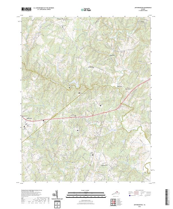 2022 Jeffersonton2022 Print · USGSThe Virginia Piedmont is documented here in the early twenty-first century, showing the rural landscapes of Fauquier and Culpeper counties. Genealogists can trace family heritage at the Ney Family Graveyard, Lawson Family Cem, and Cliff Mills.
 - 2022 Map of Castleton, 2022 Print
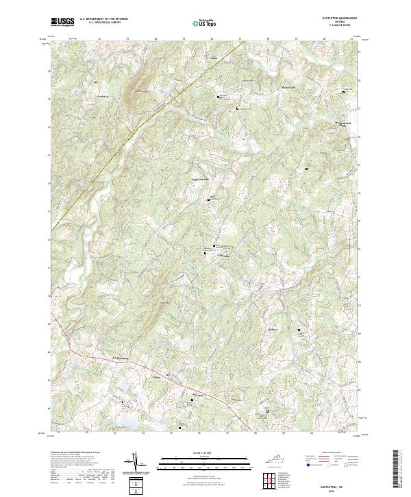 2022 Castleton2022 Print · USGSCulpeper County at the start of the 2020s remains a landscape of historic river crossings and small upland communities. Genealogists and local historians can trace family ties through numerous sites like the Tutt-Covington Cem, Monumental Mills, and Gourdvine Baptist Church.
 - 2022 Map of Brandy Station, 2022 Print
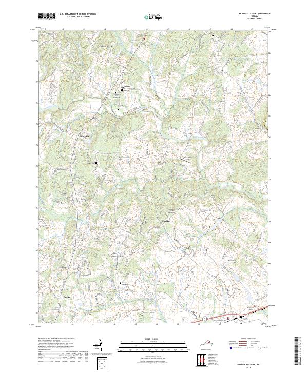 2022 Brandy Station2022 Print · USGSCulpeper County comes into focus in the early 2020s, revealing a landscape of small Piedmont communities and significant family-named landmarks. Genealogists and historians can locate numerous family burial sites, including the Yancey Family Cem, the Freeman - Botts Cem, and the historic Fleetwood Hill.
 - 2022 Map of Woodville, 2022 Print
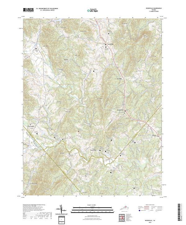 2022 Woodville2022 Print · USGSRappahannock County's rural landscape is revealed in this modern survey of the Virginia Piedmont. Family historians can trace ancestral roots through dozens of private burial sites like the Hitt Family Graveyard and old church grounds at Slate Mills Baptist Church Cem.
 - 2022 Map of Culpeper West, 2022 Print
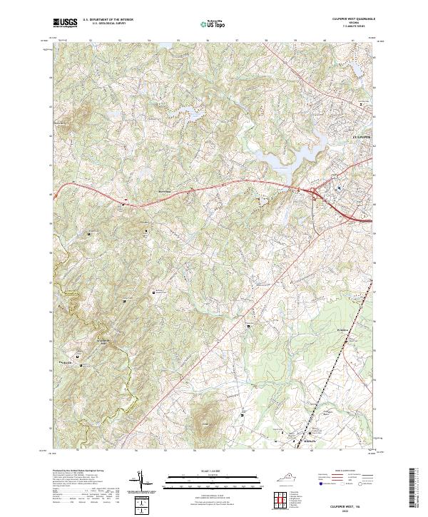 2022 Culpeper West2022 Print · USGSCulpeper County in the early 2020s shows a landscape where growing residential areas meet a long agricultural and family history. Researchers can trace ancestral lines through numerous local sites like Waylands Mill, Mitchells, and the Bushong Hawkins Cem.
 - 2022 Map of Brightwood, 2022 Print
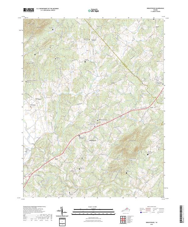 2022 Brightwood2022 Print · USGSIn the rural heart of Madison County, this survey documents a landscape of family-run farms and historic congregations at the start of the 2020s. Genealogists can trace family heritage through sites like Blankenbaker Burial Ground, the Weaver Family Cem, and Brightwood.
 - 2022 Map of Storck, 2022 Print
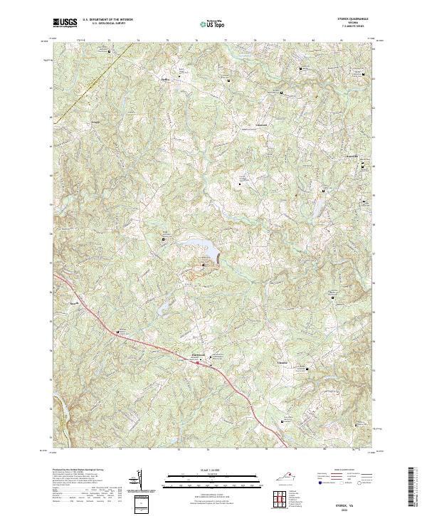 2022 Storck2022 Print · USGSStafford County is shown in this recent survey as a landscape deeply connected to its ancestral roots. Genealogists can trace family heritage through numerous private sites like the Jacobs-Humphrey Family Cem, Briggs-McDonald Family Cem, and Hartwood Presbyterian Church Cem.
 - 2022 Map of Mine Run, 2022 Print
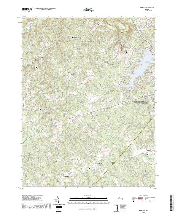 2022 Mine Run2022 Print · USGSThe Orange and Spotsylvania county line is documented here in recent years, showing where historic battlefields meet modern lakeside communities. Researchers can trace family history through numerous small plots like the Kube Family Cem or find landmarks like the Simpsonville Airport.
 - 2022 Map of Germanna Bridge, 2022 Print
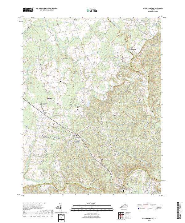 2022 Germanna Bridge2022 Print · USGSCulpeper County at the start of the 2020s remains a landscape of river-bend settlements and deep family roots. Researchers can trace ancestral locations at James William Brown Family Cem, Kellys Ford, and the crossroads of Lignum.
 - 2022 Map of Culpeper East, 2022 Print
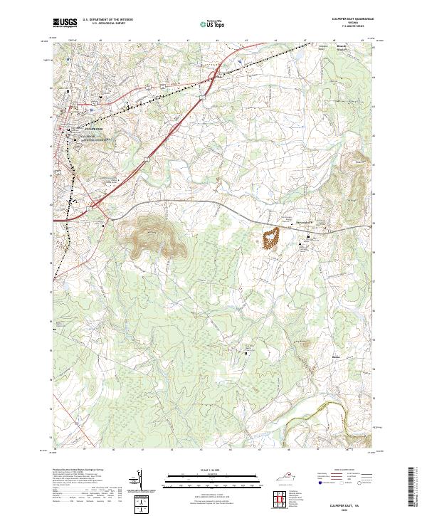 2022 Culpeper East2022 Print · USGSThe area around CULPEPER is shown in this modern survey, capturing the transition from a historic county seat to a contemporary regional center. Genealogists and local historians can locate numerous family burial sites, including the Bell Family Cem, and trace the rural reaches of Brandy Station and Stevensburg.
 - 2022 Map of Warrenton, 2022 Print
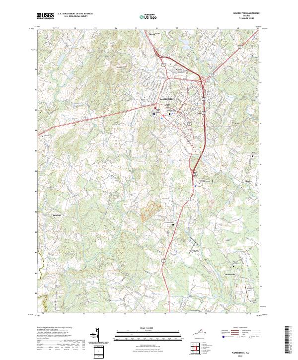 2022 Warrenton2022 Print · USGSWarrenton and its surrounding Fauquier County countryside appear here in the early twenty-first century, balancing its role as a county seat with deep-rooted rural traditions. Genealogists can locate family sites like the William Edmonds Family Cem and Bell - Lewis - Smith Family Cem, or trace landmarks like the Fauquier County Courthouse.
 - 2022 Map of Chancellorsville, 2022 Print
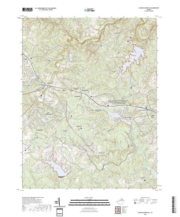 2022 Chancellorsville2022 Print · USGSSpotsylvania County’s storied Civil War battlefields and rural crossroads are preserved here in the early twenty-first century. Genealogists and historians can locate numerous family burial sites like the Ellwood Family Cem and trace the historic grounds of Hazel Grove.
 - 2022 Map of Salem Church, 2022 Print
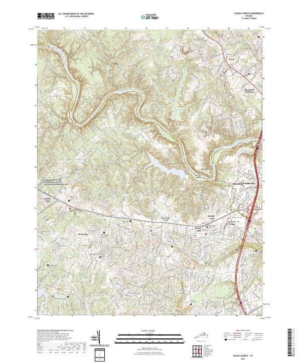 2022 Salem Church2022 Print · USGSThe Rappahannock River corridor west of Fredericksburg is captured here in its contemporary state, where battlefield preservation meets suburban growth. Researchers can locate numerous family burial grounds and historic churchyards like Zoan Baptist Church Cem and the Hildrup Family Burial Ground.
End of results
Showing maps 1-18 of 18
Top cities of Culpeper County
Frequently asked questions
- What are the different types of historical maps available for Culpeper County?
- What is the oldest map of Culpeper County?
- Where can I purchase historical maps of Culpeper County for my home or office?
- Where can I download high-res historical maps of Culpeper County?
- Are there historical topographic maps available for Culpeper County?
- Is there historical aerial imagery available for Culpeper County?
- Where are historical maps of Culpeper County sourced from?