Old Maps of Culpeper County, Virginia for Academic Research
Study the evolution of Culpeper County with 157 high-resolution historic maps. Whether you're teaching, researching, or modeling changes in land use, these maps provide essential visual documentation of urban, environmental, and geographic change.
- Analyze long-term change: Track patterns in development, transportation, and natural features.
- Ideal for environmental or urban studies: Support academic projects with primary historical map data.
- Use in the classroom or lab: Educators and researchers rely on these maps to bring historical context to life.
These maps are a powerful tool for teaching, research, and visualizing how Culpeper County has changed over the decades.
Culpeper County, VA maps
(157)- 1887 Map of Spottsylvania
 1887 Spottsylvania1887 Print · USGSCentral Virginia in the late 1880s remains a landscape of river fords and crossroads shops before modern development. Genealogists and historians can trace the locations of the Vaucluse Gold Mine, Wilderness Tavern, and the path of the Narrow Gauge Railroad.
 - 1892 Map of Spottsylvania
 1892 Spottsylvania1892 Print · USGSCentral Virginia’s post-war landscape is captured here in the late nineteenth century, showing a rural economy defined by gold mining and river crossings. Genealogists can trace family footprints at Todds Tavern, the Vaucluse Gold Mine, and along the Narrow Gauge Railroad.6 unique versions available
 - 1892 Map of Gordonsville, 1899 Print
 1892 Gordonsville1899 Print · USGSCentral Virginia’s railway hubs and mountain gaps come alive in this late nineteenth-century survey. Genealogists and historians can trace the foundations of Charlottesville and the bustling rail junctions at Gordonsville and Orange.6 unique versions available
 - 1893 Map of Luray, 1898 Print
 1893 Luray1898 Print · USGSThe Shenandoah Valley in the 1890s was a land of steep mountain ridges and vital new railways. Genealogists and historians can trace old homesteads and depots along the Shenandoah Valley Railroad or find remote hamlets like Seven Fountains and Browntown.
 - 1894 Map of Warrenton
 1894 Warrenton1894 Print · USGSVirginia's northern Piedmont and mountain gaps are mapped here in the late nineteenth century as the rail-and-river economy flourished. Genealogists can trace family names and small crossroads from Warrenton and Brentsville to White Sulphur Springs.9 unique versions available
 - 1894 Map of Warrenton, 1897 Print
 1894 Warrenton1897 Print · USGSFauquier County and its neighbors are documented here in the late nineteenth century, showing a landscape defined by the Bull Run Mountains and the Rappahannock. Genealogists and historians can trace old homesteads and transport hubs like Warrenton, Thorofare Gap, and Sudley Spring.
 - 1905 Map of Luray, 1910 Print
 1905 Luray1910 Print · USGSThe Blue Ridge and Shenandoah Valley are frozen in time just after the turn of the century, showing the critical rail networks and mountain gaps of the period. Genealogists can trace family names and settlements like Luray, Front Royal, and Strasburg along the Shenandoah Valley Railroad.4 unique versions available
 - 1927 Map of Remington
 1927 Remington1927 Print · USGSFauquier and Culpeper counties appear here in the late twenties, captured as a landscape of river-bottom farms and rail towns. Genealogists can trace family footprints at Fauquier Sulphur Springs, Westley Chapel, and the Luttrell Sch.4 unique versions available
 - 1930 Map of Warrenton
 1930 Warrenton1930 Print · USGSFauquier and Culpeper counties are captured here in the late twenties, showing a rural landscape organized around the Southern railroad and the Rappahannock River. Researchers can trace old school districts and river crossings like Hinson Ford and Litchfield Sch.2 unique versions available
 - 1943 Map of Germanna Bridge, 1957 Print
 1943 Germanna Bridge1957 Print · USGSCulpeper County and the surrounding river borders are captured here during the early 1940s as a landscape of crossroads stores and river crossings. Genealogists can trace family footprints through sites like Lignum, South Lignum School, and the historic Kellys Ford.2 unique versions available
 - 1943 Map of Chancellorsville, 1957 Print
 1943 Chancellorsville1957 Print · USGSSpotsylvania and Orange counties are captured during the early 1940s, highlighting the preserved grounds of the Wilderness National Military Park. Genealogists can trace family footprints at Paynes Store, Zion Hill Church, and the Parker School located near the Ni River.
 - 1943 Map of Salem Church, 1961 Print
 1943 Salem Church1961 Print · USGSCentral Virginia during the mid-forties reveals a rural landscape of family-named runs and hilltop parishes. Genealogists and historians can trace local life through markers like Chancellor Sch, Zoan Ch, and the crossroads at Holly Corner.
 - 1943 Map of Culpeper, 1961 Print
 1943 Culpeper1961 Print · USGSCulpeper and its surroundings are documented here during the early 1940s as a bustling railroad and county hub. Researchers can locate specific local landmarks like the U S National Cem, tracing the rail lines through Brandy or visiting rural outposts like Batna.
 - 1943 Map of Mine Run, 1961 Print
 1943 Mine Run1961 Print · USGSOrange County and the surrounding tri-county area are shown here during the early years of the Second World War. Researchers can locate local landmarks like Zoar Sch, the Wilderness National Military Park, and rural centers at Golddale and Locustgrove.
 - 1943 Map of Unionville, 1961 Print
 1943 Unionville1961 Print · USGSOrange County and Culpeper County were largely defined by small crossroads communities and river crossings during the early 1940s. Genealogists can trace family locations near Raccoon Ford, Unionville, and rural houses of worship like Mt Pisgah Ch.
 - 1944 Map of Culpeper
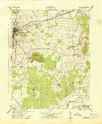 1944 Culpeper1944 Print · USGSCulpeper and the surrounding Piedmont landscape are captured here during the mid-1940s. Genealogists and local historians can locate family landmarks like Cedar Grove Church and the U S National Cemetery, or trace the old Southern rail line through Stevensburg.
 - 1944 Map of Unionville
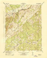 1944 Unionville1944 Print · USGSOrange County and the banks of the Rapidan River are captured here during the 1940s. Local researchers can trace old crossroads and community sites like Unionville, Raccoon Ford, and Sleets Shop, along with rural landmarks such as Palmyra Church.
 - 1944 Map of Mine Run
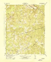 1944 Mine Run1944 Print · USGSCentral Virginia at the height of the war reveals a landscape of small crossroads and rural schoolhouses. Researchers can locate the Zoar School, early settlements like Locustgrove and Gold Dale, and the wartime presence of a CCC Camp.
 - 1944 Map of Salem Church
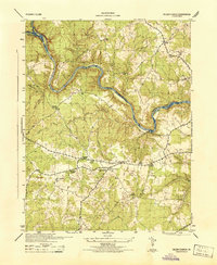 1944 Salem Church1944 Print · USGSSpotsylvania and Stafford Counties were still primarily rural landscapes of crossroads and small farms during the mid-1940s. Genealogists can trace family roots through specific landmarks like Spring Knoll Farm or local institutions such as Diggs School and Zoan Church.
 - 1944 Map of Chancellorsville
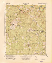 1944 Chancellorsville1944 Print · USGSSpotsylvania County is documented during the mid-1940s, highlighting the overlapping layers of Civil War history and rural Virginia life. Researchers can trace the grounds of Wilderness National Military Park or locate local landmarks like Wilderness Church and Parker School.
 - 1944 Map of Richardsville
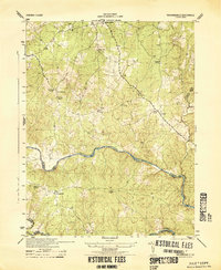 1944 Richardsville1944 Print · USGSRichardsville and the surrounding Virginia Piedmont are captured here in the 1940s as the river-riven borders of four counties meet. Researchers can trace the legacy of rural life through landmarks like Oakland Church, the Goldvein School, and Harding Mill.
 - 1944 Map of Storck
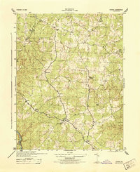 1944 Storck1944 Print · USGSStafford County communities and crossroads appear in detail during the mid-1940s, showing the rural structure of the Virginia Piedmont. Researchers can trace local family landmarks and community centers like Mt Olive School, Dodds Store, and Hartwood Church.
 - 1944 Map of Germanna Bridge
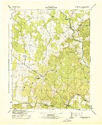 1944 Germanna Bridge1944 Print · USGSCulpeper and Fauquier counties are captured here in the mid-1940s as rural river-bound communities. Genealogists and local historians can trace the road networks connecting Kellys Ford, Lignum, and the historic crossing at Germanna Bridge.
 - 1948 Map of Washington
 1948 Washington1948 Print · USGSThe Potomac and Chesapeake regions in the late 1940s reveal a landscape of expanding military reach and deep-rooted Tidewater settlements. Trace old rail corridors like the Richmond Fredericksburg & Potomac RR or locate landmarks like the Wakefield Washington Monument and St. Marys College.2 unique versions available
 - 1949 Map of Charlottesville
 1949 Charlottesville1949 Print · USGSThe Shenandoah Valley and Blue Ridge appear in the late 1940s as a thriving corridor of rail and river commerce. Researchers can trace the mid-century footprints of Harrisonburg, Staunton, and Culpeper alongside the historic routes of the Southern Railway.2 unique versions available
Showing maps 1-25 of 157
Top cities of Culpeper County
Frequently asked questions
- What are the different types of historical maps available for Culpeper County?
- What is the oldest map of Culpeper County?
- Where can I purchase historical maps of Culpeper County for my home or office?
- Where can I download high-res historical maps of Culpeper County?
- Are there historical topographic maps available for Culpeper County?
- Is there historical aerial imagery available for Culpeper County?
- Where are historical maps of Culpeper County sourced from?