Old Maps of South Run, Fairfax County for Hiking & Exploration
Hike through history with 28 historic maps of South Run. Explore old trails, ghost towns, and forgotten backroads — perfect for outdoor adventurers and local explorers.
- Rediscover forgotten places: Map out old mining camps, roads, and footpaths that no longer exist on modern maps.
- Layer with modern tools: Combine with LiDAR or satellite views to plan hikes through historical terrain.
- Made for exploration: Popular among hikers, overlanders, and local history lovers.
Use these maps to find adventure and explore the hidden past of South Run.
South Run, Fairfax County maps
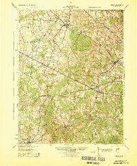
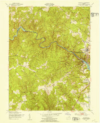
(28)- 1890 Map of Mt. Vernon
 1890 Mt. Vernon1890 Print · USGSCovers South Run, including Washington, Arlington, and other nearby areas
 - 1891 Map of Mt. Vernon
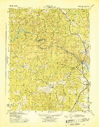
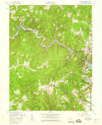
 1891 Mt. Vernon1891 Print · USGSCovers South Run, including Washington, Arlington, and other nearby areas
 - 1894 Map of Mt. Vernon, 1904 Print
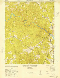
 1894 Mt. Vernon1904 Print · USGSCovers South Run, including Washington, Arlington, and other nearby areas6 unique versions available
 - 1897 Map of Mt. Vernon
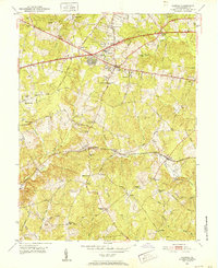
 1897 Mt. Vernon1897 Print · USGSCovers South Run, including Washington, Arlington, and other nearby areas2 unique versions available
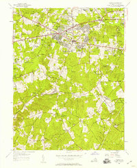
 - 1915 Map of Fairfax
 1915 Fairfax1915 Print · USGSCovers South Run, including Centreville, Reston, and other nearby areas4 unique versions available
 - 1927 Map of Quantico
 1927 Quantico1927 Print · USGSCovers South Run, including Dale City, Lake Ridge, and other nearby areas
 - 1940 Map of Quantico
 1940 Quantico1940 Print · USGSCovers South Run, including Dale City, Lake Ridge, and other nearby areas2 unique versions available
 - 1943 Map of Quantico
 1943 Quantico1943 Print · USGSCovers South Run, including Dale City, Lake Ridge, and other nearby areas
 - 1944 Map of Fairfax
 1944 Fairfax1944 Print · USGSCovers South Run, including Centreville, Reston, and other nearby areas
 - 1944 Map of Occoquan
 1944 Occoquan1944 Print · USGSCovers South Run, including Dale City, Lake Ridge, and other nearby areas
 - 1944 Map of Quantico
 1944 Quantico1944 Print · USGSCovers South Run, including Dale City, Lake Ridge, and other nearby areas
 - 1948 Map of Occoquan
 1948 Occoquan1948 Print · USGSCovers South Run, including Dale City, Lake Ridge, and other nearby areas
 - 1948 Map of Washington
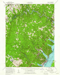
 1948 Washington1948 Print · USGSCovers South Run, including Washington, Arlington, and other nearby areas2 unique versions available
 - 1951 Map of Fairfax, 1952 Print
 1951 Fairfax1952 Print · USGSCovers South Run, including Burke, Fair Oaks, and other nearby areas
 - 1951 Map of Occoquan, 1953 Print
 1951 Occoquan1953 Print · USGSCovers South Run, including Dale City, Lake Ridge, and other nearby areas
 - 1955 Map of Fairfax, 1958 Print
 1955 Fairfax1958 Print · USGSCovers South Run, including Burke, Fair Oaks, and other nearby areas2 unique versions available
 - 1956 Map of Occoquan, 1959 Print
 1956 Occoquan1959 Print · USGSCovers South Run, including Dale City, Lake Ridge, and other nearby areas4 unique versions available
 - 1957 Map of Quantico, 1961 Print
 1957 Quantico1961 Print · USGSCovers South Run, including Dale City, Lake Ridge, and other nearby areas2 unique versions available
 - 1957 Map of Washington, 1966 Print
 1957 Washington1966 Print · USGSCovers South Run, including Washington, Arlington, and other nearby areas5 unique versions available
 - 1961 Map of Washington
 1961 Washington1961 Print · USGSCovers South Run, including Washington, Arlington, and other nearby areas2 unique versions available
 - 1966 Map of Fairfax, 1967 Print
 1966 Fairfax1967 Print · USGSCovers South Run, including Burke, Fair Oaks, and other nearby areas5 unique versions available
 - 1966 Map of Occoquan, 1968 Print
 1966 Occoquan1968 Print · USGSCovers South Run, including Dale City, Lake Ridge, and other nearby areas4 unique versions available
 - 1977 Map of Occoquan, 1982 Print
 1977 Occoquan1982 Print · USGSCovers South Run, including Dale City, Lake Ridge, and other nearby areas
 - 1982 Map of Washington West, 1983 Print
 1982 Washington West1983 Print · USGSCovers South Run, including Washington, Arlington, and other nearby areas
 - 1986 Map of Washington West
 1986 Washington West1986 Print · USGSCovers South Run, including Washington, Arlington, and other nearby areas2 unique versions available
Showing maps 1-25 of 28
Frequently asked questions
- What are the different types of historical maps available for South Run?
- What is the oldest map of South Run?
- Where can I purchase historical maps of South Run for my home or office?
- Where can I download high-res historical maps of South Run?
- Are there historical topographic maps available for South Run?
- Is there historical aerial imagery available for South Run?
- Where are historical maps of South Run sourced from?