Old Maps of South Run, Fairfax County for Metal Detecting
Plan your next treasure hunt with 28 historic maps of South Run. Find old homesites, ghost towns, trails, and gathering spots that may be lost to time — perfect for identifying promising metal detecting locations.
- Locate forgotten sites: Uncover places like long-lost settlements, abandoned rail lines, or gathering spots.
- Plan better hunts: Use map overlays combined with LiDAR or satellite views to narrow in on historically rich areas.
- Made for detectorists: Thousands of hobbyists use these maps to discover relics, coins, and hidden history.
Use these historic maps to boost your research and find new opportunities beneath the surface of South Run.
South Run, Fairfax County maps
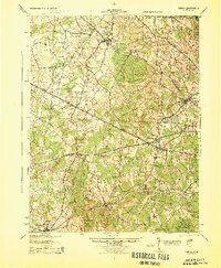
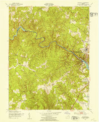
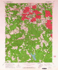
(28)- 1890 Map of Mt. Vernon
 1890 Mt. Vernon1890 Print · USGSCovers South Run, including Washington, Arlington, and other nearby areas
 - 1891 Map of Mt. Vernon
 1891 Mt. Vernon1891 Print · USGSCovers South Run, including Washington, Arlington, and other nearby areas
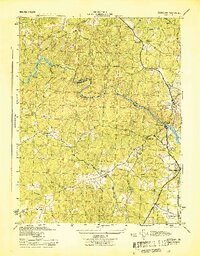
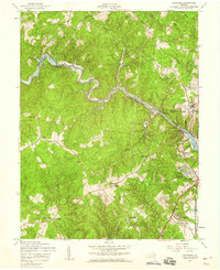
 - 1894 Map of Mt. Vernon, 1904 Print
 1894 Mt. Vernon1904 Print · USGSCovers South Run, including Washington, Arlington, and other nearby areas6 unique versions available
 - 1897 Map of Mt. Vernon
 1897 Mt. Vernon1897 Print · USGSCovers South Run, including Washington, Arlington, and other nearby areas2 unique versions available
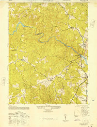
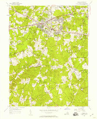
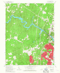
 - 1915 Map of Fairfax
 1915 Fairfax1915 Print · USGSCovers South Run, including Centreville, Reston, and other nearby areas4 unique versions available
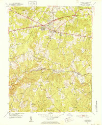
 - 1927 Map of Quantico
 1927 Quantico1927 Print · USGSCovers South Run, including Dale City, Lake Ridge, and other nearby areas
 - 1940 Map of Quantico
 1940 Quantico1940 Print · USGSCovers South Run, including Dale City, Lake Ridge, and other nearby areas2 unique versions available
 - 1943 Map of Quantico
 1943 Quantico1943 Print · USGSCovers South Run, including Dale City, Lake Ridge, and other nearby areas
 - 1944 Map of Fairfax
 1944 Fairfax1944 Print · USGSCovers South Run, including Centreville, Reston, and other nearby areas
 - 1944 Map of Occoquan
 1944 Occoquan1944 Print · USGSCovers South Run, including Dale City, Lake Ridge, and other nearby areas
 - 1944 Map of Quantico
 1944 Quantico1944 Print · USGSCovers South Run, including Dale City, Lake Ridge, and other nearby areas
 - 1948 Map of Occoquan
 1948 Occoquan1948 Print · USGSCovers South Run, including Dale City, Lake Ridge, and other nearby areas
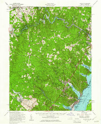
 - 1948 Map of Washington
 1948 Washington1948 Print · USGSCovers South Run, including Washington, Arlington, and other nearby areas2 unique versions available
 - 1951 Map of Fairfax, 1952 Print
 1951 Fairfax1952 Print · USGSCovers South Run, including Burke, Fair Oaks, and other nearby areas
 - 1951 Map of Occoquan, 1953 Print
 1951 Occoquan1953 Print · USGSCovers South Run, including Dale City, Lake Ridge, and other nearby areas
 - 1955 Map of Fairfax, 1958 Print
 1955 Fairfax1958 Print · USGSCovers South Run, including Burke, Fair Oaks, and other nearby areas2 unique versions available
 - 1956 Map of Occoquan, 1959 Print
 1956 Occoquan1959 Print · USGSCovers South Run, including Dale City, Lake Ridge, and other nearby areas4 unique versions available
 - 1957 Map of Quantico, 1961 Print
 1957 Quantico1961 Print · USGSCovers South Run, including Dale City, Lake Ridge, and other nearby areas2 unique versions available
 - 1957 Map of Washington, 1966 Print
 1957 Washington1966 Print · USGSCovers South Run, including Washington, Arlington, and other nearby areas5 unique versions available
 - 1961 Map of Washington
 1961 Washington1961 Print · USGSCovers South Run, including Washington, Arlington, and other nearby areas2 unique versions available
 - 1966 Map of Fairfax, 1967 Print
 1966 Fairfax1967 Print · USGSCovers South Run, including Burke, Fair Oaks, and other nearby areas5 unique versions available
 - 1966 Map of Occoquan, 1968 Print
 1966 Occoquan1968 Print · USGSCovers South Run, including Dale City, Lake Ridge, and other nearby areas4 unique versions available
 - 1977 Map of Occoquan, 1982 Print
 1977 Occoquan1982 Print · USGSCovers South Run, including Dale City, Lake Ridge, and other nearby areas
 - 1982 Map of Washington West, 1983 Print
 1982 Washington West1983 Print · USGSCovers South Run, including Washington, Arlington, and other nearby areas
 - 1986 Map of Washington West
 1986 Washington West1986 Print · USGSCovers South Run, including Washington, Arlington, and other nearby areas2 unique versions available
Showing maps 1-25 of 28
Frequently asked questions
- What are the different types of historical maps available for South Run?
- What is the oldest map of South Run?
- Where can I purchase historical maps of South Run for my home or office?
- Where can I download high-res historical maps of South Run?
- Are there historical topographic maps available for South Run?
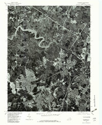
- Is there historical aerial imagery available for South Run?
- Where are historical maps of South Run sourced from?