1960s Maps of Bealeton, Virginia
Explore 3 historic maps of Bealeton from the 1960s. These maps offer a rare glimpse into what life looked like during the 1960s — showing old roads, neighborhoods, homes, and landmarks that have changed or disappeared over time.
Whether you're researching your family's past, planning a metal detecting trip, or studying how Bealeton's landscape evolved across the 1960s, these high-resolution maps are a powerful tool for exploring the history of this region.
- Focus on a specific era: All maps on this page are from the 1960s, giving you a focused view of this time period.
- See what’s changed: Compare century-old streets, trails, and buildings to today's modern landscape using overlays and satellite layers.
- Research with precision: Use these maps for genealogy, historical research, land use analysis, or educational projects.
- View, download, or print: Maps are fully viewable online in high resolution, and can be downloaded or printed for your own records.
Start exploring Bealeton's history through authentic maps from the 1960s. This is your window into the past.
Bealeton, VA maps
(3)- 1961 Map of Washington
 1961 Washington1961 Print · USGSThe mid-Atlantic region in the late fifties is presented in remarkable detail, from the Blue Ridge foothills to the Chesapeake Eastern Shore. Researchers can trace historic river landings and military sites like Mount Vernon, Fort Belvoir, and Point Lookout.2 unique versions available
 - 1966 Map of Remington, 1969 Print
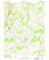 1966 Remington1969 Print · USGSThe Rappahannock River border between Fauquier and Culpeper counties comes alive in this mid-sixties survey. Researchers can trace rural lineages through local landmarks like Cedar Grove Cem, Payne Sch, and the depot at Remington.4 unique versions available
 - 1967 Map of Midland, 1969 Print
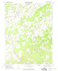 1967 Midland1969 Print · USGSMidland and the surrounding Fauquier County countryside are captured here in the late sixties as the rail-and-creek economy still defined the area. Genealogists can locate family landmarks like the John Marshall Birthplace, Ensors Shop, and the Franklin Mine.3 unique versions available
End of results
Showing maps 1-3 of 3
Top cities near Bealeton
- Linton Hall historical maps
- Culpeper historical maps
- Gainesville historical maps
- Warrenton historical maps
- Nokesville historical maps
- Haymarket historical maps
See more
Frequently asked questions
- What are the different types of historical maps available for Bealeton?
- What is the oldest map of Bealeton?
- Where can I purchase historical maps of Bealeton for my home or office?
- Where can I download high-res historical maps of Bealeton?
- Are there historical topographic maps available for Bealeton?
- Is there historical aerial imagery available for Bealeton?
- Where are historical maps of Bealeton sourced from?