Old Maps of Paris, Virginia for Academic Research
Study the evolution of Paris with 35 high-resolution historic maps. Whether you're teaching, researching, or modeling changes in land use, these maps provide essential visual documentation of urban, environmental, and geographic change.
- Analyze long-term change: Track patterns in development, transportation, and natural features.
- Ideal for environmental or urban studies: Support academic projects with primary historical map data.
- Use in the classroom or lab: Educators and researchers rely on these maps to bring historical context to life.
These maps are a powerful tool for teaching, research, and visualizing how Paris has changed over the decades.
Paris, VA maps
(35)- 1884 Map of Harpers Ferry
 1884 Harpers Ferry1884 Print · USGSThe confluence of the Potomac and Shenandoah rivers is captured in the mid-1880s, documenting a landscape of strategic gaps and vital transit corridors. Researchers can trace the path of the Chesapeake and Ohio Canal and locate historic river crossings like Conrad Ferry and Castleman Ferry.
 - 1891 Map of Harpers Ferry
 1891 Harpers Ferry1891 Print · USGSThe tri-state borderlands of the Potomac and Shenandoah valleys were a vital hub of transport and trade in the late 1800s. Researchers can trace historic river crossings like Castlemans Ferry, follow the route of the Chesapeake and Ohio Canal, or locate family-named settlements like Oatlands and Taylorstown.
 - 1893 Map of Harpers Ferry, 1898 Print
 1893 Harpers Ferry1898 Print · USGSThe tri-state region of the Potomac and Shenandoah valleys is captured here in the late nineteenth century, showing a landscape defined by water and rail. Trace the historic Chesapeake and Ohio Canal or locate local landmarks like Snyder Mills and Harpers Ferry.7 unique versions available
 - 1894 Map of Warrenton
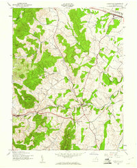
 1894 Warrenton1894 Print · USGSVirginia's northern Piedmont and mountain gaps are mapped here in the late nineteenth century as the rail-and-river economy flourished. Genealogists can trace family names and small crossroads from Warrenton and Brentsville to White Sulphur Springs.9 unique versions available
 - 1916 Map of Berryville, 1920 Print
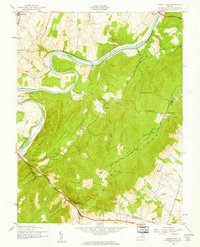
 1916 Berryville1920 Print · USGSThe lower Shenandoah Valley at the onset of the Great War was a landscape defined by its river ferries and growing rail lines. Genealogists and historians can trace the foundations of local life through rural landmarks like Mountain Mission, Furnace School, and the river crossing at Shannondale Ferry.2 unique versions available
 - 1939 Map of Berryville
 1939 Berryville1939 Print · USGSNorthern Virginia and the West Virginia borderlands appear here in the late thirties as a landscape of river fords and mountain gaps. Genealogists can trace family names at Locke Mill, Shepherd Ford, and the Mt Olive Cem.
 - 1943 Map of Ashby Gap, 1961 Print
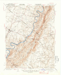
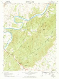
 1943 Ashby Gap1961 Print · USGSThe Blue Ridge mountains and Shenandoah Valley meet in the early 1940s, showing a landscape of high ridges and winding river bends. Trace the path of the Appalachian Trail past Mt Weather or locate rural landmarks like Mt Carmel Ch and Millwood.
 - 1943 Map of Upperville, 1961 Print
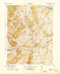
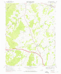
 1943 Upperville1961 Print · USGSNorthern Virginia's Piedmont and Blue Ridge foothills are captured here during the early 1940s. Genealogists can trace family footprints at Upperville, Delaplane, and Markham, or locate landmarks like Pennys Hill Sch and the SOUTHERN rail line.
 - 1944 Map of Upperville
 1944 Upperville1944 Print · USGSThe Fauquier County countryside during the mid-1940s shows a landscape of prominent ridges and rural crossroads. Genealogists and local historians can trace the paths between Delaplane and Markham, locating landmarks like Fleetwood Roller Mills and the Fennys Hill School.
 - 1944 Map of Berryville
 1944 Berryville1944 Print · USGSThe Virginia and West Virginia borderlands are captured here in the mid-1940s, showing the agricultural valley around Berryville meeting the steep Blue Ridge. Researchers can trace the path of the Appalachian Trail or locate vanished landmarks like Boyds Ferry and the Yellow Schoolhouse.
 - 1948 Map of Baltimore
 1948 Baltimore1948 Print · USGSMaryland and Pennsylvania crossroads are captured in the late 1940s, showing a landscape defined by historic rail lines and major military installations. Genealogists can trace family connections in Gettysburg, Westminster, and near the U.S. Naval Academy in Annapolis.2 unique versions available
 - 1948 Map of Washington
 1948 Washington1948 Print · USGSThe Potomac and Chesapeake regions in the late 1940s reveal a landscape of expanding military reach and deep-rooted Tidewater settlements. Trace old rail corridors like the Richmond Fredericksburg & Potomac RR or locate landmarks like the Wakefield Washington Monument and St. Marys College.2 unique versions available
 - 1954 Map of Baltimore
 1954 Baltimore1954 Print · USGSThe Mid-Atlantic region in the early fifties shows a landscape of growing suburban centers and heavy rail corridors. Trace mid-century transit networks and military landmarks from the Aberdeen Proving Ground to the Gettysburg National Military Park.
 - 1956 Map of Baltimore
 1956 Baltimore1956 Print · USGSMid-century Maryland and Pennsylvania are captured here during a period of massive suburban and military growth across the Chesapeake region. Genealogists and historians can trace the rail corridors of the Baltimore & Ohio RR and locate landmarks like Fort McHenry or the Aberdeen Proving Ground.
 - 1957 Map of Baltimore, 1964 Print
 1957 Baltimore1964 Print · USGSMaryland and Southern Pennsylvania are shown during the mid-century expansion of the Baltimore-Washington corridor. Researchers can trace the extensive rail lines of the Baltimore & Ohio RR and locate sites like Fort Detrick and Gettysburg National Military Park.5 unique versions available
 - 1957 Map of Washington, 1966 Print
 1957 Washington1966 Print · USGSThe mid-Atlantic region during the mid-fifties and early sixties reveals a landscape of growing suburbs and vital military outposts. Researchers can trace historic river towns and shorelines from Alexandria to the Hooper Islands and St Clements Island.5 unique versions available
 - 1961 Map of Washington
 1961 Washington1961 Print · USGSThe mid-Atlantic region in the late fifties is presented in remarkable detail, from the Blue Ridge foothills to the Chesapeake Eastern Shore. Researchers can trace historic river landings and military sites like Mount Vernon, Fort Belvoir, and Point Lookout.2 unique versions available
 - 1961 Map of Baltimore
 1961 Baltimore1961 Print · USGSMaryland and Pennsylvania are captured at a mid-century peak of industrial and military expansion. Genealogists and historians can trace rail corridors like the Western Maryland Ry or locate regional landmarks such as Camp Detrick and Kent Island.
 - 1970 Map of Ashby Gap, 1971 Print
 1970 Ashby Gap1971 Print · USGSThe Blue Ridge high country and the winding Shenandoah River dominate the landscape in the early seventies. Genealogists and historians can locate remote mountain landmarks like Ashby Gap, Mt Weather, and the Providence Chapel cemetery.4 unique versions available
 - 1970 Map of Upperville, 1976 Print
 1970 Upperville1976 Print · USGSNorthern Fauquier County and the Blue Ridge foothills are captured in the early seventies as the region maintained its rural character. Genealogists and historians can trace the locations of old country churches like Pleasant Vale Ch and rail stops at Markham or Delaplane.3 unique versions available
 - 1982 Map of Washington West, 1983 Print
 1982 Washington West1983 Print · USGSThe Virginia and Maryland suburbs were undergoing intense development in the early eighties as the capital region expanded outward. Researchers can trace the footprint of Cold War-era defense sites like Fort Belvoir and Vint Hill Farms Station alongside growing academic centers like George Mason University.
 - 1984 Map of Frederick, 1985 Print
 1984 Frederick1985 Print · USGSMaryland's Piedmont and the Potomac River valley are shown here in the mid-eighties as suburban growth began to meet historic rural landscapes. Genealogists and historians can trace the paths of the Baltimore and Ohio RR or locate the boundaries of Antietam National Battlefield and Fort Detrick.
 - 1986 Map of Washington West
 1986 Washington West1986 Print · USGSNorthern Virginia and the D.C. metro area are captured here in the mid-eighties as suburban growth began to meet rural Fauquier County. Trace the development of the corridor from Alexandria out to Dulles and the preserved lands of Prince William Forest Park.2 unique versions available
 - 1989 Map of Baltimore
 1989 Baltimore1989 Print · USGSThe Mid-Atlantic corridor in the late eighties is captured here, from the Baltimore harbor to the Blue Ridge foothills. Researchers can trace the sprawling footprints of Aberdeen Proving Ground, the historic grounds of Gettysburg National Military Park, and the winding Susquehanna River.
 - 1989 Map of Washington
 1989 Washington1989 Print · USGSThe Potomac River valley and Chesapeake Bay are shown in comprehensive detail during the late 1980s. Genealogists and historians can trace the transition from urban Alexandria to the rural Northern Neck, locating landmarks like Mount Vernon and Stratford Hall.
Showing maps 1-25 of 35
Top cities near Paris
- Winchester historical maps
- Front Royal historical maps
- Purcellville historical maps
- Berryville historical maps
- Shenandoah Farms historical maps
- Shannondale historical maps
See more
Frequently asked questions
- What are the different types of historical maps available for Paris?
- What is the oldest map of Paris?
- Where can I purchase historical maps of Paris for my home or office?
- Where can I download high-res historical maps of Paris?
- Are there historical topographic maps available for Paris?
- Is there historical aerial imagery available for Paris?
- Where are historical maps of Paris sourced from?