2020s Maps of Fluvanna County, Virginia
Explore 12 historic maps of Fluvanna County from the 2020s. These maps offer a rare glimpse into what life looked like during the 2020s — showing old roads, neighborhoods, homes, and landmarks that have changed or disappeared over time.
Whether you're researching your family's past, planning a metal detecting trip, or studying how Fluvanna County's landscape evolved across the 2020s, these high-resolution maps are a powerful tool for exploring the history of this region.
- Focus on a specific era: All maps on this page are from the 2020s, giving you a focused view of this time period.
- See what’s changed: Compare century-old streets, trails, and buildings to today's modern landscape using overlays and satellite layers.
- Research with precision: Use these maps for genealogy, historical research, land use analysis, or educational projects.
- View, download, or print: Maps are fully viewable online in high resolution, and can be downloaded or printed for your own records.
Start exploring Fluvanna County's history through authentic maps from the 2020s. This is your window into the past.
Fluvanna County, VA maps
(12)- 2022 Map of Columbia, 2022 Print
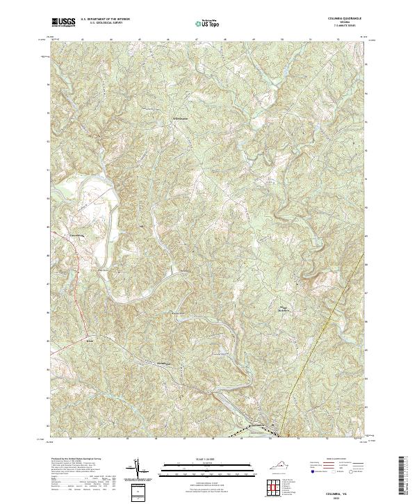 2022 Columbia2022 Print · USGSFluvanna and Goochland counties are shown here as they appeared in the early 2020s, defined by the winding course of the Rivanna River. Genealogists and local historians can trace family-named roads and settlements like Wilmington, Stage Junction, and the historic Point of Fork.
 - 2022 Map of Simeon, 2022 Print
 2022 Simeon2022 Print · USGSAlbemarle County's rolling landscape appears in detail during the early 2020s, centered on the historic crossroads of Simeon. Researchers can trace old family burial sites like Slate Hill Cem and local landmarks along the Thomas Jefferson Pkwy.
 - 2022 Map of Arvonia, 2022 Print
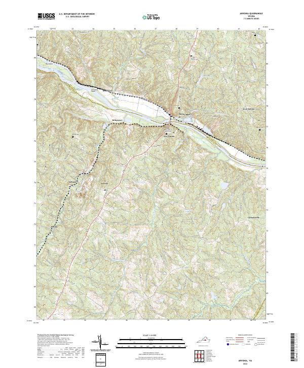 2022 Arvonia2022 Print · USGSThe James River corridor in Buckingham County is shown here in the early 2020s, highlighting the enduring river-and-road connections of the Virginia Piedmont. Researchers can trace family history through sites like Trinity Presbyterian Church Cem, Arvonia, and Bremo Bluff.
 - 2022 Map of Caledonia, 2022 Print
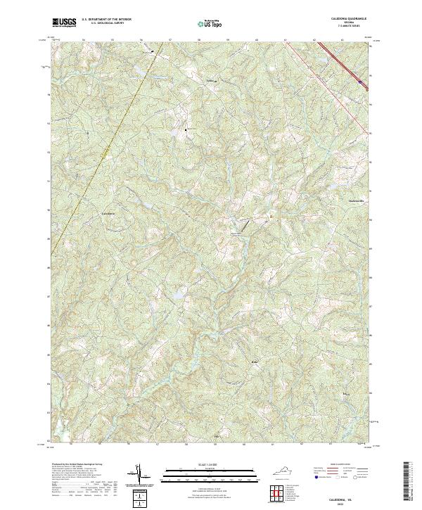 2022 Caledonia2022 Print · USGSGoochland County remains a landscape of quiet crossroads and historic family holdings in the early twenty-first century. Genealogists and local researchers can locate family sites like Bowles Cem or trace the drainage of Little Lickinghole Cr and Johnson Cr.
 - 2022 Map of Palmyra, 2022 Print
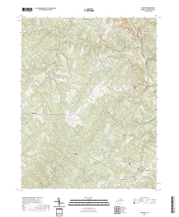 2022 Palmyra2022 Print · USGSFluvanna County's rural heartland and the historic seat of Palmyra are documented in this recent survey. Genealogists and local researchers can trace family landmarks and community centers such as Cohasset, Kidds Store, and the Fluvanna County Courthouse.
 - 2022 Map of Ferncliff, 2022 Print
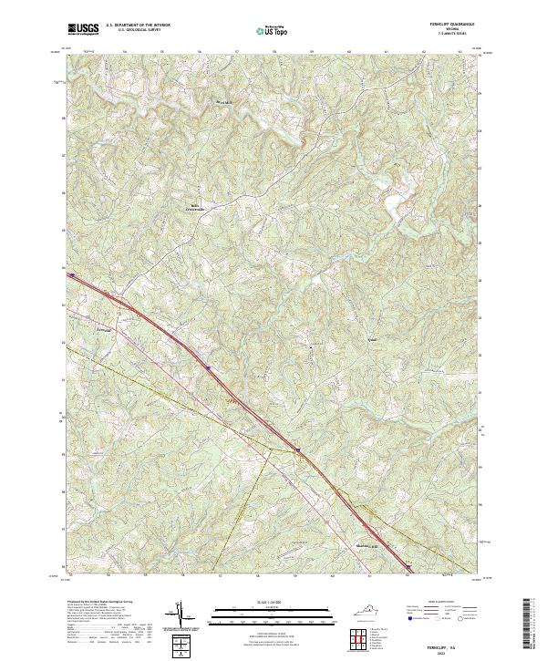 2022 Ferncliff2022 Print · USGSLouisa and Fluvanna counties meet in this 2022 survey, showing a landscape defined by historic crossroads and winding river valleys. Genealogists and historians can locate family landmarks like Grubbs Cem and Byrd Mill or trace the routes through Bells Crossroads and Ferncliff.
 - 2022 Map of Diana Mills, 2022 Print
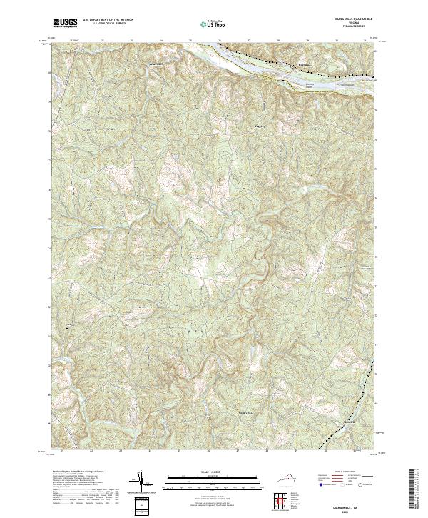 2022 Diana Mills2022 Print · USGSBuckingham and Fluvanna Counties are captured here in the early 2020s, centered on the confluence of the James and Hardware Rivers. Local researchers can trace family landmarks and rural settlements like Paynes Mill, Sunny Side, and the Hale Cem.
 - 2022 Map of Lakeside Village, 2022 Print
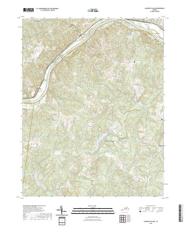 2022 Lakeside Village2022 Print · USGSCentral Virginia’s riverfront comes into focus here during the early twenty-first century, showing the intersection of three counties along the James River. Researchers can locate family landmarks like Cochran Cem and Little Fork Cem near Lakeside Village.
 - 2022 Map of Zion Crossroads, 2022 Print
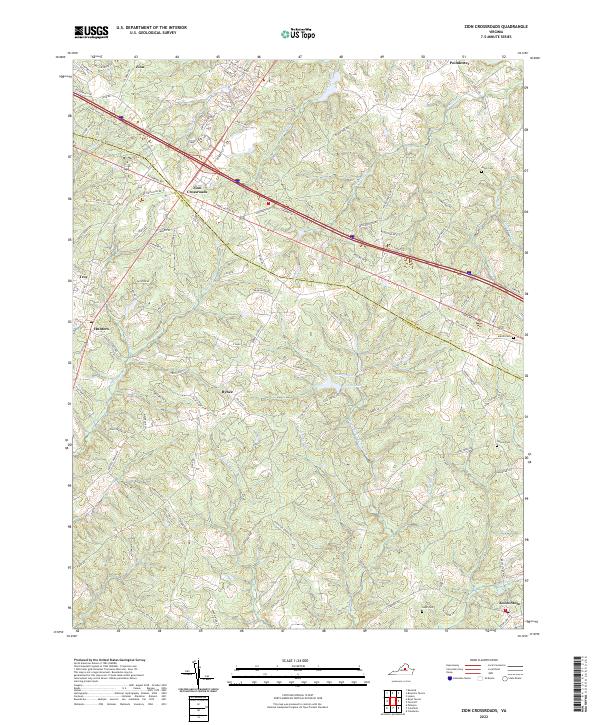 2022 Zion Crossroads2022 Print · USGSCrossing the border of Fluvanna and Louisa counties in the early twenty-first century, this area shows a landscape of growing crossroads and rural pockets. Genealogists can locate family landmarks like Jones Cemetery or trace the historic route of Three Notch Road near Bybee.
 - 2022 Map of Scottsville, 2022 Print
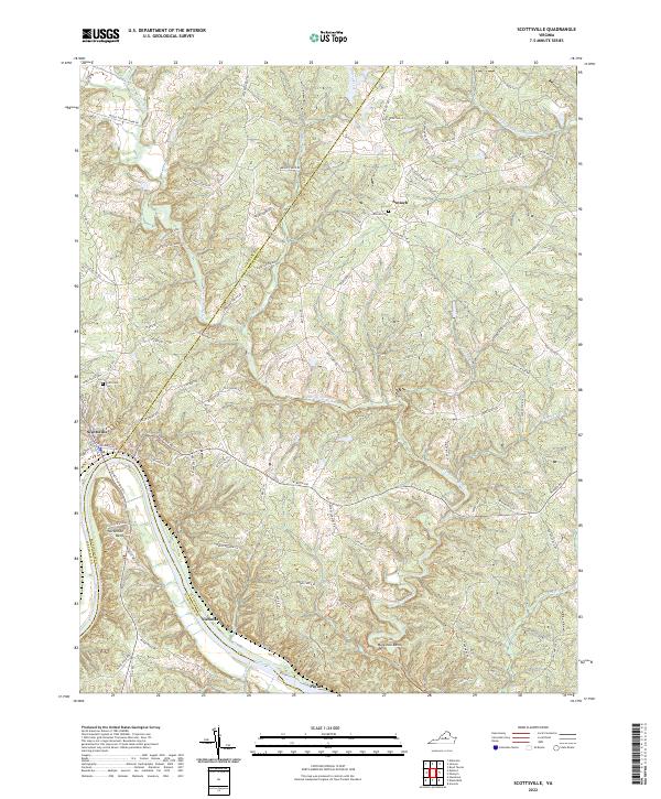 2022 Scottsville2022 Print · USGSThe town of Scottsville and the winding James River highlight this Virginia landscape at the start of the 2020s. Researchers can trace family history at Antioch Cem or follow the paths of the Hardware River and Coles Rolling Rd.
 - 2022 Map of Boyd Tavern, 2022 Print
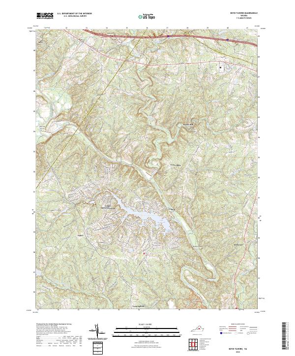 2022 Boyd Tavern2022 Print · USGSFluvanna County's landscape at the start of the 2020s shows a mix of historic mill sites and modern lakeside communities. Researchers can trace the legacy of local industry at Union Mills or explore the many coves of Lake Monticello and the banks of the Rivanna River.
 - 2022 Map of Keswick, 2022 Print
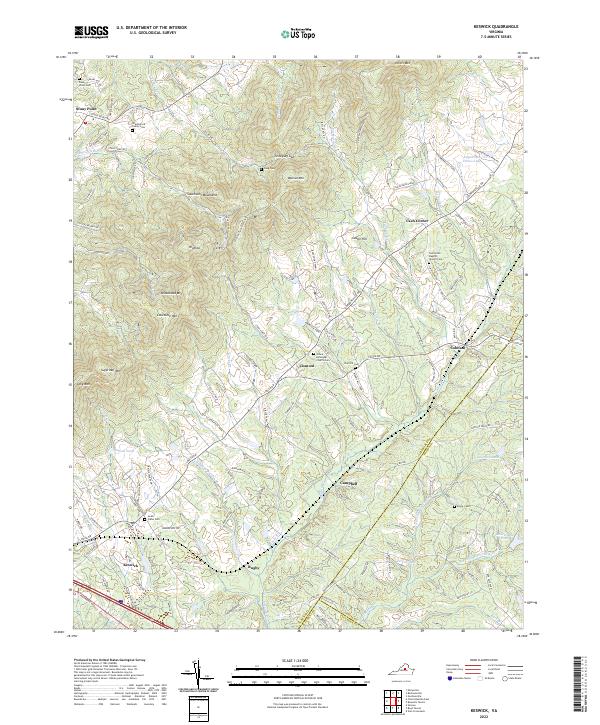 2022 Keswick2022 Print · USGSAlbemarle County's estate country and the ridges of the Southwest Mountains are shown here as they appeared in 2022. Genealogists and researchers can trace historic family lands and congregational sites like Grace Episcopal Church Cem and Castle Hill.
End of results
Showing maps 1-12 of 12
Top cities of Fluvanna County
Frequently asked questions
- What are the different types of historical maps available for Fluvanna County?
- What is the oldest map of Fluvanna County?
- Where can I purchase historical maps of Fluvanna County for my home or office?
- Where can I download high-res historical maps of Fluvanna County?
- Are there historical topographic maps available for Fluvanna County?
- Is there historical aerial imagery available for Fluvanna County?
- Where are historical maps of Fluvanna County sourced from?