Old Maps of Fluvanna County, Virginia for Hiking & Exploration
Hike through history with 48 historic maps of Fluvanna County. Explore old trails, ghost towns, and forgotten backroads — perfect for outdoor adventurers and local explorers.
- Rediscover forgotten places: Map out old mining camps, roads, and footpaths that no longer exist on modern maps.
- Layer with modern tools: Combine with LiDAR or satellite views to plan hikes through historical terrain.
- Made for exploration: Popular among hikers, overlanders, and local history lovers.
Use these maps to find adventure and explore the hidden past of Fluvanna County.
Fluvanna County, VA maps
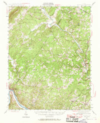
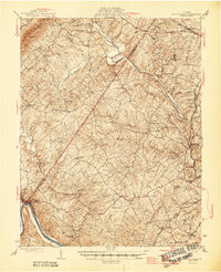
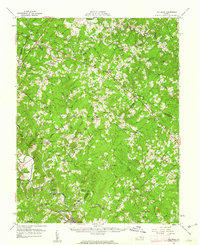
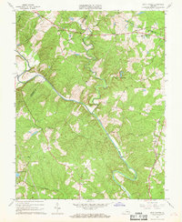
(48)- 1891 Map of Palmyra
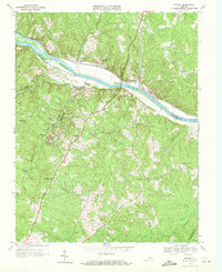
 1891 Palmyra1891 Print · USGSCentral Virginia during the late nineteenth century was a landscape of river-driven industry and railroad expansion along the James. Genealogists and historians can locate old processing sites like Arvonia Slate Quarry, remote outposts like Boyds Tavern, and the track of the Richmond and Alleghany Railroad.
 - 1892 Map of Gordonsville, 1899 Print
 1892 Gordonsville1899 Print · USGSCentral Virginia’s railway hubs and mountain gaps come alive in this late nineteenth-century survey. Genealogists and historians can trace the foundations of Charlottesville and the bustling rail junctions at Gordonsville and Orange.6 unique versions available
 - 1895 Map of Palmyra
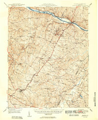
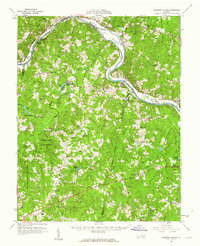
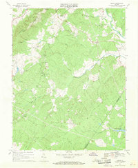
 1895 Palmyra1895 Print · USGSThe James and Rivanna River valleys of central Virginia are captured here in the 1890s, revealing a landscape of rail-connected river towns and rural mills. Researchers can trace the Richmond and Alleghany Railroad and locate landmarks like the Arvon Slate Quarry or Flanagan Mill.
 - 1897 Map of Palmyra
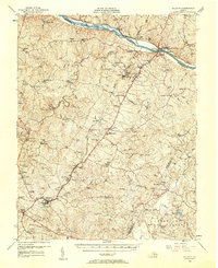
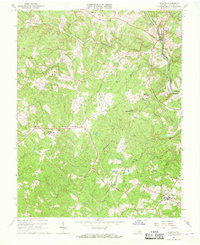
 1897 Palmyra1897 Print · USGSCentral Virginia during the late 1880s is defined by its deep river valleys and the industrial reach of the James and Rivanna. Genealogists and historians can trace the growth of river towns like Scottsville or explore industrial roots at the Slate Quarry and Union Mills.7 unique versions available
 - 1935 Map of Charlottesville
 1935 Charlottesville1935 Print · USGSAlbemarle County's landscape is meticulously detailed in the mid-1930s, centered on the historic crossroads and river forks surrounding the city. Genealogists and local historians can trace family-named landmarks and essential community sites like Monticello, the Rosenwald Sch, and the rail junction at Barboursville.2 unique versions available
 - 1939 Map of Charlottesville
 1939 Charlottesville1939 Print · USGSAlbemarle and Orange Counties come alive in the late 1930s, showing a Piedmont landscape defined by the Southwest Mountains and historic river valleys. Genealogists can locate family landmarks from Monticello to the Rosenwald Sch, alongside dozens of rural churches like Bethany Ch.3 unique versions available
 - 1943 Map of Scottsville, 1969 Print
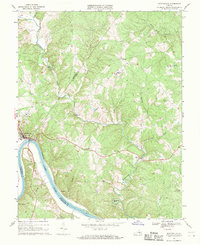
 1943 Scottsville1969 Print · USGSCentral Virginia’s river valleys and historic estates are preserved in this mid-century portrait of the Albemarle and Fluvanna borderlands. Researchers can trace ancestral locations at Ash Lawn, follow the Chesapeake and Ohio line through Nicholas Siding, or locate rural landmarks like Jefferson Mill.
 - 1946 Map of Scottsville
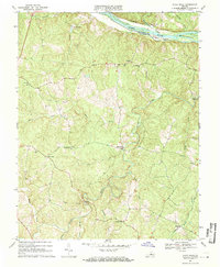
 1946 Scottsville1946 Print · USGSCentral Virginia during the mid-1940s is shown here as a landscape of river-bend towns and quiet country crossroads. Genealogists and historians can trace family locations through named landmarks like Jefferson Mill, Blenheim, and Antioch Ch, or follow the historic Three Chopt Road.2 unique versions available
 - 1947 Map of Roanoke, 1948 Print
 1947 Roanoke1948 Print · USGSCentral Virginia in the late 1940s reveals a region defined by its great mountain ridges and the powerful river-and-rail economy connecting Roanoke to Lynchburg. Researchers can trace the path of the Virginian RR and locate historic county seats like Charlotte Court House.2 unique versions available
 - 1949 Map of Charlottesville
 1949 Charlottesville1949 Print · USGSThe Shenandoah Valley and Blue Ridge appear in the late 1940s as a thriving corridor of rail and river commerce. Researchers can trace the mid-century footprints of Harrisonburg, Staunton, and Culpeper alongside the historic routes of the Southern Railway.2 unique versions available
 - 1949 Map of Charlottesville, 1962 Print
 1949 Charlottesville1962 Print · USGSMid-century Albemarle County is captured here during a period of steady growth, anchored by the expansion of the Charlottesville area and its surrounding ridges. Researchers can locate rural landmarks like Advance Mills, the Albemarle Training Sch, and the historic Spotswood Trail.
 - 1950 Map of Dillwyn
 1950 Dillwyn1950 Print · USGSBuckingham County's mid-century landscape is defined here by the river-and-rail corridor of the James River and the industrial activity near Dillwyn. Genealogists can trace family landmarks like Lower Bremo Mansion, Diana Mills P.O., and the Mourning Valley School.2 unique versions available
 - 1956 Map of Charlottesville, 1966 Print
 1956 Charlottesville1966 Print · USGSThe Shenandoah Valley and Blue Ridge are captured in detail during the mid-1960s as the modern interstate system began to emerge. Genealogists and historians can trace rail-connected hubs like Waynesboro or follow the river paths of the Rapidan River and Rivanna River.4 unique versions available
 - 1958 Map of Dillwyn, 1960 Print
 1958 Dillwyn1960 Print · USGSBuckingham and Fluvanna counties are captured in the late fifties along the industrial and historic James River corridor. Genealogists and historians can trace family roots through numerous country sites like Diana Mills, Mourning Valley Ch Cem, and Woodson High Sch.2 unique versions available
 - 1959 Map of Roanoke
 1959 Roanoke1959 Print · USGSCentral Virginia and the Blue Ridge appear in great detail during the late fifties, showcasing the transition from mountain industry to Piedmont farmland. Trace the path of the Norfolk and Western railroad or find old river towns like Appomattox and Amelia Court House.
 - 1960 Map of Columbia, 1962 Print
 1960 Columbia1962 Print · USGSThe Virginia Piedmont at the start of the sixties reveals a landscape of river-fronting industry and tight-knit crossroads communities. Genealogists and historians can trace family-named landmarks like Yanceys Store, Bells Crossroads, and several rural churches including Beulah Church.2 unique versions available
 - 1960 Map of Lakeside Village, 1962 Print
 1960 Lakeside Village1962 Print · USGSThe James River and the Chesapeake and Ohio railroad shaped the Cumberland and Goochland borderlands during the early 1960s. Genealogists can trace family names and social centers through landmarks like Flippen Millpond, Little Fork Ch, and Muddy Creek Cem.2 unique versions available
 - 1963 Map of Roanoke
 1963 Roanoke1963 Print · USGSCentral Virginia and the Blue Ridge front appear here in the early sixties, caught between their deep railroad roots and new postwar developments. Genealogists and historians can trace the rail lines of the Norfolk and Western through towns like Bedford and Altavista, or locate family landmarks near Smith Mountain Lake.
 - 1964 Map of Keswick, 1965 Print
 1964 Keswick1965 Print · USGSAlbemarle County's rural landscape is captured here in the mid-1960s, defined by the rise of the Southwestern Mountains and the busy Chesapeake and Ohio railroad. Researchers can trace family sites and old roads near Walkers Parish Ch, Cismont, and the Shackelford Cem.5 unique versions available
 - 1967 Map of Palmyra, 1968 Print
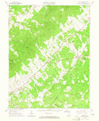
 1967 Palmyra1968 Print · USGSFluvanna County in the late sixties shows a landscape where historic river routes meet the developing inland road network. Genealogists can locate family landmarks such as Fork Union Military Academy, rural congregations like Thessalonian Ch, and old centers like Kidds Store.3 unique versions available
 - 1967 Map of Boyd Tavern, 1968 Print
 1967 Boyd Tavern1968 Print · USGSFluvanna County's rural landscape is captured here in the late sixties as the Rivanna River snakes through a region of old mills and crossroads. Genealogists can trace family footprints near historic sites like Boyd Tavern, Union Mills, and Haden Chapel.4 unique versions available
 - 1967 Map of Simeon, 1969 Print
 1967 Simeon1969 Print · USGSAlbemarle County is shown in the mid-sixties, capturing the rural character of the Piedmont hills before modern suburban expansion. Genealogists and historians can trace the estates at Ash Lawn and Blenheim alongside local landmarks like Middle Oak Ch.2 unique versions available
 - 1967 Map of Scottsville, 1969 Print
 1967 Scottsville1969 Print · USGSThe James River region at the end of the 1960s reveals a landscape defined by sharp river bends and industrial heritage. Genealogists and historians can trace family locations near Scottsville, Jefferson Mill, and rural landmarks like Fox Memorial Ch.2 unique versions available
 - 1967 Map of Diana Mills, 1971 Print
 1967 Diana Mills1971 Print · USGSBuckingham County's riverfront and upland ridges are captured here in the late sixties as the rural landscape remained centered on its old mills and country churches. Genealogists and local historians can locate Diana Mills, Paynes Mill, and Spreading Oak Ch.4 unique versions available
 - 1968 Map of Arvonia, 1971 Print
 1968 Arvonia1971 Print · USGSThe James River corridor in the late sixties reveals a landscape of historic estates and industrial pockets at the crossing of Buckingham and Fluvanna counties. Researchers can trace family roots through Seven Islands Chapel, the Bettie Cem, and the old Quarry works at Arvonia.2 unique versions available
Showing maps 1-25 of 48
Top cities of Fluvanna County
Frequently asked questions
- What are the different types of historical maps available for Fluvanna County?
- What is the oldest map of Fluvanna County?
- Where can I purchase historical maps of Fluvanna County for my home or office?
- Where can I download high-res historical maps of Fluvanna County?
- Are there historical topographic maps available for Fluvanna County?
- Is there historical aerial imagery available for Fluvanna County?
- Where are historical maps of Fluvanna County sourced from?