2020s Maps of Frederick County, Virginia
Explore 15 historic maps of Frederick County from the 2020s. These maps offer a rare glimpse into what life looked like during the 2020s — showing old roads, neighborhoods, homes, and landmarks that have changed or disappeared over time.
Whether you're researching your family's past, planning a metal detecting trip, or studying how Frederick County's landscape evolved across the 2020s, these high-resolution maps are a powerful tool for exploring the history of this region.
- Focus on a specific era: All maps on this page are from the 2020s, giving you a focused view of this time period.
- See what’s changed: Compare century-old streets, trails, and buildings to today's modern landscape using overlays and satellite layers.
- Research with precision: Use these maps for genealogy, historical research, land use analysis, or educational projects.
- View, download, or print: Maps are fully viewable online in high resolution, and can be downloaded or printed for your own records.
Start exploring Frederick County's history through authentic maps from the 2020s. This is your window into the past.
Frederick County, VA maps
(15)- 2022 Map of Hayfield, 2022 Print
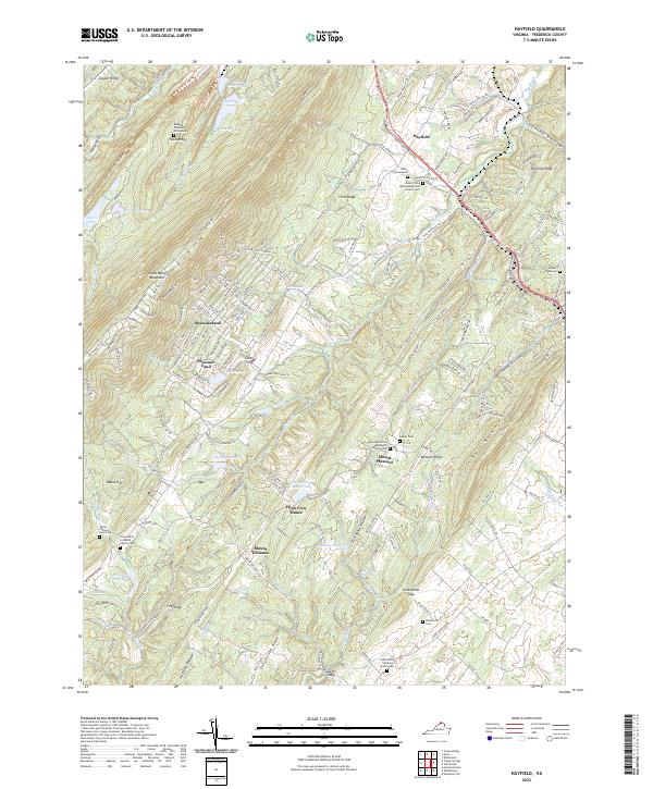 2022 Hayfield2022 Print · USGSFrederick County’s ridge-and-valley terrain is captured here in the early twenty-first century, showing the enduring rural crossroads of Hayfield and Mount Pleasant. Genealogists can trace family footprints through several burial sites including Michael Anderson Graveyard and Harper Graveyard.
 - 2022 Map of Stephens City, 2022 Print
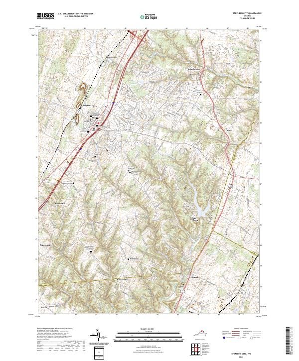 2022 Stephens City2022 Print · USGSStephens City and the surrounding Frederick County countryside are captured here in the early 2020s, showing a landscape defined by deep family roots. Researchers can trace ancestral locations through the Peter Stephens Farm Cem, Ridings Mill, and Vaucluse Spring.
 - 2022 Map of Middletown, 2022 Print
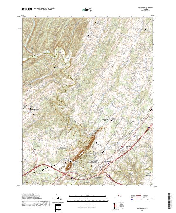 2022 Middletown2022 Print · USGSThe Shenandoah Valley corridor near Middletown and Strasburg is documented here with modern precision, detailing a landscape steeped in early Virginia history. Researchers can trace numerous family burial sites such as the Bowman Graveyard and Windle Cem alongside landmarks like Stephens Fort.
 - 2022 Map of Boyce, 2022 Print
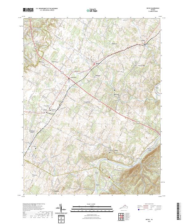 2022 Boyce2022 Print · USGSThe Shenandoah Valley in the early twenty-first century maintains its deep agricultural and equestrian character. Researchers can trace family sites like the Trenary Family Cem or visit historic hubs like White Post and Millwood.
 - 2022 Map of Gore, 2022 Print
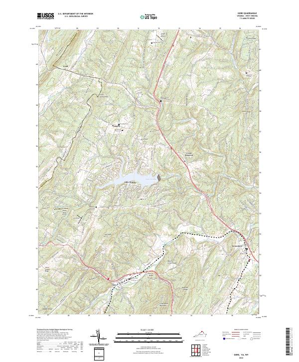 2022 Gore2022 Print · USGSGore and the surrounding Frederick County ridges appear in this recent survey during a period of modern residential growth around Lake Holiday. Genealogists can locate family burial sites including Heironimus Gravesite and Seibert Cemetery, or trace the old paths of Northwestern Pike through Gore.
 - 2022 Map of Winchester, 2022 Print
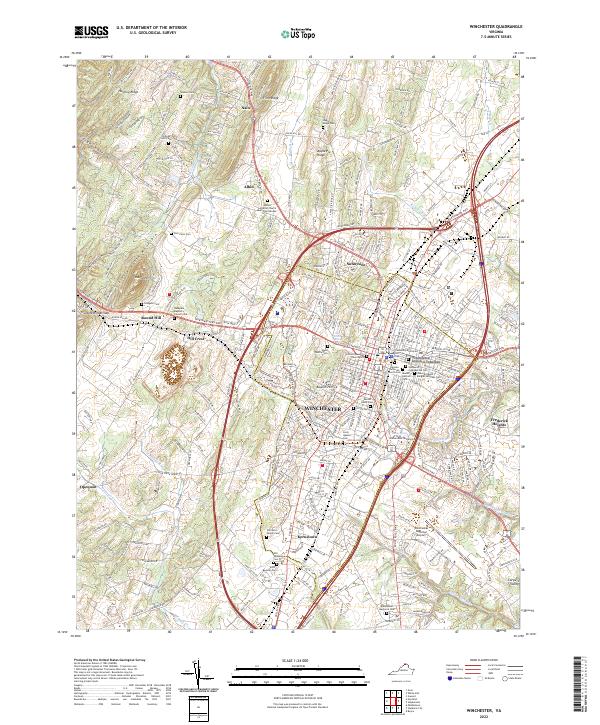 2022 Winchester2022 Print · USGSWinchester and its surrounding valley pikes are shown in this modern survey during a period of sustained growth. Genealogists can trace numerous family and military burial sites, from Mount Hebron Cem to the Old Opequon Cem and Hodgson Cem.
 - 2022 Map of Stephenson, 2022 Print
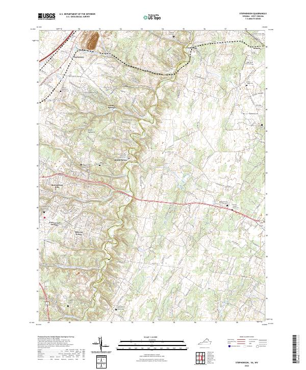 2022 Stephenson2022 Print · USGSThe borderlands of Frederick and Clarke Counties come into focus in this contemporary study of the northern Shenandoah Valley. Genealogists can trace family heritage at Stones Chapel Cemetery and Russell Family Cemetery or locate the old crossroads at Burnt Factory.
 - 2022 Map of White Hall, 2022 Print
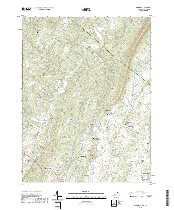 2022 White Hall2022 Print · USGSFrederick County, Virginia, and the West Virginia borderlands are shown here in the early 2020s, showing a landscape defined by ridge-and-valley topography. Genealogists can trace family names through numerous rural burial grounds like Strowbridge Cemetery and Mount Pleasant Cemetery.
 - 2022 Map of Mountain Falls, 2022 Print
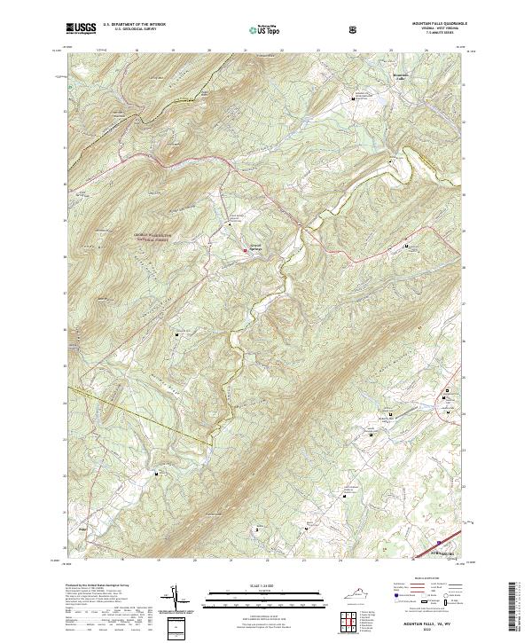 2022 Mountain Falls2022 Print · USGSThe Virginia and West Virginia borderlands are shown here in the early twenty-first century as a landscape of rural settlements and protected forest. Genealogists can trace family footprints across numerous sites like Richards Cem, Gravel Springs, and the Mulberry Run Cem.
 - 2023 Map of Capon Bridge, 2023 Print
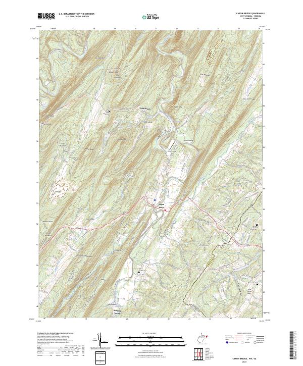 2023 Capon Bridge2023 Print · USGSHampshire County in the twenty-first century remains defined by the winding Cacapon River and the rural community of Capon Bridge. Genealogists and historians can trace local family landmarks through Capon Chapel Cem, Bethel Church Cem, and the high ridges of Dillons Mtn.
 - 2023 Map of Capon Springs, 2023 Print
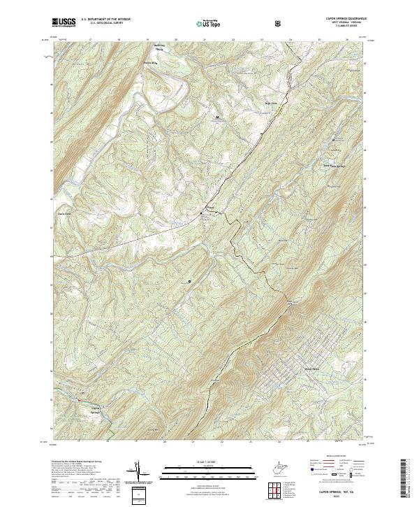 2023 Capon Springs2023 Print · USGSThe West Virginia and Virginia borderlands come into focus in this recent survey of the ridges and valleys between Hooks Mills and Wilde Acres. Researchers can locate family landmarks such as Racey Cem, Shiloh United Methodist Church Cem, and the springs at Capon Springs.
 - 2023 Map of Wardensville, 2023 Print
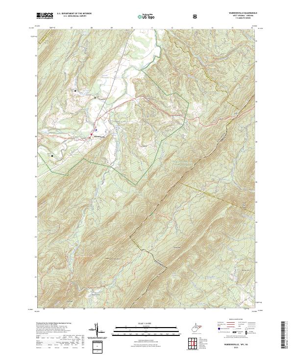 2023 Wardensville2023 Print · USGSWardensville sits at the gateway to the Cacapon Valley in the 2020s, a landscape shaped by river bends and high mountain ridges. Local historians can trace family plots at Clagett Cem and Wilson Cem or locate old holdings like Upper State Farm and Richard Farm.
 - 2023 Map of Glengary, 2023 Print
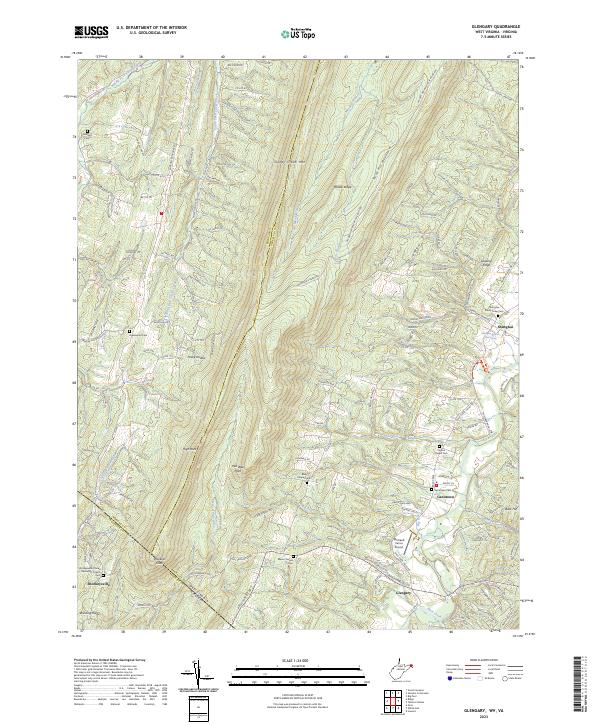 2023 Glengary2023 Print · USGSThe West Virginia and Virginia borderlands are revealed in this modern survey of the ridge-and-valley country. Genealogists and hikers can trace the paths between old settlements like Shanghai and Shockeysville, or locate family sites at Roe Chapel Cem and Ganotown Cem.
 - 2023 Map of Inwood, 2023 Print
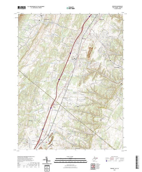 2023 Inwood2023 Print · USGSThe West Virginia and Virginia borderlands come into focus here, showing the evolved settlement patterns of Berkeley and Frederick counties. Researchers can trace family history through numerous specific sites like Gerrardstown Cem, Morgan Chapel Cem, and Hopewell Friends Burial Ground.
 - 2023 Map of Ridge, 2023 Print
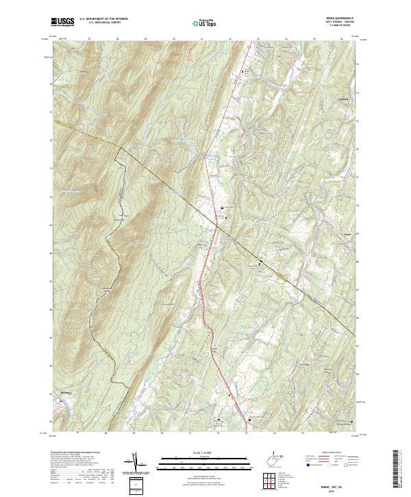 2023 Ridge2023 Print · USGSThe West Virginia and Virginia borderlands come into focus in this recent survey of the ridges and hollows east of Bloomery. Genealogists can locate several remote burial sites and rural congregations, including Union Chapel Cem, Wesley Chapel Cem, and Winding Ridge.
End of results
Showing maps 1-15 of 15
Top cities of Frederick County
- Stephens City historical maps
- Shawneeland historical maps
- Lake Holiday historical maps
- Middletown historical maps
- Brucetown historical maps
- Gore historical maps
Frequently asked questions
- What are the different types of historical maps available for Frederick County?
- What is the oldest map of Frederick County?
- Where can I purchase historical maps of Frederick County for my home or office?
- Where can I download high-res historical maps of Frederick County?
- Are there historical topographic maps available for Frederick County?
- Is there historical aerial imagery available for Frederick County?
- Where are historical maps of Frederick County sourced from?