2020s Maps of Giles County, Virginia
Explore 15 historic maps of Giles County from the 2020s. These maps offer a rare glimpse into what life looked like during the 2020s — showing old roads, neighborhoods, homes, and landmarks that have changed or disappeared over time.
Whether you're researching your family's past, planning a metal detecting trip, or studying how Giles County's landscape evolved across the 2020s, these high-resolution maps are a powerful tool for exploring the history of this region.
- Focus on a specific era: All maps on this page are from the 2020s, giving you a focused view of this time period.
- See what’s changed: Compare century-old streets, trails, and buildings to today's modern landscape using overlays and satellite layers.
- Research with precision: Use these maps for genealogy, historical research, land use analysis, or educational projects.
- View, download, or print: Maps are fully viewable online in high resolution, and can be downloaded or printed for your own records.
Start exploring Giles County's history through authentic maps from the 2020s. This is your window into the past.
Giles County, VA maps
(15)- 2022 Map of Staffordsville, 2022 Print
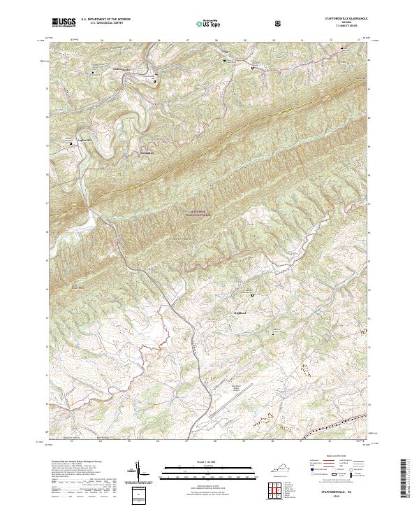 2022 Staffordsville2022 Print · USGSThe ridge-and-valley landscape of the Pulaski and Giles County border comes into focus in this contemporary survey. Genealogists can locate family burial grounds like the Wilson Family Cem and Shannon-King Cem near Staffordsville.
 - 2022 Map of Eggleston, 2022 Print
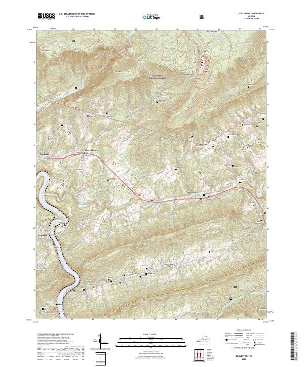 2022 Eggleston2022 Print · USGSGiles and Montgomery Counties are captured here as they appeared in 2022, from the heights of the Jefferson National Forest to the banks of the New River. Genealogists can locate dozens of family-named burial grounds including the George Snidow Cem and Ernest Link Family Cem.
 - 2022 Map of Interior, 2022 Print
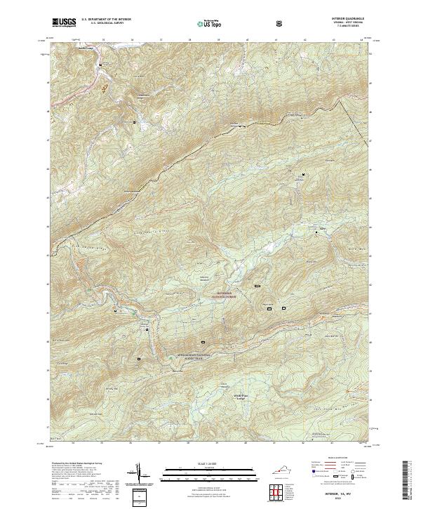 2022 Interior2022 Print · USGSThe West Virginia and Virginia border comes alive in this contemporary topographical view of the Appalachian ridges. Genealogists and hikers can trace the Appalachian National Scenic Trail past several family burial grounds like the Kessinger Family Cem and Harvey Cem.
 - 2022 Map of Radford North, 2022 Print
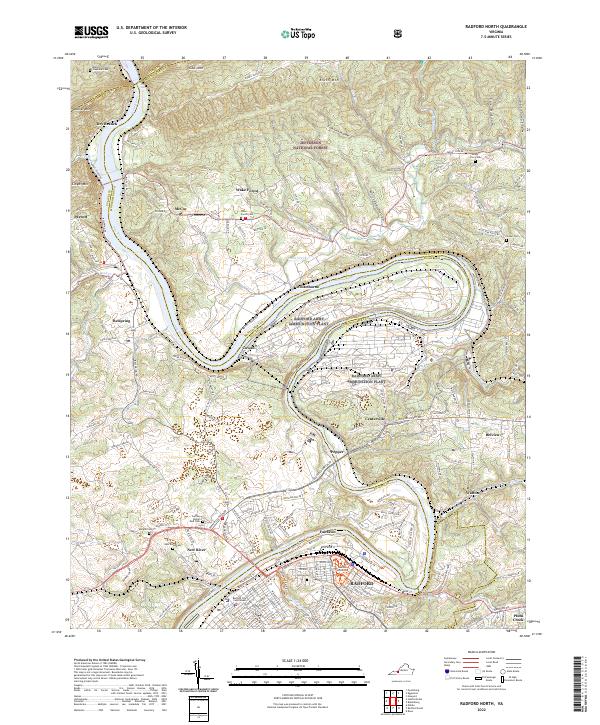 2022 Radford North2022 Print · USGSModern-day Montgomery County and the city of Radford are shown here as the New River winds through the Great Valley. Researchers can locate the Radford Army Ammunition Plant, the Radford University campus, and several historic burial sites like Wake Forest Cem.
 - 2022 Map of Mechanicsburg, 2022 Print
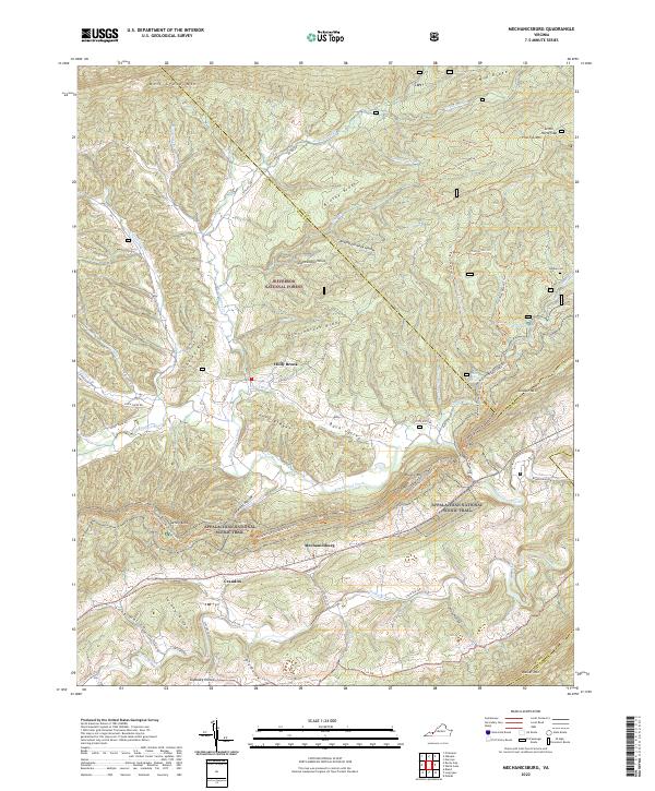 2022 Mechanicsburg2022 Print · USGSBland County's high ridges and fertile valleys are captured here in the modern era, showing the enduring rural character of the Virginia Highlands. Researchers can locate the Warden Cem, trace the Appalachian National Scenic Trail over Jenny Knob, and explore old settlements like Mechanicsburg and Holly Brook.
 - 2022 Map of Narrows, 2022 Print
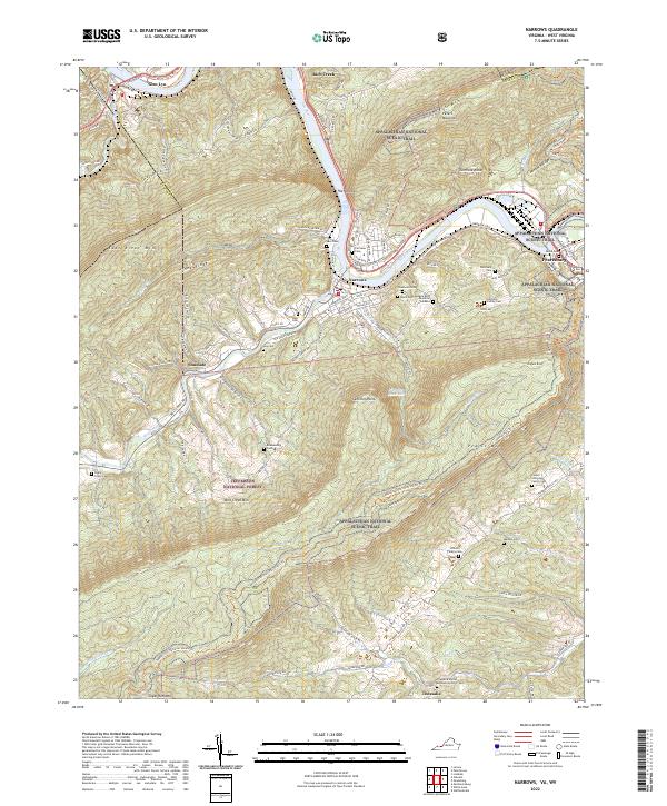 2022 Narrows2022 Print · USGSGiles County, Virginia, is shown in the early 2020s as the New River cuts between massive ridgelines. Genealogists and hikers can trace the Appalachian National Scenic Trail past remote family plots like Woolwine Cem and Fletcher's Cem.
 - 2022 Map of White Gate, 2022 Print
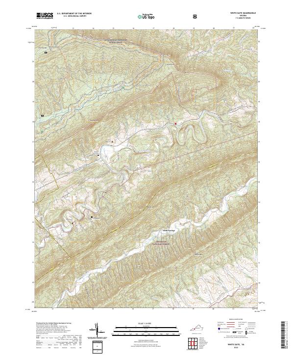 2022 White Gate2022 Print · USGSThe ridges and valleys of Giles and Pulaski counties are captured here in the early twenty-first century. Genealogists can trace family landmarks like Jacob Stinson Cem and First Bane Cem along the Walker Creek drainage.
 - 2022 Map of Pearisburg, 2022 Print
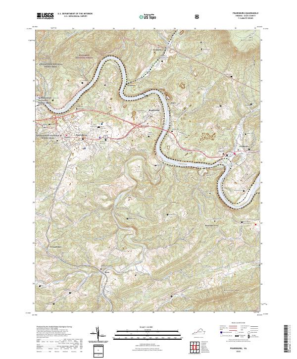 2022 Pearisburg2022 Print · USGSThe New River valley and the ridges of the Jefferson National Forest define this part of Giles County in the 2020s. Genealogists can trace dozens of family sites, including the Martin Family Cemetery, Stafford Cemetery, and Giles County Courthouse.
 - 2022 Map of Newport, 2022 Print
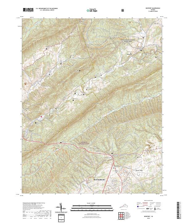 2022 Newport2022 Print · USGSThe northern reaches of the Blacksburg area appear here in the early twenty-first century, spanning the ridgelines of the Jefferson National Forest. Researchers can trace dozens of family burial sites like Shrader Family Cem and the small settlements of Newport and Huffman.
 - 2023 Map of Lerona, 2023 Print
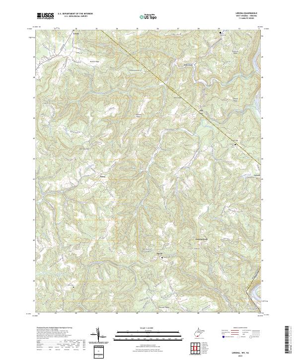 2023 Lerona2023 Print · USGSThe West Virginia uplands of Mercer County come alive in this detailed look at rural settlements like Lerona and Elgood. Researchers can trace family history through sites like White Cem and Browns Chapel Cem while orienting by landmarks like Bent Mountain.
 - 2023 Map of Lindside, 2023 Print
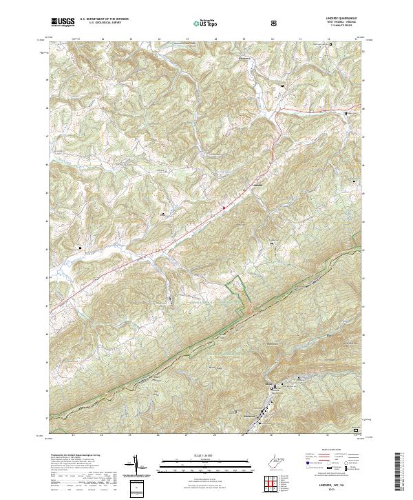 2023 Lindside2023 Print · USGSMonroe County, West Virginia, and the Virginia borderlands are shown here in this recent survey of the Peters Mountain gap. Genealogists can locate family burial sites like Broyles Cem and Olean Brethren Cem or trace the early industrial footprint of Wilsons Mill.
 - 2023 Map of Peterstown, 2023 Print
 2023 Peterstown2023 Print · USGSThe West Virginia-Virginia borderlands near Peterstown are mapped here in the early twenty-first century, showing the enduring rural character of the New River valley. Genealogists can trace family heritage through sites like Shumate Cem and Shanklins Ferry.
 - 2023 Map of Oakvale, 2023 Print
 2023 Oakvale2023 Print · USGSThe East River valley at the West Virginia-Virginia border shows a landscape where mountain ridges dictate the flow of travel and settlement. Genealogists can trace family names through the Millirons Family Cem, First Ford, and the old rail-side community of Oakvale.
 - 2023 Map of Waiteville, 2023 Print
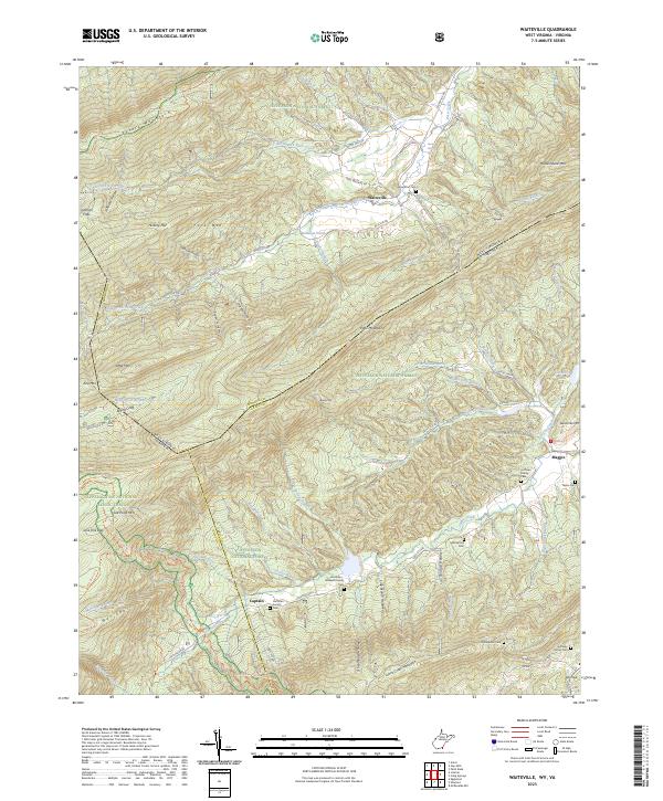 2023 Waiteville2023 Print · USGSThe Monroe County highlands are captured here during the 2020s, showing a landscape defined by the Jefferson National Forest and the Appalachian Trail. Family historians can locate several burial grounds, such as New Zion Cem, Bell Family Cem, and the settlement of Waiteville.
 - 2023 Map of Princeton, 2023 Print
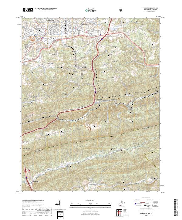 2023 Princeton2023 Print · USGSModern Princeton and the West Virginia-Virginia borderlands are documented here at a moment when urban growth meets the protected slopes of East River Mtn. Genealogists and local historians can trace family locations through numerous sites like Shumate Cem, Stumpy Bottom, and the Mercer County Courthouse.
End of results
Showing maps 1-15 of 15
Top cities of Giles County
- Pearisburg historical maps
- Narrows historical maps
- Pembroke historical maps
- Rich Creek historical maps
- Ripplemead historical maps
- Glen Lyn historical maps
See more
Frequently asked questions
- What are the different types of historical maps available for Giles County?
- What is the oldest map of Giles County?
- Where can I purchase historical maps of Giles County for my home or office?
- Where can I download high-res historical maps of Giles County?
- Are there historical topographic maps available for Giles County?
- Is there historical aerial imagery available for Giles County?
- Where are historical maps of Giles County sourced from?