Old Maps of Gloucester County, Virginia for Academic Research
Study the evolution of Gloucester County with 116 high-resolution historic maps. Whether you're teaching, researching, or modeling changes in land use, these maps provide essential visual documentation of urban, environmental, and geographic change.
- Analyze long-term change: Track patterns in development, transportation, and natural features.
- Ideal for environmental or urban studies: Support academic projects with primary historical map data.
- Use in the classroom or lab: Educators and researchers rely on these maps to bring historical context to life.
These maps are a powerful tool for teaching, research, and visualizing how Gloucester County has changed over the decades.
Gloucester County, VA maps
(116)- 1906 Map of Williamsburg
 1906 Williamsburg1906 Print · USGSCoastal Virginia at the turn of the century reveals a landscape of river steamboats and early rail lines near the York River. Researchers can trace historic church sites like Abingdon Church, colonial-era Powhatans House Ruins, and the infrastructure of Bigler Mill.6 unique versions available
 - 1907 Map of Yorktown
 1907 Yorktown1907 Print · USGSThe Virginia Peninsula and the banks of the James River are shown here at the turn of the century, revealing a landscape defined by colonial roots and Civil War defenses. Genealogists can trace early twentieth-century life at Denbigh P O, Bacons Castle, and the National Cem.6 unique versions available
 - 1907 Map of Hampton, 1916 Print
 1907 Hampton1916 Print · USGSThe Virginia Peninsula is mapped here in the early twentieth century, showing a coastal landscape shaped by its military and maritime heritage. Genealogists can trace family lines in settlements like Poquoson, Dare, and Phoebus, or locate records at the National Soldiers Home and Hampton Normal School.6 unique versions available
 - 1916 Map of Kilmarnock
 1916 Kilmarnock1916 Print · USGSBefore the era of modern bridges, this coastal Virginia region relied on a busy steamboat route network connecting the Northern Neck and Middle Peninsula. Genealogists can locate family landmarks like Wharton Grove Camp, White Chapel Church, and numerous landings including Morattico Wharf.2 unique versions available
 - 1916 Map of Mathews, 1965 Print
 1916 Mathews1965 Print · USGSThe Virginia Middle Peninsula during the mid-1910s reveals a maritime landscape where travel centered on the water. Genealogists can trace family roots through numerous local landmarks like Lee-Jackson School, Trinity Church, and the remains of Fort Nonsense.
 - 1917 Map of Urbanna
 1917 Urbanna1917 Print · USGSMiddlesex and Lancaster Counties come alive in this survey of the Virginia Tidewater during the Great War era. Researchers can trace ancestral roots through dozens of local landmarks like Christ Church, Healys Mill, and Royal Oak School.3 unique versions available
 - 1917 Map of Kilmarnock
 1917 Kilmarnock1917 Print · USGSThe Northern Neck and Middle Peninsula of Virginia are shown during the height of the steamboat era. Genealogists can locate family-named landmarks and essential community hubs like the Old Brick Church, Harmony Village, and Kilmarnock Wharf.4 unique versions available
 - 1917 Map of Mathews
 1917 Mathews1917 Print · USGSThe Virginia Tidewater is captured here during the First World War, showing a coastal world reliant on the Mobjack Bay and the York River. Researchers can trace old steamboat routes and locate vanished community landmarks like Fort Nonsense (Ruins) and the Lee-Jackson School.7 unique versions available
 - 1942 Map of Kilmarnock
 1942 Kilmarnock1942 Print · USGSThe Virginia Tidewater in the early 1940s was a world of steamboat routes and bustling river landings. Trace the maritime history of the Northern Neck through Whitestone Wharf, the Shipleys Ferry crossing, and the grounds of Christ Church.
 - 1943 Map of Yorktown
 1943 Yorktown1943 Print · USGSThe Virginia Tidewater is captured here during the Second World War, showing the strategic riverfronts of the James and Warwick rivers. Researchers can locate colonial landmarks and defensive ruins like Old Fort Yorktown, Bacons Castle, and Warwick Courthouse.
 - 1943 Map of Richmond, 1972 Print
 1943 Richmond1972 Print · USGSCoastal Virginia and the state capital are shown in detail during the mid-century era of infrastructure expansion. Genealogists and historians can trace the grounds of Richmond Nat Battlefield Park, locate the Yorktown Nat Cem, or follow the many rural routes through Amelia Court House and Tappahannock.
 - 1944 Map of Yorktown
 1944 Yorktown1944 Print · USGSVirginia's historic Peninsula is captured here during the height of the 1940s mobilization, showing the massive infrastructure of wartime military installations. Researchers can trace the grounds of Fort Eustis and Camp Patrick Henry alongside older landmarks like Old Fort McPherson and Lee Mansion.
 - 1944 Map of Harris Grove, 1953 Print
 1944 Harris Grove1953 Print · USGSCoastal York County and the Poquoson area are captured here during the height of the Second World War. You can trace military boundaries at Camp Patrick Henry or find family landmarks like Tabb Ch and Cem, St Michaels Ch, and the Poor Farm.
 - 1948 Map of Ware Neck
 1948 Ware Neck1948 Print · USGSThe Gloucester and Mathews County shorelines are caught in a moment of post-war transition, where the river remained the primary highway. Genealogists and historians can trace family locations near Dixondale, Auburn Wharf, and the historical site of Fort Nonsense.
 - 1948 Map of Achilles
 1948 Achilles1948 Print · USGSCoastal Gloucester County is depicted here in the late 1940s, a period defined by the tidewater economy and maritime navigation. Genealogists and historians can trace family locations near Achilles, Naxera, and Maryus, or locate landmarks like Severn Ch and Roanes Wharf.2 unique versions available
 - 1948 Map of New Point Comfort
 1948 New Point Comfort1948 Print · USGSCoastal Mathews County during the late 1940s reveals a maritime landscape of tidal necks and small harbor settlements. Genealogists and researchers can trace local families through landmarks like Diggs Wharf, Antioch Sch, and the New Point Comfort lighthouse.2 unique versions available
 - 1949 Map of Saluda
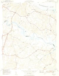 1949 Saluda1949 Print · USGSCoastal Middlesex and Gloucester counties are captured here in the late 1940s, situated between the Rappahannock and Piankatank rivers. Genealogists and local historians can locate early homesteads near Saluda, the historic Christ Church (PO), and landmarks like Burhans Wharf or the Air Field at Harcum.2 unique versions available
 - 1949 Map of Shacklefords
 1949 Shacklefords1949 Print · USGSMid-century King and Queen County comes alive in this survey of the Virginia Middle Peninsula, where the Tidewater Trail connects small rural crossroads. Genealogists can locate family-named settlements like Bakers and community hubs such as Hockley PO and Snow Hill Sch.2 unique versions available
 - 1949 Map of Wilton
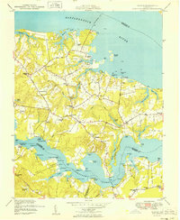 1949 Wilton1949 Print · USGSCoastal Middlesex County comes alive in this post-war survey of the peninsulas between the Rappahannock and Piankatank rivers. Genealogists and historians can trace old landings and community hubs like Blands Wharf, Old Brick Ch, and Harmony Village.
 - 1949 Map of Richmond, 1951 Print
 1949 Richmond1951 Print · USGSCoastal Virginia in the years following World War II remained a landscape of historic river towns and expanding military bases. Genealogists and historians can trace the rail lines of the Southern Ry and locate established landmarks from Camp Lee to the remote reaches of Dragon Swamp.
 - 1950 Map of Yorktown, 1954 Print
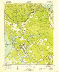 1950 Yorktown1954 Print · USGSThe Virginia Peninsula at the midpoint of the century reveals a landscape where Revolutionary War history meets massive military expansion. Genealogists and historians can trace the footprint of Yorktown alongside mid-century landmarks like the National Cem, Lee Mansion, and the Patrick Henry Airport.
 - 1951 Map of Williamsburg
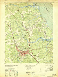 1951 Williamsburg1951 Print · USGSMid-century Williamsburg and York County reflect a landscape of deep colonial history overlaid by World War II-era military expansion. Researchers can trace the grounds of William and Mary College and the Governors Palace alongside major naval installations like Camp Peary and the Cheatham Annex.
 - 1952 Map of Clay Bank, 1956 Print
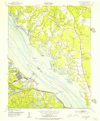 1952 Clay Bank1956 Print · USGSThe York River shoreline in the early fifties shows a fascinating mix of federal defense installations and colonial Virginia heritage. Trace the grounds of Camp Peary and the Yorktown Naval Mine Depot or locate the Powhatan House Ruins.
 - 1952 Map of Gloucester, 1957 Print
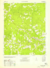 1952 Gloucester1957 Print · USGSCoastal Virginia in the early fifties reveals a landscape of tidal creeks and family crossroads. Trace genealogy through historic landmarks like the Birthplace of Dr Walter Reed, Zion Poplar Church, and the Gloucester County Training School.
 - 1952 Map of Williamsburg, 1957 Print
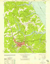 1952 Williamsburg1957 Print · USGSThe Virginia Peninsula is captured here in the early fifties during a period of heavy military and institutional expansion. Researchers can trace the grounds of William and Mary College, find the Fort Magruder Ruins, and locate forgotten landings like Blaine Landing.
Showing maps 1-25 of 116
Top cities of Gloucester County
Frequently asked questions
- What are the different types of historical maps available for Gloucester County?
- What is the oldest map of Gloucester County?
- Where can I purchase historical maps of Gloucester County for my home or office?
- Where can I download high-res historical maps of Gloucester County?
- Are there historical topographic maps available for Gloucester County?
- Is there historical aerial imagery available for Gloucester County?
- Where are historical maps of Gloucester County sourced from?