1950s Maps of Wan, Virginia
Explore 3 historic maps of Wan from the 1950s. These maps offer a rare glimpse into what life looked like during the 1950s — showing old roads, neighborhoods, homes, and landmarks that have changed or disappeared over time.
Whether you're researching your family's past, planning a metal detecting trip, or studying how Wan's landscape evolved across the 1950s, these high-resolution maps are a powerful tool for exploring the history of this region.
- Focus on a specific era: All maps on this page are from the 1950s, giving you a focused view of this time period.
- See what’s changed: Compare century-old streets, trails, and buildings to today's modern landscape using overlays and satellite layers.
- Research with precision: Use these maps for genealogy, historical research, land use analysis, or educational projects.
- View, download, or print: Maps are fully viewable online in high resolution, and can be downloaded or printed for your own records.
Start exploring Wan's history through authentic maps from the 1950s. This is your window into the past.
Wan, VA maps
(3)- 1952 Map of Gloucester, 1957 Print
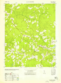 1952 Gloucester1957 Print · USGSCoastal Virginia in the early fifties reveals a landscape of tidal creeks and family crossroads. Trace genealogy through historic landmarks like the Birthplace of Dr Walter Reed, Zion Poplar Church, and the Gloucester County Training School.
 - 1953 Map of Gloucester
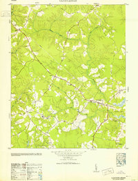 1953 Gloucester1953 Print · USGSGloucester County during the early fifties reveals a landscape of Tidewater settlements and vast wetlands. Genealogists and local historians can trace the locations of the Gloucester County Training School, the Bellamy Memorial Cem, and the rural crossroads at Sassafras.
 - 1959 Map of Richmond
 1959 Richmond1959 Print · USGSMid-century Virginia is captured here at its most vital rail and river junctions, from the capital city to the Chesapeake Bay. Genealogists and historians can trace the development of colonial settlements like Williamsburg and military landmarks including Fort Monroe and Camp Lee.
End of results
Showing maps 1-3 of 3
Top cities near Wan
- Williamsburg historical maps
- Gloucester Point historical maps
- Gloucester historical maps
- Deltaville historical maps
- Saluda historical maps
- Hudgins historical maps
See more
Frequently asked questions
- What are the different types of historical maps available for Wan?
- What is the oldest map of Wan?
- Where can I purchase historical maps of Wan for my home or office?
- Where can I download high-res historical maps of Wan?
- Are there historical topographic maps available for Wan?
- Is there historical aerial imagery available for Wan?
- Where are historical maps of Wan sourced from?