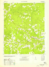
1952 Map of Gloucester
USGS Topo · Published 1957About this map
The Birthplace of Dr Walter Reed at Belroi anchors the southern portion of this mid-century coastal plain survey, situated just west of the George Washington Memorial Highway. The landscape is defined by the winding reaches of Beaverdam Swamp and Woods Swamp, which divide the higher agricultural ground and small rural settlements. In the center, the village of Gloucester serves as a hub of civic life, featuring Botetourt High School and the Church of the Little Flower. To the south, the Gloucester County Training School near Short Lane reflects the educational infrastructure of the early 1950s. The map also captures significant cultural and religious landmarks, including the Bellamy Memorial Museum, Zion Poplar Church, and the colonial-era Ware Church near Wan, illustrating the deep historical layers of this Tidewater community.
Find a feature on this map
44 named features on this map. Tap any name to fly to it.
Don’t see what you’re looking for? This feature index may not catch every label — zoom into the map to look around manually.
Map Details
Editions of this 1952 Gloucester Map
This is the sole edition of this map. No revisions or reprints were ever made.
Other maps of this area

1906 · Williamsburg
USGS Topo · 1:62,500

1916 · Kilmarnock
USGS Topo · 1:48,000

1916 · Mathews
USGS Topo · 1:62,500

1917 · Urbanna
USGS Topo · 1:62,500

1917 · Kilmarnock
USGS Topo · 1:62,500

1917 · Mathews
USGS Topo · 1:62,500

1942 · Kilmarnock
USGS Topo · 1:62,500

1943 · Richmond
USGS Topo · 1:250,000

1948 · Ware Neck
USGS Topo · 1:24,000

1948 · Achilles
USGS Topo · 1:24,000