Loading...
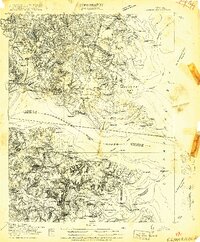
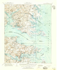
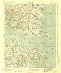
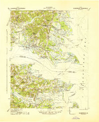
Loading map...1916 Map of Kilmarnock
USGS Topo · Published 1916About this map
Steamboat routes crisscross the Chesapeake Bay and the wide mouths of the Rappahannock River and Piankatank River, illustrating the maritime dependency of Virginia's Northern Neck and Middle Peninsula in the early twentieth century. This survey, conducted in cooperation with the War Department, highlights a coastline defined by intricate inlets like Antipoison Creek and Tabbs Creek, where landings such as Ottomans Wharf and North End Wharf served as vital links for local commerce.
Find a feature on this map
71 named features on this map. Tap any name to fly to it.
Don’t see what you’re looking for? This feature index may not catch every label — zoom into the map to look around manually.
Map Details
Date Portrayed1916
Date Published1916
PublisherU.S. Geological Survey
Map TypeTopographic
Scale1:48,000
Physical Dimensions21.85 x 26.41 inches
Editions of this 1916 Kilmarnock Map
2 editions found
Historical Maps of Kilmarnock Through Time
3 maps found
Featured Locations
Source Details
SourceU.S. Geological Survey
CopyrightPublic Domain