Old Maps of Fletcher, Virginia for Metal Detecting
Plan your next treasure hunt with 14 historic maps of Fletcher. Find old homesites, ghost towns, trails, and gathering spots that may be lost to time — perfect for identifying promising metal detecting locations.
- Locate forgotten sites: Uncover places like long-lost settlements, abandoned rail lines, or gathering spots.
- Plan better hunts: Use map overlays combined with LiDAR or satellite views to narrow in on historically rich areas.
- Made for detectorists: Thousands of hobbyists use these maps to discover relics, coins, and hidden history.
Use these historic maps to boost your research and find new opportunities beneath the surface of Fletcher.
Fletcher, VA maps
(14)- 1892 Map of Gordonsville, 1899 Print
 1892 Gordonsville1899 Print · USGSCentral Virginia’s railway hubs and mountain gaps come alive in this late nineteenth-century survey. Genealogists and historians can trace the foundations of Charlottesville and the bustling rail junctions at Gordonsville and Orange.6 unique versions available
 - 1930 Map of Madison
 1930 Madison1930 Print · USGSThe Blue Ridge foothills of Madison and Greene counties are captured here just as Shenandoah National Park was being established. Researchers can trace the early mountain communities around Graves Mill, Criglersville, and the remote Upper Pocosin Mission.3 unique versions available
 - 1933 Map of Madison
 1933 Madison1933 Print · USGSThe Virginia Piedmont meets the Blue Ridge in the early thirties, just as the national park is taking shape. Genealogists can trace family names across Eppards Mill, The Presidents Camp, and remote schools like the Upper Pocosin Mission.3 unique versions available
 - 1949 Map of Charlottesville
 1949 Charlottesville1949 Print · USGSThe Shenandoah Valley and Blue Ridge appear in the late 1940s as a thriving corridor of rail and river commerce. Researchers can trace the mid-century footprints of Harrisonburg, Staunton, and Culpeper alongside the historic routes of the Southern Railway.2 unique versions available
 - 1956 Map of Charlottesville, 1966 Print
 1956 Charlottesville1966 Print · USGSThe Shenandoah Valley and Blue Ridge are captured in detail during the mid-1960s as the modern interstate system began to emerge. Genealogists and historians can trace rail-connected hubs like Waynesboro or follow the river paths of the Rapidan River and Rivanna River.4 unique versions available
 - 1965 Map of Fletcher, 1967 Print
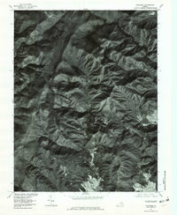
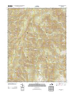
 1965 Fletcher1967 Print · USGSMadison and Greene Counties are shown in the mid-sixties as the mountain communities of the Blue Ridge foothills intersected with the developing Shenandoah National Park. Researchers can locate family landmarks like the Fletcher Cem, Shiloh Ch, and the presidential retreat at Rapidan Camp.4 unique versions available
 - 1977 Map of Fletcher, 1981 Print
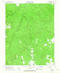
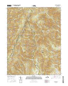
 1977 Fletcher1981 Print · USGSThe high mountain country near the Madison and Greene county line comes into focus in the late 1970s. Trace the remote settlement at Fletcher, the heights of Bearfence Mountain, and the winding route of Skyline Drive.
 - 1986 Map of Charlottesville
 1986 Charlottesville1986 Print · USGSCentral Virginia in the mid-eighties shows a landscape balanced between the growing city centers of the Piedmont and the protected ridges of the Blue Ridge. Trace the historic rail lines of the Chesapeake and Ohio Railway or locate local landmarks like Monticello Mountain and Bridgewater College.3 unique versions available
 - 1999 Map of Fletcher, 2000 Print
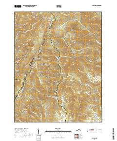
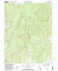 1999 Fletcher2000 Print · USGSThe Blue Ridge highlands meet the rural settlements of Madison County in the late 1990s as the wilderness of Shenandoah transitions to mountain valleys. Genealogists and hikers can trace the Appalachian Trail past historic sites like Fletcher, Shiloh Ch, and the Lower Pocosin Mission.
 - 2010 Map of Fletcher, 2010 Print
 2010 Fletcher2010 Print · USGSCovers Fletcher, including Upper Pocosin, Rockingham County, and other nearby areas
 - 2013 Map of Fletcher, 2013 Print
 2013 Fletcher2013 Print · USGSCovers Fletcher, including Upper Pocosin, Rockingham County, and other nearby areas
 - 2016 Map of Fletcher, 2016 Print
 2016 Fletcher2016 Print · USGSCovers Fletcher, including Upper Pocosin, Rockingham County, and other nearby areas
 - 2019 Map of Fletcher, 2019 Print
 2019 Fletcher2019 Print · USGSCovers Fletcher, including Upper Pocosin, Rockingham County, and other nearby areas
 - 2022 Map of Fletcher, 2022 Print
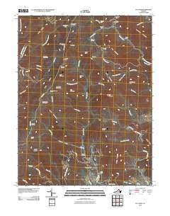
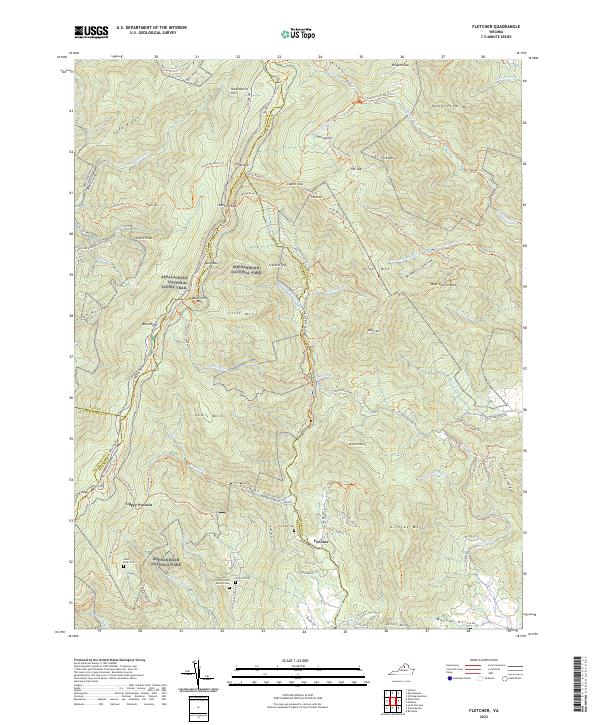 2022 Fletcher2022 Print · USGSThe high peaks and deep hollows of the Blue Ridge are documented here in the early twenty-first century. Genealogists and hikers can trace remote landmarks like Lower Pocosin Mission Cem, Bear Church Rock, and the settlement of Fletcher.
End of results
Showing maps 1-14 of 14
Top cities near Fletcher
- Elkton historical maps
- Shenandoah historical maps
- Twin Lakes historical maps
- Ruckersville historical maps
- Stanley historical maps
- Brightwood historical maps
See more
Frequently asked questions
- What are the different types of historical maps available for Fletcher?
- What is the oldest map of Fletcher?
- Where can I purchase historical maps of Fletcher for my home or office?
- Where can I download high-res historical maps of Fletcher?
- Are there historical topographic maps available for Fletcher?
- Is there historical aerial imagery available for Fletcher?
- Where are historical maps of Fletcher sourced from?