1940s Maps of Hampton, Virginia
Explore 7 historic maps of Hampton from the 1940s. These maps offer a rare glimpse into what life looked like during the 1940s — showing old roads, neighborhoods, homes, and landmarks that have changed or disappeared over time.
Whether you're researching your family's past, planning a metal detecting trip, or studying how Hampton's landscape evolved across the 1940s, these high-resolution maps are a powerful tool for exploring the history of this region.
- Focus on a specific era: All maps on this page are from the 1940s, giving you a focused view of this time period.
- See what’s changed: Compare century-old streets, trails, and buildings to today's modern landscape using overlays and satellite layers.
- Research with precision: Use these maps for genealogy, historical research, land use analysis, or educational projects.
- View, download, or print: Maps are fully viewable online in high resolution, and can be downloaded or printed for your own records.
Start exploring Hampton's history through authentic maps from the 1940s. This is your window into the past.
Hampton, VA maps
(7)- 1943 Map of Richmond, 1972 Print
 1943 Richmond1972 Print · USGSCoastal Virginia and the state capital are shown in detail during the mid-century era of infrastructure expansion. Genealogists and historians can trace the grounds of Richmond Nat Battlefield Park, locate the Yorktown Nat Cem, or follow the many rural routes through Amelia Court House and Tappahannock.
 - 1944 Map of Hampton
 1944 Hampton1944 Print · USGSThe Virginia Peninsula is seen here during the war years, characterized by a mix of historic coastal towns and expanding military installations. Researchers can trace family roots through Fox Hill Cem, visit Buckroe Beach, or locate landmarks like Roseland Manor and the Hampton Normal School.
 - 1944 Map of Messick
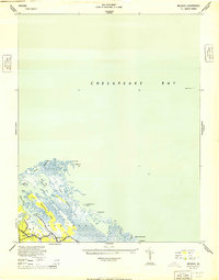 1944 Messick1944 Print · USGSCoastal Virginia at the height of the war reveals a landscape of quiet maritime settlements and active military training grounds. Researchers can trace the layout of Jeffs and Messick alongside the expansive U S Army Bombing Area and Plumtree Island.
 - 1944 Map of Morrison
 1944 Morrison1944 Print · USGSThe Virginia Peninsula is captured here during the height of the Second World War. Genealogists and local historians can trace the development of Hilton Village, identify sites like Big Bethel Battlefield, and locate family-named landmarks such as Curtis Corner.
 - 1948 Map of Ocean View
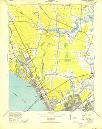
 1948 Ocean View1948 Print · USGSChesapeake Bay's shoreline in the late 1940s is a landscape defined by military bases and growing coastal neighborhoods. Researchers can trace local landmarks like Diamond Springs, Little Creek Mine Base, and the original footprint of Norfolk Airport.
 - 1948 Map of Norfolk North
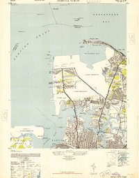 1948 Norfolk North1948 Print · USGSCoastal Virginia at the height of its mid-century military importance shows a dense network of naval bases and growing suburbs. Genealogists and historians can trace the development of Titustown, Ocean View, and Colonial Heights alongside landmarks like Forest Lawn Cemetery and the Marine Hospital.2 unique versions available
 - 1949 Map of Richmond, 1951 Print
 1949 Richmond1951 Print · USGSCoastal Virginia in the years following World War II remained a landscape of historic river towns and expanding military bases. Genealogists and historians can trace the rail lines of the Southern Ry and locate established landmarks from Camp Lee to the remote reaches of Dragon Swamp.
End of results
Showing maps 1-7 of 7
Top cities of Hampton
Frequently asked questions
- What are the different types of historical maps available for Hampton?
- What is the oldest map of Hampton?
- Where can I purchase historical maps of Hampton for my home or office?
- Where can I download high-res historical maps of Hampton?
- Are there historical topographic maps available for Hampton?
- Is there historical aerial imagery available for Hampton?
- Where are historical maps of Hampton sourced from?