1970s Maps of Hampton, Virginia
Explore 5 historic maps of Hampton from the 1970s. These maps offer a rare glimpse into what life looked like during the 1970s — showing old roads, neighborhoods, homes, and landmarks that have changed or disappeared over time.
Whether you're researching your family's past, planning a metal detecting trip, or studying how Hampton's landscape evolved across the 1970s, these high-resolution maps are a powerful tool for exploring the history of this region.
- Focus on a specific era: All maps on this page are from the 1970s, giving you a focused view of this time period.
- See what’s changed: Compare century-old streets, trails, and buildings to today's modern landscape using overlays and satellite layers.
- Research with precision: Use these maps for genealogy, historical research, land use analysis, or educational projects.
- View, download, or print: Maps are fully viewable online in high resolution, and can be downloaded or printed for your own records.
Start exploring Hampton's history through authentic maps from the 1970s. This is your window into the past.
Hampton, VA maps
(5)- 1971 Map of Chesapeake Channel, 1972 Print
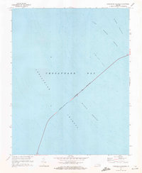 1971 Chesapeake Channel1972 Print · USGSThe lower Chesapeake Bay was undergoing major infrastructure changes in the early 1970s. Trace the path of the Chesapeake Bay Bridge-Tunnel as it navigates through Nine Foot Shoal and the Chesapeake Channel.3 unique versions available
 - 1973 Map of Richmond, 1974 Print
 1973 Richmond1974 Print · USGSThe Virginia Tidewater and Piedmont come alive in the early seventies, showcasing a region defined by its great rivers and massive military installations. Researchers can trace the mid-century growth of Richmond or locate family sites near Amelia Court House and Highland Springs.2 unique versions available
 - 1973 Map of Newport News North, 1977 Print
 1973 Newport News North1977 Print · USGSVirginia's Tidewater region comes into sharp focus in the early seventies, showing the rapid expansion of coastal neighborhoods and industry. Genealogists and local historians can trace the mid-century footprint of Newport News and Hampton along the James River.
 - 1973 Map of Poquoson East, 1977 Print
 1973 Poquoson East1977 Print · USGSThe coastal fringes of the Virginia Peninsula meet the Chesapeake Bay in the early seventies, captured in high-contrast aerial detail. Researchers can study the tidal marsh patterns and early residential footprints around Poquoson as they appeared decades ago.
 - 1973 Map of Hampton, 1977 Print
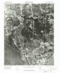
 1973 Hampton1977 Print · USGSThe Virginia coast comes into sharp focus in the early 1970s, showing the intersection of urban growth and the shoreline. Researchers can trace the mid-century footprint of Hampton and the extensive waterfront developments along the Chesapeake.
End of results
Showing maps 1-5 of 5
Top cities of Hampton
Frequently asked questions
- What are the different types of historical maps available for Hampton?
- What is the oldest map of Hampton?
- Where can I purchase historical maps of Hampton for my home or office?
- Where can I download high-res historical maps of Hampton?
- Are there historical topographic maps available for Hampton?
- Is there historical aerial imagery available for Hampton?
- Where are historical maps of Hampton sourced from?