Old Maps of Hampton, Virginia for Hiking & Exploration
Hike through history with 88 historic maps of Hampton. Explore old trails, ghost towns, and forgotten backroads — perfect for outdoor adventurers and local explorers.
- Rediscover forgotten places: Map out old mining camps, roads, and footpaths that no longer exist on modern maps.
- Layer with modern tools: Combine with LiDAR or satellite views to plan hikes through historical terrain.
- Made for exploration: Popular among hikers, overlanders, and local history lovers.
Use these maps to find adventure and explore the hidden past of Hampton.
Hampton, VA maps
(88)- 1907 Map of Norfolk
 1907 Norfolk1907 Print · USGSCoastal Virginia is mapped here at the dawn of the twentieth century, during the bustle of the great Jamestown Exposition. Researchers can trace the early rail-and-canal economy through the Albemarle and Chesapeake Canal, the Navy Yard, and historic outposts like the Cape Henry Light.
 - 1907 Map of Hampton, 1916 Print
 1907 Hampton1916 Print · USGSThe Virginia Peninsula is mapped here in the early twentieth century, showing a coastal landscape shaped by its military and maritime heritage. Genealogists can trace family lines in settlements like Poquoson, Dare, and Phoebus, or locate records at the National Soldiers Home and Hampton Normal School.6 unique versions available
 - 1918 Map of Cape Henry, 1961 Print
 1918 Cape Henry1961 Print · USGSThe Virginia coast at the close of the First World War shows a landscape of tidal inlets and rail-dependent settlements before modern expansion. Researchers can locate early landmarks like Old Donation Church, London Bridge, and the Dam Neck Mills.
 - 1919 Map of Cape Henry
 1919 Cape Henry1919 Print · USGSIn the years following the Great War, the Virginia coast was a mix of quiet truck farms and emerging resorts. Researchers can trace ancestral lands through dozens of named crossroads like Kempsville and Oceana, or find old houses of worship such as Old Donation Church.7 unique versions available
 - 1921 Map of Newport News
 1921 Newport News1921 Print · USGSThe Virginia tidewater area comes alive in the early twentieth century, showing a landscape defined by maritime industry and massive military installations. Genealogists and historians can trace rail lines and early settlements from Camp Stuart down to Jolliff School and the Dismal Swamp.4 unique versions available
 - 1943 Map of Richmond, 1972 Print
 1943 Richmond1972 Print · USGSCoastal Virginia and the state capital are shown in detail during the mid-century era of infrastructure expansion. Genealogists and historians can trace the grounds of Richmond Nat Battlefield Park, locate the Yorktown Nat Cem, or follow the many rural routes through Amelia Court House and Tappahannock.
 - 1944 Map of Hampton
 1944 Hampton1944 Print · USGSThe Virginia Peninsula is seen here during the war years, characterized by a mix of historic coastal towns and expanding military installations. Researchers can trace family roots through Fox Hill Cem, visit Buckroe Beach, or locate landmarks like Roseland Manor and the Hampton Normal School.
 - 1944 Map of Messick
 1944 Messick1944 Print · USGSCoastal Virginia at the height of the war reveals a landscape of quiet maritime settlements and active military training grounds. Researchers can trace the layout of Jeffs and Messick alongside the expansive U S Army Bombing Area and Plumtree Island.
 - 1944 Map of Morrison
 1944 Morrison1944 Print · USGSThe Virginia Peninsula is captured here during the height of the Second World War. Genealogists and local historians can trace the development of Hilton Village, identify sites like Big Bethel Battlefield, and locate family-named landmarks such as Curtis Corner.
 - 1948 Map of Ocean View
 1948 Ocean View1948 Print · USGSChesapeake Bay's shoreline in the late 1940s is a landscape defined by military bases and growing coastal neighborhoods. Researchers can trace local landmarks like Diamond Springs, Little Creek Mine Base, and the original footprint of Norfolk Airport.
 - 1948 Map of Norfolk North
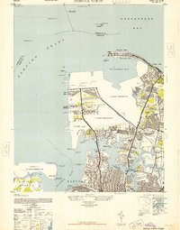 1948 Norfolk North1948 Print · USGSCoastal Virginia at the height of its mid-century military importance shows a dense network of naval bases and growing suburbs. Genealogists and historians can trace the development of Titustown, Ocean View, and Colonial Heights alongside landmarks like Forest Lawn Cemetery and the Marine Hospital.2 unique versions available
 - 1949 Map of Richmond, 1951 Print
 1949 Richmond1951 Print · USGSCoastal Virginia in the years following World War II remained a landscape of historic river towns and expanding military bases. Genealogists and historians can trace the rail lines of the Southern Ry and locate established landmarks from Camp Lee to the remote reaches of Dragon Swamp.
 - 1952 Map of Newport News
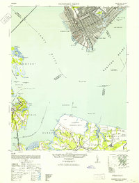 1952 Newport News1952 Print · USGSThe industrial waterfront of Hampton Roads and the James River are captured here just after the war. Local researchers can trace the rail yards of the C & O, the military grounds of Camp Stuart, and the oyster-working life at Eclipse.
 - 1952 Map of Cape Henry
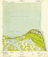 1952 Cape Henry1952 Print · USGSThe Virginia coast at the mouth of the Chesapeake comes alive in this mid-century survey of the Cape Henry region. Researchers can trace the layout of Fort Story, the original boundaries of Seashore State Park, and early bayfront communities like Ocean Park.
 - 1953 Map of Norfolk, 1954 Print
 1953 Norfolk1954 Print · USGSCoastal Virginia and northeastern North Carolina appear here during the post-war industrial boom, showing the critical rail-and-sea connections of Hampton Roads. Genealogists can trace family roots through rural landmarks like Gethsemane Ch, the Caledonia State Prison Farm, and the vast interior of the Dismal Swamp.4 unique versions available
 - 1954 Map of Ocean View, 1958 Print
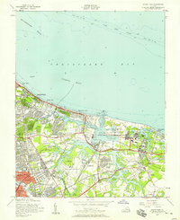 1954 Ocean View1958 Print · USGSCoastal Virginia in the mid-fifties shows a landscape of rapid growth where the City of Norfolk pushes into the countryside. Genealogists and historians can trace the development of neighborhoods like Camellia Shores and Brandon Place near the Norfolk Municipal Airport.
 - 1955 Map of Newport News, 1958 Print
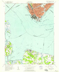 1955 Newport News1958 Print · USGSThe Virginia Peninsula and Southside meet at the James River just as the mid-century port economy peaked. Genealogists and historians can trace neighborhood landmarks from Newport News to Eclipse, locating Mt Zion Ch and the Chesapeake & Ohio Ry docks.
 - 1955 Map of Morrison, 1958 Print
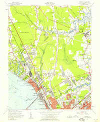 1955 Morrison1958 Print · USGSMid-century development spreads across the Virginia Peninsula in the years following the war, bridging the gap between old battlefields and new suburbs. Genealogists and historians can trace neighborhood growth through Hilton Village, Aberdeen Garden, and the location of Blooming Zion Ch.
 - 1955 Map of Cape Henry, 1958 Print
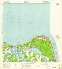 1955 Cape Henry1958 Print · USGSCoastal Virginia at the mid-century shows the transition from military outposts to growing waterfront communities along the Chesapeake. Trace the landscape before modern expansion through landmarks like Fort Story, the Old Cape Henry Lighthouse, and Lynnhaven Inlet.
 - 1955 Map of Messick, 1958 Print
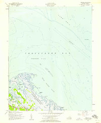 1955 Messick1958 Print · USGSCoastal York County in the mid-fifties is defined by the intersection of military zones and small tidewater communities. Local historians can trace the early layout of Poquoson and Messick alongside the Plum Tree Island Bombing Range and the lonely York Spit Lighthouse.
 - 1955 Map of Norfolk North, 1958 Print
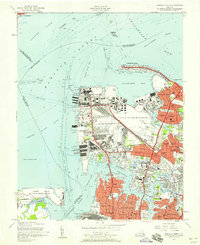 1955 Norfolk North1958 Print · USGSMid-century Norfolk and the Hampton Roads waterfront are captured here during a peak of military and rail activity. Genealogists and historians can trace neighborhood growth in Larchmont or locate vanished infrastructure like the Virginian Railway and Fort Wool.
 - 1955 Map of Hampton, 1958 Print
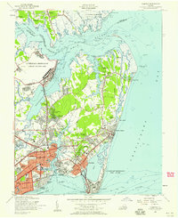 1955 Hampton1958 Print · USGSHampton and the tip of the Virginia Peninsula are shown here during the mid-fifties, dominated by military installations and bayfront communities. Genealogists and historians can trace neighborhood growth in Pleasant Manor, locate the Western Cem, or study the grounds of Hampton Institute and Fort Monroe.
 - 1959 Map of Richmond
 1959 Richmond1959 Print · USGSMid-century Virginia is captured here at its most vital rail and river junctions, from the capital city to the Chesapeake Bay. Genealogists and historians can trace the development of colonial settlements like Williamsburg and military landmarks including Fort Monroe and Camp Lee.
 - 1964 Map of Richmond
 1964 Richmond1964 Print · USGSCoastal and central Virginia are mapped during the mid-twentieth century, showing the critical intersection of rail, river, and military life. Genealogists can trace family roots through rural county seats like Amelia or find vanished coastal neighborhoods near Phoebus and Hilton Village.
 - 1964 Map of Poquoson East, 1966 Print
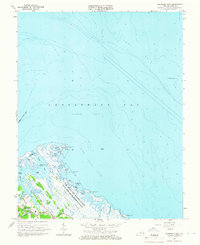 1964 Poquoson East1966 Print · USGSThe Virginia coastline near York County is shown here during the mid-sixties, dominated by wetlands and military installations. Researchers can trace family sites near Blackwalnut Ridge or locate the Plum Tree Island Bombing Range and Poquoson High Sch.6 unique versions available
Showing maps 1-25 of 88
Top cities of Hampton
Frequently asked questions
- What are the different types of historical maps available for Hampton?
- What is the oldest map of Hampton?
- Where can I purchase historical maps of Hampton for my home or office?
- Where can I download high-res historical maps of Hampton?
- Are there historical topographic maps available for Hampton?
- Is there historical aerial imagery available for Hampton?
- Where are historical maps of Hampton sourced from?