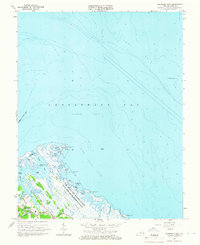
1964 Map of Poquoson East
USGS Topo · Published 1966About this map
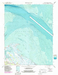
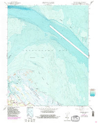
Salt marsh and complex tidal waterways dominate this mid-1960s coastal landscape, where the Poquoson Corporation Boundary meets the western edge of the Chesapeake Bay. The most striking feature is the U.S. Military Reservation Plum Tree Island Bombing Range, which encompasses a vast stretch of wetlands and islands including Drum Point and Whalebone Island. Inland, the developing settlement of Poquoson is visible along Little Florida Rd and Poplar Rd, anchored by the Poquoson High Sch. This map highlights the precarious nature of the Virginia coastline before extensive modern development, noting treacherous shallows at Poquoson Flats and the navigational importance of the York Spit Lighthouse out in the York Spit. Local landmarks like Blackwalnut Ridge and various cemeteries provide critical reference points for genealogists and local historians.
Find a feature on this map
35 named features on this map. Tap any name to fly to it.
Don’t see what you’re looking for? This feature index may not catch every label — zoom into the map to look around manually.
Map Details
Editions of this 1964 Poquoson East Map
6 editions found
Other maps of this area

1907 · Hampton
USGS Topo · 1:62,500

1916 · Mathews
USGS Topo · 1:62,500

1917 · Mathews
USGS Topo · 1:62,500

1943 · Richmond
USGS Topo · 1:250,000

1944 · Hampton
USGS Topo · 1:24,000

1944 · Messick
USGS Topo · 1:24,000

1944 · Morrison
USGS Topo · 1:24,000

1944 · Harris Grove
USGS Topo · 1:24,000

1948 · Achilles
USGS Topo · 1:24,000

1948 · New Point Comfort
USGS Topo · 1:24,000