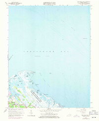
1964 Map of Poquoson East
USGS Topo · Published 1971About this map
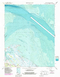
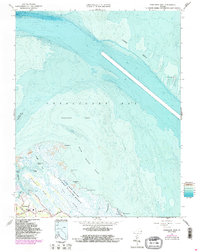
US Military Reservation Plum Tree Island Bombing Range dominates the coastal salt marshes of this York County peninsula, illustrating the mid-century intersection of tactical military needs and the fragile coastal environment. The settlement of Poquoson is concentrated in the southwest, where residential growth is visible along Messick Rd and North Lawson Road near the Poquoson High Sch. This survey provides a specialized look at the transition from the inhabited uplands of Blackwalnut Ridge to the vast Salt Marsh and complex waterways like Easton Cove. Off the coast, the hydrography of the Chesapeake Bay is defined by the Poquoson Flats and the protective light of the York Spit Lighthouse, marking the deep-water transition at York Spit.
Find a feature on this map
39 named features on this map. Tap any name to fly to it.
Don’t see what you’re looking for? This feature index may not catch every label — zoom into the map to look around manually.
Map Details
Editions of this 1964 Poquoson East Map
6 editions found
Other maps of this area

1907 · Hampton
USGS Topo · 1:62,500

1916 · Mathews
USGS Topo · 1:62,500

1917 · Mathews
USGS Topo · 1:62,500

1943 · Richmond
USGS Topo · 1:250,000

1944 · Hampton
USGS Topo · 1:24,000

1944 · Messick
USGS Topo · 1:24,000

1944 · Morrison
USGS Topo · 1:24,000

1944 · Harris Grove
USGS Topo · 1:24,000

1948 · Achilles
USGS Topo · 1:24,000

1948 · New Point Comfort
USGS Topo · 1:24,000