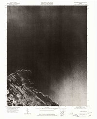
1973 Map of Poquoson East
USGS Topo · Published 1977About this map
Poquoson shoreline reaches into the Chesapeake Bay on this 1973 orthophotograph, documenting the complex coastal geography of the Virginia Peninsula during the early 1970s. Published as part of the 7.5 minute series, this map replaces standard topographic contour lines with a rectified aerial photograph, offering an unfiltered look at the tidal marshes, inlets, and emerging residential patterns in the southern portion of the quadrangle. The imagery provides an precise account of the interface between land and water, showing the intricate network of guts and marshes that define the local coastal environment before later development changed the waterfront landscape. It remains a valuable resource for researchers tracking coastal erosion and the historical footprint of the local community.
Find a feature on this map
2 named features on this map. Tap any name to fly to it.
Don’t see what you’re looking for? This feature index may not catch every label — zoom into the map to look around manually.
Map Details
Editions of this 1973 Poquoson East Map
This is the sole edition of this map. No revisions or reprints were ever made.
Other maps of this area

1907 · Hampton
USGS Topo · 1:62,500

1916 · Mathews
USGS Topo · 1:62,500

1917 · Mathews
USGS Topo · 1:62,500

1943 · Richmond
USGS Topo · 1:250,000

1944 · Hampton
USGS Topo · 1:24,000

1944 · Messick
USGS Topo · 1:24,000

1944 · Morrison
USGS Topo · 1:24,000

1944 · Harris Grove
USGS Topo · 1:24,000

1948 · Achilles
USGS Topo · 1:24,000

1948 · New Point Comfort
USGS Topo · 1:24,000